• Hello, please take a minute to check out our awesome content, contributed by the wonderful members of our community. We hope you'll add your own thoughts and opinions by making a free account!

Pattern Sweatember

First storm related outage of the day. Will be more before this event folds over.
Estimated Time of RestorationSeptember 18, 5:15 p.m. - 6:15 p.m.
Crew Status icon

Status
info icon

Dispatched
star icon

CauseThe outage was caused by fallen trees or limbs damaging our equipment.
Customers without power icon

Customers Without Power1,023
Outage Identified icon

Outage IdentifiedSeptember 18, 1:56 p.m.
 
70MPH WIND GUSTS REPORTED WITH THIS STORM!!! SEEK INDOORS NOW AND PREPARE TO LOSE POWER!!!
GREENSBORO/PIEDMONT_(ASOS),NC (GSO) ASOS reports gust of 60 knots (69.1 mph) from W @ 1833Z
KGSO 181833Z 27032G60KT 1/2SM R23L/3500VP6000FT +TSRA FG BKN050CB BKN250 20/19 A3017 RMK AO2 PK WND 27060/1831 RAB24 TSB11 PRESRR CONS LTGICCG OHD TS OHD MOV S P0029 T02000194 https://mesonet.agron.iastate.edu/ASOS/current.phtml?network=NC_ASOS
 
HOLY ------- ----!!! ITS BAD!!! 70MPH WINDS ARE IN THIS STORM. GET INDOORS NOW!!!
WWUS52 KRAH 181842
SVSRAH

Severe Weather Statement
National Weather Service Raleigh NC
242 PM EDT Fri Sep 18 2026

NCC057-067-081-151-181900-
/O.CON.KRAH.SV.W.0284.000000T0000Z-260918T1900Z/
Forsyth NC-Davidson NC-Randolph NC-Guilford NC-
242 PM EDT Fri Sep 18 2026

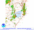
...A SEVERE THUNDERSTORM WARNING REMAINS IN EFFECT UNTIL 300 PM EDT
FOR EAST CENTRAL FORSYTH...NORTHEASTERN DAVIDSON...NORTHWESTERN
RANDOLPH AND SOUTHWESTERN GUILFORD COUNTIES...

At 240 PM EDT, a severe thunderstorm was located near Greensboro,
moving south at 20 mph.

HAZARD...70 mph wind gusts.

SOURCE...Radar indicated. At 2:31pm, Greensboro International
Airport reported a wind gust to 69 mph.

IMPACT...Expect considerable tree damage. Damage is likely to mobile
homes, roofs, and outbuildings.

Locations impacted include...
Greensboro, High Point, Asheboro, Randleman, Thomasville,
Kernersville, Archdale, Trinity, Pleasant Garden, and Jamestown.

This includes the following highways...
Interstate 85 between Mile Markers 33 and 35, and between Mile
Markers 104 and 124.
Interstate 40 between Mile Markers 201 and 220.
Interstate 73 between Mile Markers 79 and 103.
Interstate 74 between Mile Markers 61 and 79.

PRECAUTIONARY/PREPAREDNESS ACTIONS...

For your protection move to an interior room on the lowest floor of a
building.

&&

LAT...LON 3610 8011 3617 7986 3581 7968 3570 8005
TIME...MOT...LOC 1840Z 338DEG 16KT 3606 7993

THUNDERSTORM DAMAGE THREAT...CONSIDERABLE
HAIL THREAT...RADAR INDICATED
MAX HAIL SIZE...<.75 IN
WIND THREAT...OBSERVED
MAX WIND GUST...70 MPH

$$
 
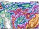
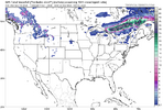
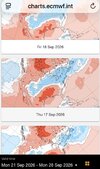
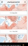
Weather models are wild man. AIFS been hinting at coastal development and midweek wedging since like Monday or something. Big fan of how it yeets gloriously dry air our way next weekend
 
On our drive to Montreal for the cycling world championships… makes me wish for all of us …that the weather in central NY makes its way to us. Just stunning .
51fa06215d90a1e7a18b92ba6bdc2e58.jpg


Sent from my iPhone using Tapatalk
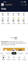
My mother is from Syracuse and my father is from Watertown. Looks like this is on the thruway. Sending you best wishes!
 
Ill paint the Bermuda and let them play imby if they bring the rain with them
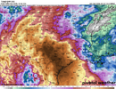
Its amazing whole south in drought but come Saturday wherever theres a game it dumps.
Columbia Clemson Boone/ couple weeks ago campbell had to play sun morning/ lightening hit a pole i bekeive.

Game temp in Nashville today was 99 degrees
 
Duke is POSSIBLY scheduling rolling blackouts this weekend. GREAT 🙄🙄🙄😠😠😠😠😭😭😭😬😬
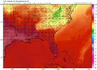
CHARLOTTE, N.C. – Unusually hot September weather is driving high electricity demand across parts of the Carolinas. Duke Energy is asking customers in North Carolina and South Carolina to voluntarily reduce electricity use from 2-8 p.m. today, Sept. 18, to help reduce demand on the power grid during the day’s peak period.

Customers can help by taking simple steps during this peak period:

  • Raise your thermostat to the highest comfortable setting.
  • Avoid using major appliances such as washing machines, clothes dryers and dishwashers.
  • Limit use of electric ranges and ovens, which can add heat to your home and increase air conditioning demand.
  • Electric vehicle owners: Charge overnight, when demand is lower.
“Above-average heat puts pressure on the system during peak hours,” said Kendal Bowman, president of Duke Energy’s utility operations in North Carolina. “Small actions during the late afternoon and early evening can help reduce strain on the grid and support reliable service for everyone.”

“We recognize it is inconvenient to reduce electric use, but it makes a real difference," said Tim Pearson, president of Duke Energy’s utility operations in South Carolina. “We’re using every available resource to meet demand so power keeps flowing to our communities.”

Duke Energy has approximately 3.9 million electric customers in North Carolina and more than 870,000 electric customers in South Carolina.

Duke Energy

Duke Energy (NYSE: DUK), a Fortune 150 company headquartered in Charlotte, N.C., is one of America’s largest energy holding companies. The company’s electric utilities serve 8.7 million customers in North Carolina, South Carolina, Florida, Indiana, Ohio and Kentucky, and collectively own 55,700 megawatts of energy capacity. Its natural gas utilities serve 1.6 million customers in North Carolina, South Carolina, Ohio and Kentucky.

Duke Energy is executing an energy modernization strategy, keeping customer value at the forefront as it invests in electric grid upgrades and efficient generation resources to strengthen the system and serve growing energy needs.

More information is available at duke-energy.com. Follow Duke Energy on X, LinkedIn, Instagram, TikTok and Facebook for stories about the people and innovations powering its communities.

24-Hour: 800.559.3853
FULL ARTICLE HERE
 
Duke: We recognize it is inconvenient to reduce electric use, but it makes a real difference,
Me reading that: We rEcOgNiZe iT Is iNcOnVeNiEnT To rEdUcE ElEcTrIc uSe, BuT It mAkEs a rEaL DiFfErEnCe,
 
Back
Top