• Hello, please take a minute to check out our awesome content, contributed by the wonderful members of our community. We hope you'll add your own thoughts and opinions by making a free account!

Pattern Sweatember

El Niño is here. All I see is orange and red View attachment 198111

For some reason TT uses the colder 1981-2010 climo, which obviously makes it more difficult to not be warmer than normal vs what would be the case if 1991-2020 climo were used instead. So, of course, that leads to more intense reds and/or more red coverage/less blue. But I fully realize the map would still be dominated by reds (nothing new as maps practically every day regardless of ENSO have more red than blue globally in this warming world and it’s not going away), but wouldn’t look quite as warm.
 
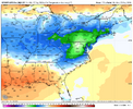
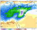
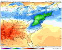
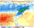
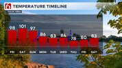
Looks like real relief outside of the southern plains has ultimately survived to being within about 5 days. The relief is a drop to average-ish temps, but it’s ultimately better than nothing.

**will note that Brent’s territory will also drop temp wise, but I can still see some pinks indicating temps in the mid-90s to the south.
 
Looks like real relief outside of the southern plains has ultimately survived to being within about 5 days. The relief is a drop to average-ish temps, but it’s ultimately better than nothing.

**will note that Brent’s territory will also drop temp wise, but I can still see some pinks indicating temps in the mid-90s to the south.

Yeah, looks like pretty good consensus that the nineties end for most of us after this weekend.

Crazy how 84 will feel amazing...
 

giphy.gif


Sent from my iPhone using Tapatalk
 
Nice to see this nino behaving similar to other strong/super ninos. Extended summer through much of sept, noticeable cooling the last 10 days of the month, potential high precip event, increased tropical activity. If we keep up a similar progression that should mean. One more heat burst in October probably 7th-14th or so, stj starts to appear after the 15th, maybe one last run at the tropics mid month. Though looking at what's going on i could see the heat push and stj being delayed 7-14 days
 
Nice to see this nino behaving similar to other strong/super ninos. Extended summer through much of sept, noticeable cooling the last 10 days of the month, potential high precip event, increased tropical activity. If we keep up a similar progression that should mean. One more heat burst in October probably 7th-14th or so, stj starts to appear after the 15th, maybe one last run at the tropics mid month. Though looking at what's going on i could see the heat push and stj being delayed 7-14 days
Define “heat burst”? 80s? Surely not 90s in October?
 
Define “heat burst”? 80s? Surely not 90s in October?
85-90 for a few days. Maybe low to mid 90s for a day. The post 1990 ninos have a better signal for warmer and given our tendency to repeat those years vs the previous decades you have to lean that way. The good thing is though even if it's warm nothing screams crazy extended warmth, most of the pre 90 ninos didn't even make it to 85 at rdu in October.

On an even brighter side if you composite out a lot of strong or super ninos for Oct and Nov you land BN with October carrying most of the weight.

With the jet cranking it'll be hard to get or stay bn for long periods for at least a while. Favorable wave breaking like the 12z gfs though can give us nice fall periods even in an overall not great for cool background
 
Last edited:
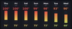
LOL, I don’t mean to judge but if you hit 100 in late Sept, it’s not something to brag about, but rather something to be mourned..

RDU low 63 btw.
My low was 74. 10 degrees warmer than my buddies in Athens ga. There was talk about nuking a hurricane once…I’m willing to give it a go on a heat dome at this point.
IMG_3333.jpeg
 
My low was 74. 10 degrees warmer than my buddies in Athens ga. There was talk about nuking a hurricane once…I’m willing to give it a go on a heat dome at this point.
View attachment 198128
That looks absolutely dreadful.🔥

Desperate times call for desperate measures, and I sympathize. Unfortunately there are no hurricanes to nuke at the moment. 🤷‍♂️
 
Last edited:
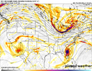
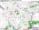
Big HP slides into position early next week and shes still saving the day a week latter into Monday of the following week.

Reminder of what CAD looks like. Will be our saving grace Apps- east. Go set out the mums and pumpkins this weekend. Summer finally ends

1789728188803.png
 
Chattanooga's unprecedented streak of consecutive days of 90+ currently stands at 45 days (Aug 4th to Sept 17th). It's very likely this streak reaches 50 days as our next day with forecast highs below 90 isn't until Wednesday.
 
And the first one of the day!
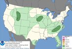
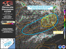
BULLETIN - IMMEDIATE BROADCAST REQUESTED
Severe Thunderstorm Warning
National Weather Service Raleigh NC
219 PM EDT Fri Sep 18 2026

The National Weather Service in Raleigh has issued a

* Severe Thunderstorm Warning for...
East central Forsyth County in central North Carolina...
Northeastern Davidson County in central North Carolina...
Northwestern Randolph County in central North Carolina...
Southwestern Guilford County in central North Carolina...

* Until 300 PM EDT.

* At 219 PM EDT, a severe thunderstorm was located near Kernersville,
or 8 miles north of High Point, moving south at 20 mph.

HAZARD...60 mph wind gusts.

SOURCE...Radar indicated.

IMPACT...Expect damage to roofs, siding, and trees.

* Locations impacted include...
Greensboro, High Point, Asheboro, Randleman, Thomasville,
Kernersville, Archdale, Trinity, Pleasant Garden, and Jamestown.

This includes the following highways...
Interstate 85 between Mile Markers 33 and 35, and between Mile
Markers 104 and 124.
Interstate 40 between Mile Markers 201 and 220.
Interstate 73 between Mile Markers 79 and 103.
Interstate 74 between Mile Markers 61 and 79.

PRECAUTIONARY/PREPAREDNESS ACTIONS...

For your protection move to an interior room on the lowest floor of a
building.

&&

LAT...LON 3610 8011 3617 7986 3581 7968 3570 8005
TIME...MOT...LOC 1819Z 340DEG 19KT 3607 7998

HAIL THREAT...RADAR INDICATED
MAX HAIL SIZE...<.75 IN
WIND THREAT...RADAR INDICATED
MAX WIND GUST...60 MPH

 
Back
Top