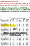
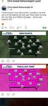
RDU made it above 75 today after three straight sub-75 degree highs. Pretty wild for July. 74 on 7/23 was a record low max temp, while 7/24's 75 and yesterday's 73 each came up a few degrees above the record.



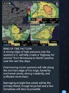





Yep nothing says August like moisture flow from the equator into the region. At least the heat will likely be less than what we've seen but the flattening of the western ridge makes me wonder if we run a heat release outyeah those of you that get some cooler mornings and drier afternoons the second half of this week, enjoy it. back to the slop factory afterwards
Worried the mcs tonight screws up tomorrow but otherwise this setup is 100% giddy up
Yep. Wouldn't be shocked if we don't realize full potential, especially coverage wiseWorried the mcs tonight screws up tomorrow but otherwise this setup is 100% giddy up
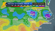
If RDU gets under a good storm on Tuesday, this could finish as the wettest July on record.

Things always find a way to balance out don't they.RDU has had THE wettest July 1-26 on record with 11.13” with records going back to 1887!
This first 26 days of the month is the 2nd wettest 1st 26 days of any met. summer month with only Aug of 1908 wetter (13.63”)!
Data source link:
Things always find a way to balance out don't they.
This is great news.
Bump; JK / lucky guess as he caught a 5 inch plus storm and we all knew we where headed toward a above avg week.Of course, nobody saw anything like this rapid rate of nearly balancing out occurring there.
Meanwhile, other areas like mine are still in drought though not as severe as earlier. But there are high hopes that the upcoming El Niño will take care of that.
This is the opposite of winter for RDU.


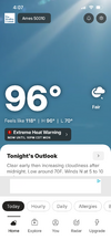
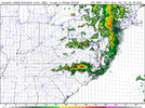
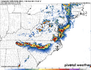
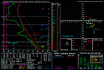
Is this a late evening/night threat?HRRR and RRFS worlds apart awesome. RRFS wallops WNC and HRRR goes for GSO-CLT-RDU and down east. I feel like the latter is more likely but it may just end up being "place that had less junk in the morning"
at the same time the july sun is gonna be pretty good at recovering very quickly for places that do have junk
REFS is pretty similar to RRFS (go figure)
Probably in the 4-8pm window for youIs this a late evening/night threat?
Thanks
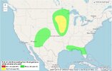
Famine to Feast! We like to get a few hundred degree weeks in , in between our thousand year floods! View attachment 197048
GSP is not bullish at all as far as pops go, in my area. Only 20% and I hope it's right. If that one model is right, it's derecho time. The HRRR says no for the GSP area as of now.HRRR and RRFS worlds apart awesome. RRFS wallops WNC and HRRR goes for GSO-CLT-RDU and down east. I feel like the latter is more likely but it may just end up being "place that had less junk in the morning"
at the same time the july sun is gonna be pretty good at recovering very quickly for places that do have junk
REFS is pretty similar to RRFS (go figure)

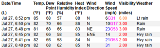
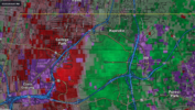
Through Friday. I think it may be covering this Thursday/FridayMac,
What period does this cover?

Mac,
What period does this cover?