• Hello, please take a minute to check out our awesome content, contributed by the wonderful members of our community. We hope you'll add your own thoughts and opinions by making a free account!

Pattern July Fry

Congrats to everyone with rain.

I'm still somewhat skeptical of the flood watches down here in the coastal plain. QPF is predicted a 1"-3" over the next 5 days and short term modeling looks drier today.
 
3.38" and unsure of when it will end. The washout is delivering

Funny how we got a flood warning and then it stopped raining within minutes of the warning lol. Would like to see the updated drought map after this is done.
 
past few julys at local CWOP
2023 - 1.69"
2024 - 5.33"
2025 - 3.15"
2026 so far - 2.50"
 
  • Like
Reactions: SD
84 degrees at 5pm a week before August

We've been so lucky this summer so far

Even this alleged heat wave coming doesn't look endless
 
Last edited:
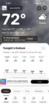
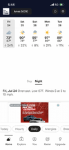
A nice below normal day befor the surface of the sun temps start! Hi was 74IMG_6034.png temps start tomorrow!
 
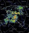
We picked up somewhere around 3” plus in a very short time sending a wall of water down the creek. Now another one is thundering
 
About to pick up a decent thunderstorm here after it looked all day that this projected event was going to be a big bust for east central GA.

Probably not likely to get too much here though, but I did lose satellite as the Braves pen struggles to close a game...

Edit: Wrapping up now 27ish minutes later. Initially the lightning wasn't too bad, but about 15 minutes after the heavy rain started, there was a huge thunder crash moment that suggested a lightning strike was very close, and it still seems as if lightning is close.
 
Last edited:
2.2" for this event after it finally moved south some.
 
You look to be in a good place this morning - building and heading your direction.

Yep looks like an inch or so total if it sticks together. We managed 0.2" yesterday which is our first measured precip since 7/3. I would jump for joy if we get a solid inch. At very least I could stop watering trees for awhile.
 
About to pick up a decent thunderstorm here after it looked all day that this projected event was going to be a big bust for east central GA.

Probably not likely to get too much here though, but I did lose satellite as the Braves pen struggles to close a game...

Edit: Wrapping up now 27ish minutes later. Initially the lightning wasn't too bad, but about 15 minutes after the heavy rain started, there was a huge thunder crash moment that suggested a lightning strike was very close, and it still seems as if lightning is close.

Just under 1.5" it seems. Didn't expect that.

Chose to go outside this morning due to cloudiness and it's kind of insufferable anyway.
 
It might be around 70 degrees, but the humidity is for real. I got in from cutting the grass in the back yard a few minutes ago and I was soaked in perspiration as if was doing yard work on a 90 degree day. I am looking forward to Fall when those 70 degree days have a lot less humidity.
 
1.39" officially in the PWS. Not gonna look the gift horse in the mouth but I'd be lying if I said that's not disappointing. We're up to just over 12" year to date now and the grass is greening up nicely. In a normal year we'd be over 30" by 8/1.
 
It’s endless summer here with a very uncomfy 94 high at KSAV.

I haven’t had significant rains at my place since way back on July 14th! However, Mon into the evening is looking promising. If that weren’t to deliver, it would be sprinklers time again.
 
Not thrilled with SD's assessment of a possible long drown out summer pattern - we saw that last year where it did not cool off until Nov. (which sucks) - and this now seems to be a more frequent type of change.

5.58" for the month in which 4.51 fell in 3-4 hours - and still down 10" for the year (made a little progress).
 
It was horrible yesterday! Today is worse! 😢View attachment 197013

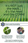
Indeed, average summer dewpoints have increased notably in the heart of the Corn Belt during the last few decades thanks largely to much larger crops. OTOH, this keeps max temps down. So, there’s somewhat of a trade-off.

Also, massive droughts in the Corn Belt have become more infrequent as a result of the huge crops emitting the moisture into the atmosphere and keeping soils more moist. That’s why a repeat of the Dust Bowl of the 1930s is highly unlikely there anytime soon. So, theres a big positive side to this in addition to it being great for the US that crops are larger.
 
Indeed, average summer dewpoints have increased notably in the heart of the Corn Belt during the last few decades thanks largely to much larger crops. OTOH, this keeps max temps down. So, there’s somewhat of a trade-off.

Also, massive droughts in the Corn Belt have become more infrequent as a result of the huge crops emitting the moisture into the atmosphere and keeping soils more moist. That’s why a repeat of the Dust Bowl of the 1930s is highly unlikely there anytime soon. So, theres a big positive side to this in addition to it being great for the US that crops are larger.
This is interesting and makes me wonder if the loss of farmland, especially in Central North Carolina, since the tobacco buyout in 2004 with the emphasis on residential and urban development is and will be a contributing factor in the rise of temperatures and the exasperation of drought conditions for the region.
 
Not thrilled with SD's assessment of a possible long drown out summer pattern - we saw that last year where it did not cool off until Nov. (which sucks) - and this now seems to be a more frequent type of change.

5.58" for the month in which 4.51 fell in 3-4 hours - and still down 10" for the year (made a little progress).
We averaged below normal Last Aug,Sept and October. It can repeat again far as im concerned.
 
Not thrilled with SD's assessment of a possible long drown out summer pattern - we saw that last year where it did not cool off until Nov. (which sucks) - and this now seems to be a more frequent type of change.

5.58" for the month in which 4.51 fell in 3-4 hours - and still down 10" for the year (made a little progress).

Huh? August was -3.6F at Florence SC and most other reporting stations in the Carolinas aside from low country areas like Charleston and points south of that. It was actually the beginning of a streak of consecutive BN months all the way to February.

Florence/Lumberton/Charlotte/etc all dropped into the 50s on 8/27 last year.
 
This is interesting and makes me wonder if the loss of farmland, especially in Central North Carolina, since the tobacco buyout in 2004 with the emphasis on residential and urban development is and will be a contributing factor in the rise of temperatures and the exasperation of drought conditions for the region.
I doubt it to be honest. In 2025 NC cultivated roughly 4.2 million acres. Go back 20 years that was over 5 million which is a change but not a huge change. Go back to the 1940s and 1950s and look at pictures from the coastal plains. It was darn near clear cut in many places to the horizon.

Could be wrong obviously just seems like that changes are more atmospheric than anything. Lots more blazing hot cloudless days than we had in the past.
 
Back
Top