ForsythSnow
Moderator
3.38" and unsure of when it will end. The washout is delivering


Funny how we got a flood warning and then it stopped raining within minutes of the warning lol. Would like to see the updated drought map after this is done.3.38" and unsure of when it will end. The washout is delivering

At least it’s filling Lanier back up3.38" and unsure of when it will end. The washout is delivering





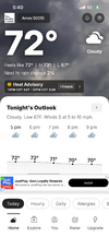 temps start tomorrow!
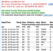
Ooofta! You betchaA nice below normal day befor the surface of the sun temps start! Hi was 74View attachment 197004 temps start tomorrow!



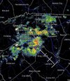
92/82 under heavy cloud cover. Raining like cats and dogs along and east of US17 but not building west of there unfortunately.
You look to be in a good place this morning - building and heading your direction.
About to pick up a decent thunderstorm here after it looked all day that this projected event was going to be a big bust for east central GA.
Probably not likely to get too much here though, but I did lose satellite as the Braves pen struggles to close a game...
Edit: Wrapping up now 27ish minutes later. Initially the lightning wasn't too bad, but about 15 minutes after the heavy rain started, there was a huge thunder crash moment that suggested a lightning strike was very close, and it still seems as if lightning is close.


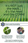
It was horrible yesterday! Today is worse!
This is interesting and makes me wonder if the loss of farmland, especially in Central North Carolina, since the tobacco buyout in 2004 with the emphasis on residential and urban development is and will be a contributing factor in the rise of temperatures and the exasperation of drought conditions for the region.Indeed, average summer dewpoints have increased notably in the heart of the Corn Belt during the last few decades thanks largely to much larger crops. OTOH, this keeps max temps down. So, there’s somewhat of a trade-off.
Also, massive droughts in the Corn Belt have become more infrequent as a result of the huge crops emitting the moisture into the atmosphere and keeping soils more moist. That’s why a repeat of the Dust Bowl of the 1930s is highly unlikely there anytime soon. So, theres a big positive side to this in addition to it being great for the US that crops are larger.

We averaged below normal Last Aug,Sept and October. It can repeat again far as im concerned.Not thrilled with SD's assessment of a possible long drown out summer pattern - we saw that last year where it did not cool off until Nov. (which sucks) - and this now seems to be a more frequent type of change.
5.58" for the month in which 4.51 fell in 3-4 hours - and still down 10" for the year (made a little progress).
Not thrilled with SD's assessment of a possible long drown out summer pattern - we saw that last year where it did not cool off until Nov. (which sucks) - and this now seems to be a more frequent type of change.
5.58" for the month in which 4.51 fell in 3-4 hours - and still down 10" for the year (made a little progress).

It was horrible yesterday! Today is worse!
This is interesting and makes me wonder if the loss of farmland, especially in Central North Carolina, since the tobacco buyout in 2004 with the emphasis on residential and urban development is and will be a contributing factor in the rise of temperatures and the exasperation of drought conditions for the region.