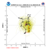
1.37 west of Winston. I really wish those icebergs would melt off the deck on the north side of the house; but it looks like they're aiming to stay rent free until March.
-
Hello, please take a minute to check out our awesome content, contributed by the wonderful members of our community. We hope you'll add your own thoughts and opinions by making a free account!
You are using an out of date browser. It may not display this or other websites correctly.
You should upgrade or use an alternative browser.
You should upgrade or use an alternative browser.
Pattern Fab Feb
- Thread starter SD
- Start date
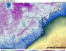
Crazy Uncle is a little to overdone next Monday night.. Most models show a 2-3 day cooldown and perhaps one more 2-3 day stretch as we flip calendar to March. But if the CFS at 0z is right, then that's it. just expect normal temps plus or minus 1-2 degrees through mid March, as things stand now.
Right now, unless things change. I'm gonna take a shot throwing spuds in the ground early 1st week of March. roll the dice.
Right now, unless things change. I'm gonna take a shot throwing spuds in the ground early 1st week of March. roll the dice.

mild high clouds and showers slop week
Also looks like we have another wet weekend in route. Raleigh NWS has 50% + chance day and night Friday through Sunday.
Could this past weekend be the harbinger of things to come, next 12 months. El nino starting to flex. We've been on the dry bone side of the equation past 6+ months. May be seeing rubber band snap back other direction
Could this past weekend be the harbinger of things to come, next 12 months. El nino starting to flex. We've been on the dry bone side of the equation past 6+ months. May be seeing rubber band snap back other direction
wow
Member
Ended up with 1.54 inches yesterday. Had a little bit of ice this morning with a low near freezing.
SnowNiner
Member
Also looks like we have another wet weekend in route. Raleigh NWS has 50% + chance day and night Friday through Sunday.
Could this past weekend be the harbinger of things to come, next 12 months. El nino starting to flex. We've been on the dry bone side of the equation past 6+ months. May be seeing rubber band snap back other direction
I feel like it aways does. We get in dry conditions for a bit, and it always eventually turns around and gets very wet. I haven't been concerned about water restrictions and drought since like the summer of 2008 or so? The pendulum of climatology always comes back around in my area.
Birds are really chirping this morning. Spring may be sprunging
NCHighCountryWX
Member
- Joined
- Dec 28, 2016
- Messages
- 697
- Reaction score
- 1,914
Brent
Member
Cancelled my model subscription let's see if that brings back winter /s
I'm getting less optimistic about a lot of sun today
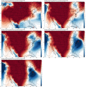
The combo of a strong to moderate -PNA, strong +AO, and moderate to strong +NAO for the last few days of Feb and first few days of March per today’s GEFS is absolutely awful if you’re like me and prefer a BN dominated temp. pattern in the SE. However, the models still indicate there may still be a few chilly days then.
- Joined
- Jan 2, 2017
- Messages
- 1,566
- Reaction score
- 4,279
- Joined
- Jan 2, 2017
- Messages
- 1,566
- Reaction score
- 4,279
Did the same this morning myself..worked earlier in wintet..lolCancelled my model subscription let's see if that brings back winter /s
Shaggy
Member
Pretty windy too which is keeping it cooler than it should be.I'm getting less optimistic about a lot of sun today
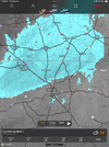
Yimmy jackpotIn alot of the right places and more to come this week.
View attachment 194188
Unless things change dramatically which they likely could/might/will next Feb should be one of the better ones in the 2000s
This looks like the exact same footprint as the heavier rates for snow 2 weeks ago.In alot of the right places and more to come this week.
View attachment 194188
- Joined
- Jan 23, 2021
- Messages
- 4,596
- Reaction score
- 15,184
- Location
- Lebanon Township, Durham County NC
The last thirty days have been the 7th coolest with regard to mean air temp, 8th coldest regarding average high temp and 2nd driest with regards to average dew point.
An absolutely remarkable, long lasting cold snap. It only lacks one tenth of a degree from being the coldest we've seen since 1981.
An absolutely remarkable, long lasting cold snap. It only lacks one tenth of a degree from being the coldest we've seen since 1981.
WolfpackHomer91
Member
Not to be Negative but we are done here aren't we? 16" Season including Sleet, but man was really hoping to get to 20" on the season that's when you start talking elite imo. Double digit total seasons are like a SW16 but if you can get to 20", I feel like that's a Final 4 run
Temps lagging a little more than I expected today. 58 so far. Looks like the 12z Euro still refuses to bite on a rainmaker Sunday
NCHighCountryWX
Member
- Joined
- Dec 28, 2016
- Messages
- 697
- Reaction score
- 1,914
Probably but too early to rule anything out. No telling what the pattern will be as we get into mid/late March, though climo obviously starts to work strongly against us then.Not to be Negative but we are done here aren't we? 16" Season including Sleet, but man was really hoping to get to 20" on the season that's when you start talking elite imo. Double digit total seasons are like a SW16 but if you can get to 20", I feel like that's a Final 4 run
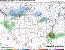
If you squint hard enough the AI Euro was almost a wedge event next weekend
LukeBarrette
im north of 90% of people on here so yeah
Meteorology Student
Member
2024 Supporter
2017-2023 Supporter
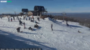
Shaded areas still have a couple inches of snow, solid 55 degree day here!
Op euro going with a scand to ural ridge may drop enough troughing to set off an eamt event and extend the pac jet around d20. Its one op run and the gfs suite hates the idea, so it's meh for now, but a mid to late March epo/pna ridge makes sense
olhausen
Member
March 12th 2022We will have freezes but winter weather after February 15 is not a thing anymore (outside the mountains) new norm with the patterns we get into this time of year now, trees blooming, grass growing, people planting their gardens, things you didn’t see until late March 20 years ago here. Even we had good snows into late March, one of our biggest snows was March 23rd 1968 we got 9 - 11 inches. You won’t get that February 23rd now. Wishing for snow this late in the year is just heartbreak. View attachment 194175
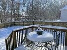
February 17th 2021
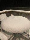
February 19th 2025
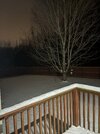
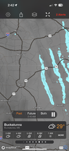
Got another inch later this night in Feb 2025 from a super clipper that was producing lake effect snow streamers off of the lakes at the land between the lakes. While it may not snow further south as much in February and later, It certainly isn’t only the mountains that gets snow in February and early March.
Op euro going with a scand to ural ridge may drop enough troughing to set off an eamt event and extend the pac jet around d20. Its one op run and the gfs suite hates the idea, so it's meh for now, but a mid to late March epo/pna ridge makes sense
Euro Weeklies are mild first half of March and then cool to NN last 2 weeks fwiw. So, coldest part could be in 2nd half because 1st part so mild.
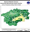
RDU finished with 0.96" liquid precipitation yesterday, extending the drought of 1"+ QPF days. RDU has not had more than an inch of precipitation on a single day since August 11, 2025, more than 6 months ago.
Watch us have another cool spring like last year. I couldn't even swim until June.Euro Weeklies are mild first half of March and then cool to NN last 2 weeks fwiw. So, coldest part could be in 2nd half because 1st part so mild.
The snow is starting to pick up here in Tahoe! Got lucky and choose the right time to make it out to Tahoe this year.
Watch us have another cool spring like last year. I couldn't even swim until June.
Mar and Apr were actually AN in 2025 in ATL-AHN.
Although today was AN mainly due to the low, it felt a good bit cooler, especially closer to the coast with a steady breeze off the cold ocean and most noticeably later in the afternoon. I love it when the nearby ocean lingers cold from a prior cold period and keeps the coast chilly.
Looking forward to a chilly walk this evening.
Looking forward to a chilly walk this evening.
Memorial Day was frigid last yearWatch us have another cool spring like last year. I couldn't even swim until June.
- Joined
- Jan 2, 2017
- Messages
- 1,566
- Reaction score
- 4,279
Just like snow brotherYimmy jackpot
You and IGR
Brent
Member
Watch us have another cool spring like last year. I couldn't even swim until June.
I remember all the people talking about their summer was ruined because it was still raining in August here. We had that week in mid August where it was near 70 degrees and rainy for days
Ever since then it's been pretty much an endless torch how ironic. I remember remarking about how warm the fall was. It's been a constant storyline here besides that week in January
Last edited:
TriplePhaser
Member
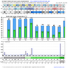
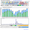
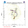
Models are backing off from their original depiction of a highly amplified phase 3-4-5 MJO orbit. Instead straddling the COD at best. I still think a new MJO wave will emerge in phase 6 and travel through phase 7-8-1(whether it hits another brick wall in phase 8 is anyone's guess) which'll constructively interfere with the West Pacific equatorial Warmpool around 160 degrees east, reignite WWB's, and reestablish our -EPO/+TNH pattern in March!
Right now the MJO being in the Eastern Hemisphere is destructively interfering with that but once it reemerges in the West, Old Man Winter should quickly reestablish himself for two-three weeks!

Right now the MJO being in the Eastern Hemisphere is destructively interfering with that but once it reemerges in the West, Old Man Winter should quickly reestablish himself for two-three weeks!
