-
Hello, please take a minute to check out our awesome content, contributed by the wonderful members of our community. We hope you'll add your own thoughts and opinions by making a free account!
You are using an out of date browser. It may not display this or other websites correctly.
You should upgrade or use an alternative browser.
You should upgrade or use an alternative browser.
Pattern Fab Feb
- Thread starter SD
- Start date
Snow-on-snow, let’s do it!!
accu35
Member
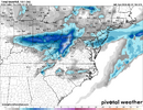
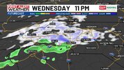
0z Nam bring backside snow flurries in Alabama Wednesday night into Thursday
Historically speaking, it seems as if we usually get a storm on the front end or back end of a pattern shift. Here’s hoping we get a big one that feeds the entire board.
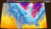
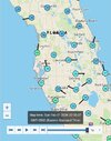
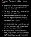
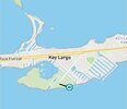
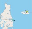
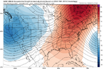
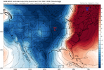
Peepaw cold snapView attachment 193356View attachment 193355
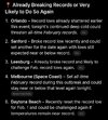
Oranges are subject to being ruined if temps are AOB 28F for 4+ hours assuming no adequate protective measures were taken.
StormSurf
Member
These are the events when I was a kid when my dad would turn on the sprinklers and our yard would be a winter wonderland the next morningPeepaw cold snapView attachment 193356View attachment 193355
CNCsnwfan1210
Member


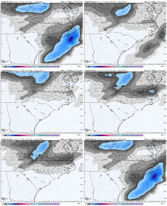
00z Euro AI, Euro, GFS, and Canadian all showing a weak system for NC with maybe a rain to snow/light snow setup.
Sent from my iPhone using Tapatalk
Edward Nygma
Member
Looks accurate. RDU local min.
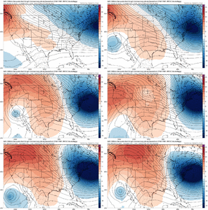
Looked out through LR. Just looks Ho-Humbug/ seasonal throughout Feb. Might can whip something up mid month. If we score its gonna have to catch some 2 day ripple where everything just lines up right. Pattern is going to start its seasonal shuffling, meaning roller coaster time as winter will start its wind down second half of Feb into early March. The CFS now goes out into the 1st week of March. Looks like the Block stays pretty entrenched up over Greenland for next couple of weeks is about only positive Ive noticed. Pretty much just seasonal wx. Which for most of us outside of elevation equals to avg daytime highs evolving and scooting back up into the 50's.
Pattern chasing is no fun after Groundhog day. You have to look for smaller windows than what you look for Nov, Dec and Jan. Occasionally you get some Like 2013, or that March back in the 1960's. So it's doable, but your better served looking for 3-5 day windows that can yield an opportunity
Pattern chasing is no fun after Groundhog day. You have to look for smaller windows than what you look for Nov, Dec and Jan. Occasionally you get some Like 2013, or that March back in the 1960's. So it's doable, but your better served looking for 3-5 day windows that can yield an opportunity
Last edited:
Brent
Member
Heading for 60s here today haha
I know winter isn't over but I'm kind of ready for a break... There's still ice on the walkway
I know winter isn't over but I'm kind of ready for a break... There's still ice on the walkway
I'm running out of Aces. Been a Fabulous winter as we've basically hit 0, Had 7 winter wx precip events ( 6 all snow). Doubled our annual Snowfall accum / sitting at 14.5. Averaged Below normal Dec and Jan temp wise. Feb is off to Below Normal start. Very fortunate here in this micro climate
Day 9 with sleet or snow on the ground. 10 this morning. Salisbury hit -1
6.8 here.
Looks like the Urban heat island effect really did its thing in CLT metro keeping lows close to 10 in the western part of Union county for the airport in Monroe back to Stallimgs and Indian Trail. Here at my house in the eastern part of the county it bottomed out at 3 this morning and friends I’ve talked to out in the country side were between 1-4
D-Ray
Member
11 this morning
wow
Member
Bottomed out at 3.9 .. that might be the lowest since 96
Bottomed out at 8.4°
Sent from my iPhone using Tapatalk
Sent from my iPhone using Tapatalk
packfan98
Moderator
3 degrees in Greensboro. Coldest since 1996.
NCWeatherhound
Member
3 degrees down in Lumberton and Chadbourn. 4 in Hoke County. The snowpack is really earning it's pay this morning.
I’ll respectfully decline that event if it includes any rain that’s going to help this snowpack go away faster.
CNCsnwfan1210
Member


Got down to 16 but the wind never went calm in SW Wilson county under snow cover.
Sent from my iPhone using Tapatalk
Heelyes
Member
NBAcentel
Member
EDIT: Omg they actually got down to -1. Insane for Lumberton.3 degrees down in Lumberton and Chadbourn. 4 in Hoke County. The snowpack is really earning it's pay this morning.
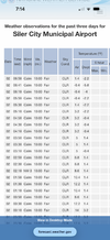
LBT :Lumberton : 32 / -1 / 0.00
Tied for second lowest all-time temp there and coldest since 1989.
landed around 15
Oh no not again

 Just from the untrained eye this looks like cold chasing moisture
Sent from my A600DL using Tapatalk
I’ve posted about how the Icon typically isn’t warm biased since it’s often 2nd coldest only to CMC for lows unless over winter precip cover when GFS sometimes gets insanely cold (<0F) like it did after the icestorm last week. Whereas that’s usually true, it isn’t this morning over deep snow, where Icon is much too warm in some areas! So, perhaps Icon tends to be too warm over deep snow.
I’ve also talked about UKMET often being too warm for lows this winter, which is true although that’s been with no deep snow. I’m stunned to see the role reversal of UK being the coldest/too cold over deep snow vs no snow. And I’ll also check the 0Z GFS/Euro/CMC for 7AM:
Icon/UK/GFS/Euro/CMC
Over deep snowcover (NC):
CLT 15/-3/10/-1/5; actual 11
FAY 17/11/10/13/14; actual 18
RDU 18/16/13/13/15; actual 12
GSO 16/5/13/12/6; actual 6
So, avg miss over deep snow
Icon/UK/GFS/Euro/CMC:
+4.8/-4.5/-0.3/-2.5/-1.8
Warmest Icon, Coldest UK, meaning role reversal!
Over (near) bare ground (GA):
SAV 21/21/27/24/18; actual 24
Columbus 24/26/26/27/17 actual 22
NE ATL 23/25/28/24/15; actual 19
Rome: 24/25/22/24/11; actual 21
So, avg miss over bare ground
Icon/UK/GFS/Euro/CMC
+1.5/+2.8/+4.3/+4.3/-6.3
Warmest GFS/Euro, coldest CMC, with this being the more typical
Sources: 0Z hour 12 of these models:
Icon
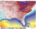
UKMET
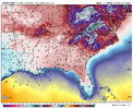
GFS
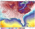
Euro
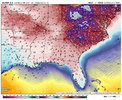
CMC
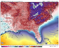
I’ve also talked about UKMET often being too warm for lows this winter, which is true although that’s been with no deep snow. I’m stunned to see the role reversal of UK being the coldest/too cold over deep snow vs no snow. And I’ll also check the 0Z GFS/Euro/CMC for 7AM:
Icon/UK/GFS/Euro/CMC
Over deep snowcover (NC):
CLT 15/-3/10/-1/5; actual 11
FAY 17/11/10/13/14; actual 18
RDU 18/16/13/13/15; actual 12
GSO 16/5/13/12/6; actual 6
So, avg miss over deep snow
Icon/UK/GFS/Euro/CMC:
+4.8/-4.5/-0.3/-2.5/-1.8
Warmest Icon, Coldest UK, meaning role reversal!
Over (near) bare ground (GA):
SAV 21/21/27/24/18; actual 24
Columbus 24/26/26/27/17 actual 22
NE ATL 23/25/28/24/15; actual 19
Rome: 24/25/22/24/11; actual 21
So, avg miss over bare ground
Icon/UK/GFS/Euro/CMC
+1.5/+2.8/+4.3/+4.3/-6.3
Warmest GFS/Euro, coldest CMC, with this being the more typical
Sources: 0Z hour 12 of these models:
Icon

UKMET

GFS

Euro

CMC

Last edited:
Bigedd09
Member
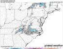
Surprised not many are talking about Wednesday into Thursday. Seems like a decent chance at some wet snow for some areas
Sent from my iPhone using Tapatalk
Sent from my iPhone using Tapatalk
CNCsnwfan1210
Member

12z RGEM suggesting wintry precip for parts of NC Wednesday night/Thursday morning
Sent from my iPhone using Tapatalk

