-
Hello, please take a minute to check out our awesome content, contributed by the wonderful members of our community. We hope you'll add your own thoughts and opinions by making a free account!
You are using an out of date browser. It may not display this or other websites correctly.
You should upgrade or use an alternative browser.
You should upgrade or use an alternative browser.
Wintry Machine Learning Mauler 1/30-2/1
- Thread starter SD
- Start date
John1122
Member
You can go to the NBM Dashboard, select the NBM run for version 4.3, select the parameter, and hour, and it tells you the models used in it. Them not using the Euro Op but using the GFS op is wild to me. As is using the oldest data from the Euro ens out of every model.NBMv4 has these models/weights:
NBMv5 (parallel) is a bit different but the weights haven't been released. Pretty sure they removed SREF and added AI Models (like AIFS). They also do some different bias correction methods in v5 such as probability matched mean to achieve more accurate/unsmoothed outputs.
View attachment 191545
That is so much better to the eyes than pivotal.
Heavy axis rides right down the median of i95 from pedros (SOB) to the rest area on va/nc line
Cary_Snow95
Member
NBMv4 has these models/weights:
NBMv5 (parallel) is a bit different but the weights haven't been released. Pretty sure they removed SREF and added AI Models (like AIFS). They also do some different bias correction methods in v5 such as probability matched mean to achieve more accurate/unsmoothed outputs.
View attachment 191545
Completely agree with this. Simply because I still don’t understand. I’m a slow learner. Thank you, for posting as some are able to discern the fantastic information you provide. Can’t thank you and many others enough. Mean that very sincerely.
WxBlue
Meteorologist
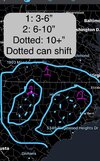
My first and only call map. Very not professional looking but my general thoughts. Dry slots are a thing but I think with all the dynamics at play plus great snow ratios the lower end who busts still get a few inches of snow.
I think Raleigh and Charlotte are golden and will each pick up their own maximum amount of snowfall. Then in those spots there will be an area that can get 10+ inches of snow. Those dotted areas can of course shift anywhere in those zones depending on where banding develops.
Let’s see how I do!
(This is NC only I didn’t give much thought to areas outside but I suppose anywhere outside of zone 1 will more than likely see 1-3)

Webberweather53
Meteorologist
If you can get the elevated warm front to produce before the mesolow cranks up over the upstate and induces surface divergence, that would totally bust my forecast in Raleigh.
Makeitsnow
Member
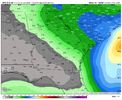
final would be a minimum of 6 inches across ne ga. would be 3 to as much as 5 on the east side of atl.AIGFS increased once again for ATL! WOW!
At around 0.25" QPF for north ATL. That's 5" at a 20:1 ratio.
View attachment 191554
The whole model progression has been pretty spectacular in my opinion for the Carolinas. We had some model runs to the SW, some to the NE, and they've converged on us now. And the 50/50 low hanging in and trending some SW was huge. All of that has been great. Now just the fine details.CMC a good hit too, good trends at 0z tonight that's for sure. Now can we hold them through go time
View attachment 191562
At the projected ratio (22:1), 0.41" would become 8.8".
I'll be staying up for the 6z HRRR!RAP going insane rn holyView attachment 191569
RAP trends precede HRRR trends bc it is the parent grid. 6z HRRR should be nice
Webberweather53
Meteorologist
Is your list a list of included models? Because if so, it appears to includes numerous Euro ensemble members.You can look at the NBM Dashboard. It lists no OP Euro that I see, and 0z Euro ens members, and 6z GEFS ens members for 18z.
Model Date Cycle Projection Valid Date
ECMWFE P1 20260129 0 60 2026013112
GEFS P27 20260129 6 54 2026013112
GEFS P26 20260129 6 54 2026013112
GEFS P25 20260129 6 54 2026013112
GEFS P24 20260129 6 54 2026013112
GEFS P23 20260129 6 54 2026013112
GEFS P22 20260129 6 54 2026013112
GEFS P21 20260129 6 54 2026013112
GEFS P20 20260129 6 54 2026013112
GEFS P2 20260129 6 54 2026013112
GEFS P28 20260129 6 54 2026013112
GEFS P19 20260129 6 54 2026013112
GEFS P17 20260129 6 54 2026013112
GEFS P16 20260129 6 54 2026013112
GEFS P15 20260129 6 54 2026013112
GEFS P14 20260129 6 54 2026013112
GEFS P13 20260129 6 54 2026013112
GEFS P12 20260129 6 54 2026013112
GEFS P11 20260129 6 54 2026013112
GEFS P10 20260129 6 54 2026013112
GEFS P1 20260129 6 54 2026013112
GEFS P18 20260129 6 54 2026013112
GEFS P29 20260129 6 54 2026013112
GEFS P3 20260129 6 54 2026013112
GEFS P30 20260129 6 54 2026013112
SREF ARW P6 20260129 3 57 2026013112
SREF ARW P4 20260129 3 57 2026013112
SREF ARW P3 20260129 3 57 2026013112
SREF ARW P2 20260129 3 57 2026013112
SREF ARW P1 20260129 3 57 2026013112
SREF ARW N6 20260129 3 57 2026013112
SREF ARW N4 20260129 3 57 2026013112
SREF ARW N3 20260129 3 57 2026013112
SREF ARW N2 20260129 3 57 2026013112
SREF ARW N1 20260129 3 57 2026013112
RAPX 20260129 15 45 2026013112
NAMH 20260129 12 48 2026013112
HRRRX 20260129 12 48 2026013112
HIRESW FV3 20260129 12 48 2026013112
GFS 20260129 6 54 2026013112
GEFS P9 20260129 6 54 2026013112
GEFS P8 20260129 6 54 2026013112
GEFS P7 20260129 6 54 2026013112
GEFS P6 20260129 6 54 2026013112
GEFS P5 20260129 6 54 2026013112
GEFS P4 20260129 6 54 2026013112
ECMWFE P9 20260129 0 60 2026013112
WRF ARW 20260129 12 48 2026013112
ECMWFE P8 20260129 0 60 2026013112
ECMWFE P6 20260129 0 60 2026013112
ECMWFE P28 20260129 0 60 2026013112
ECMWFE P27 20260129 0 60 2026013112
ECMWFE P26 20260129 0 60 2026013112
ECMWFE P25 20260129 0 60 2026013112
ECMWFE P24 20260129 0 60 2026013112
ECMWFE P23 20260129 0 60 2026013112
ECMWFE P22 20260129 0 60 2026013112
ECMWFE P21 20260129 0 60 2026013112
ECMWFE P20 20260129 0 60 2026013112
ECMWFE P29 20260129 0 60 2026013112
ECMWFE P2 20260129 0 60 2026013112
ECMWFE P18 20260129 0 60 2026013112
ECMWFE P17 20260129 0 60 2026013112
ECMWFE P16 20260129 0 60 2026013112
ECMWFE P15 20260129 0 60 2026013112
ECMWFE P14 20260129 0 60 2026013112
ECMWFE P13 20260129 0 60 2026013112
ECMWFE P12 20260129 0 60 2026013112
ECMWFE P11 20260129 0 60 2026013112
ECMWFE P10 20260129 0 60 2026013112
ECMWFE P19 20260129 0 60 2026013112
ECMWFE P3 20260129 0 60 2026013112
ECMWFE P30 20260129 0 60 2026013112
ECMWFE P31 20260129 0 60 2026013112
ECMWFE P50 20260129 0 60 2026013112
ECMWFE P5 20260129 0 60 2026013112
ECMWFE P49 20260129 0 60 2026013112
ECMWFE P48 20260129 0 60 2026013112
ECMWFE P47 20260129 0 60 2026013112
ECMWFE P46 20260129 0 60 2026013112
ECMWFE P45 20260129 0 60 2026013112
ECMWFE P44 20260129 0 60 2026013112
ECMWFE P43 20260129 0 60 2026013112
ECMWFE P42 20260129 0 60 2026013112
ECMWFE P41 20260129 0 60 2026013112
ECMWFE P40 20260129 0 60 2026013112
ECMWFE P4 20260129 0 60 2026013112
ECMWFE P39 20260129 0 60 2026013112
ECMWFE P38 20260129 0 60 2026013112
ECMWFE P37 20260129 0 60 2026013112
ECMWFE P36 20260129 0 60 2026013112
ECMWFE P35 20260129 0 60 2026013112
ECMWFE P34 20260129 0 60 2026013112
ECMWFE P33 20260129 0 60 2026013112
ECMWFE P32 20260129 0 60 2026013112
ECMWFE P7 20260129 0 60 2026013112
WRF MEM2 20260129 12 48 2026013112
This could be too light but generally I’ve always been high on totals ingesting all the data in. This just has the making, with great dynamics, to be something really special here. Can’t get better ratios for the Carolina’s. Add a coastal and upper low magic? Too many things can go right that can offset a few dry pockets here and there.My first and only call map. Very not professional looking but my general thoughts. Dry slots are a thing but I think with all the dynamics at play plus great snow ratios the lower end who busts still get a few inches of snow.
I think Raleigh and Charlotte are golden and will each pick up their own maximum amount of snowfall. Then in those spots there will be an area that can get 10+ inches of snow. Those dotted areas can of course shift anywhere in those zones depending on where banding develops.
Let’s see how I do!
(This is NC only I didn’t give much thought to areas outside but I suppose anywhere outside of zone 1 will more than likely see 1-3)
View attachment 191561
LovingGulfLows
Member
- Joined
- Jan 5, 2017
- Messages
- 1,499
- Reaction score
- 4,100
At the projected ratio (22:1), 0.41" would become 8.8".
I think it's safe just to use 15:1 ratios so no one leaves themselves disappointed. That's what I've been doing. .1 becomes 1.5. .2 becomes 3.
Btownheel
Member
That is so much better to the eyes than pivotal.
Heavy axis rides right down the median of i95 from pedros (SOB) to the rest area on va/nc line
And drops a secondary max NW because Roxboro.
Sent from my iPhone using Tapatalk
Gotta have some chasers showing up there....Cantore / Timmer
Their all time record snowfall was 0.2” in January 1977! Interior areas of Miami all got flurries from that same system!Looks like Winter Weather Advisories might be needed in *checks notes* Tampa. View attachment 191547
Also, there will most certainly be some thunder snow in the strongest bands that set up. Going to be something fun to behold.
Bad modelAnd Ukmet back to this crap
View attachment 191573
NBAcentel
Member
I think there's potential for some thundersnow west and east. Should be really dynamic as the upper teardrop wave bottoms out in the trough and starts to work east (for western to central Carolinas)....and then interacts with rapidly strengthening coastal low (eastern Carolinas)Also, there will most certainly be some thunder snow in the strongest bands that set up. Going to be something fun to behold.
John1122
Member
It has all 50 ens members. But for some reason they used euro date two model cycles old for it. They used hour 60 euro ens data for their hr 42 6 hour snowfall forecast. All other data was more recent than the Euro ens they used. After learning that, it makes sense why it felt so far behind the curve last storm.Is your list a list of included models? Because if so, it appears to includes numerous Euro ensemble members.
NBAcentel
Member
Honestly this might be the outcome. Aligns very well with my forecast
CNCsnwfan1210
Member
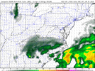
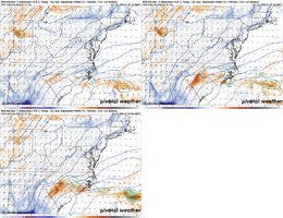
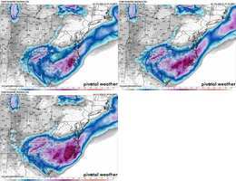
That’s the best gif I’ve seen all day, very nice trend with the elevated warm front and increased snowfall over NC
Sent from my iPhone using Tapatalk
Sctvman
Member
Eerie how similar the models have been on CHS last 2-3 days. About 2", maybe a little more or less. But the rest of the Carolinas are far, far from it. Hope we can all cash in
That's an interesting trend. It's kind of like the model is sensing more and more the strong and cold upper wave dropping in and the response is tightening temperature gradients and rising motion.

