• Hello, please take a minute to check out our awesome content, contributed by the wonderful members of our community. We hope you'll add your own thoughts and opinions by making a free account!

Wintry Machine Learning Mauler 1/30-2/1

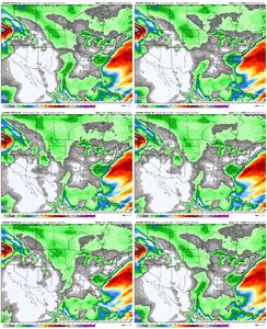
I know the focus is on the storm but this system brings really cold air into south florida and even the bahamas. gfs/canadian showing lows near freezing close to miami monday and tue am with lows into the 40s and highs only in the 50s in the bahamas...with 20mph winds out over the water. I'd hate to be the ones who booked a vacation in the bahamas.
 
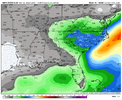
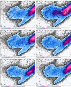
The GEFS 10:1 SLR mean has 8-9” over central NC which is insane. In reality tho, you will want to multiple at least 1.5x or so onto these given the cold deep layer temps, deep DGZ, cold ground, etc. which will all favor fluffy snow.

So really, the GEFS mean here is more like a widespread 12-15”+
Thats what I think some folks are missing here - you may only need half an inch of QPF to get 10".
 
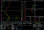
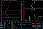
Something I would really point out to the folks west of the 77 corridor in the Carolinas and even back over northern GA… globals will often have a lot of difficulty picking up on the extent of precip with an ULL and we will often see that start to blossom when the CAMs start coming into view. That’s basically what happened in January 2003 when we saw the globals spitting out barely an inch or so over the western Carolinas and then short range models at the time really started picking up a lot more with 24 hours.
so, you think atlanta may be undermodeled? i havent looked into 2003 much
 

Further south and a bit weaker
9847d4ca4417739e2fe8e4b80a012f65.jpg


Sent from my iPhone using Tapatalk
 
This might be more of a banter post, but a repeat of January 2014 in Atlanta seems possible if people downplay the possibility of minor snow accumulation when the roads and ground will be primed for a flash freeze. It only took an inch of snow for that mess to occur.
Lucky for us, it looks like onset, if it happens, would be late Friday night (well after rush hour) or Saturday early morning.

Much less likely to cause a crazy issue here than January 2014 which hit in the middle of the work/school day.
 
i think atlanta is a super tricky forecast. i think predicting the ull, its mesoscale effects and how much banding radiates westward to you guys is tough to reason right now. i think that crew and the n ga crew will need to keep an open mind with what's on the table with this storm
Totally uneducated opinion here, but I’m thinking 50/50 shot here of *something*, assuming the general idea of the storm by the non-failure-mode models is correct (which itself has a probability associated with it)
 
Totally uneducated opinion here, but I’m thinking 50/50 shot here of *something*, assuming the general idea of the storm by the non-failure-mode models is correct (which itself has a probability associated with it)
it feels like a feast or famine kind of place to me, and modeling represents that. i could see the verification map looking like tiger stripes. if i were there i would bring a mindset of, if it happens, awesome, if it doesn't, we knew this was a possibility
 
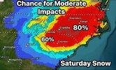
Fwiw, I just told my family in NC to prepare for up to a foot of snow, even tho i also told them the most likely outcome is probably several inches or so right now.

Could easily be a whole lot less but I’d rather be over than underprepared. This is one of those storms where you could literally be snowed in for days because nc has bad infrastructure for dealing with snow lol. And everyone is gonna flip out tomorrow and rush the grocery stores when they see those snow maps on TV with big numbers
 
i think atlanta is a super tricky forecast. i think predicting the ull, its mesoscale effects and how much banding radiates westward to you guys is tough to reason right now. i think that crew and the n ga crew will need to keep an open mind with what's on the table with this storm

When is it not honestly *sigh*? I feel like Atlanta area is always on the fringe of events like the ice storm just this past weekend. Even last year's first snow event when it got 3-4 inches of snow, it was questionable up until verification. Same thing with the gulf coast storm last year...right on the fringe. It's kind of a bit frustrating to never be confident enough to say I'm getting snow days in advance...always hoping for slow minute trends to eek out .1-.2 QPF maybe, but whatever...that's just the life of a southern snow chaser.
 
I know the focus is on the storm but this system brings really cold air into south florida and even the bahamas. gfs/canadian showing lows near freezing close to miami monday and tue am with lows into the 40s and highs only in the 50s in the bahamas...with 20mph winds out over the water. I'd hate to be the ones who booked a vacation in the bahamas.

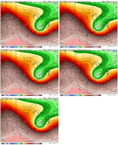
More relevant perhaps will be the 20s getting well down into the sugarcane growing areas around Lake Okeechobee. That’s gonna zap em.
 
If I’m Atlanta and I like snow, I’m optimistic here. This is going to be a dynamic event. A shift in wind here or there as this thing comes together from 3 seperate directions off the Carolina coast is going to make it snow in a lot of places along the edge of the forecast area
 
it feels like a feast or famine kind of place to me, and modeling represents that. i could see the verification map looking like tiger stripes. if i were there i would bring a mindset of, if it happens, awesome, if it doesn't, we knew this was a possibility
That is exactly the attitude I'm trying to maintain and telling friends and family that this system is unusually difficult to predict in the Atlanta area. That said, I quietly have a much colder March 2nd-type outcome rolling around in the back of my mind, given the ULL's low strength and placement south of Macon on some of the models.
 
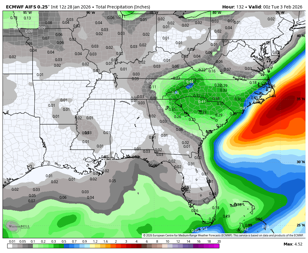
You are correct, the QPF was less. We'll have fluctuations until go time on this

With as cold as it’s going to be I’m not really worried about QPF should reality be similar to what the models are depicting. Rates last January were well over 10:1 and a streak of NC and SC wound up with nearly 10”.
 
Fwiw, I just told my family in NC to prepare for up to a foot of snow, even tho i also told them the most likely outcome is probably several inches or so right now.

Could easily be a whole lot less but I’d rather be over than underprepared. This is one of those storms where you could literally be snowed in for days because nc has bad infrastructure for dealing with snow lol. And everyone is gonna flip out tomorrow and rush the grocery stores when they see those snow maps on TV with big numbers
Well, everybody has their supplies from last week and I can see some people thinking it's a false alarm so hopefully that rush to the grocery stores isn't as bad
 
Back
Top