buckinbronco
Member
Hell CMC is giving Clearwater some snow lol
Any analogs for the upstate that come to mind?CMC took an absolute perfect path for the western carolinas to max out. And again … ULL typically overperform. You wouldn’t be able to pick up on it until we get well within short range models like the CAMs but the boom potential is massive

Bruh.... thought I'd never have the opportunity to see a March 1-2, 1980 storm again in my life. Have my doubts but like where we are atm
Watching the ACC tourney IIRC. Special days those were.Bruh.... thought I'd never have the opportunity to see a March 1-2, 1980 storm again in my life. Have my doubts but like where we are atm

If it’s going to turn the corner the CMC is usually first to do it. We laughed it off last weekend when it was the first to show that mid 20’s wedge with mid 60’s right underneath it. It likes to amp and for all of our sake I hope it’s jumping the gun with its bias and leading here
It's true that's the risk, but I mean there has to be an upper limit to both how amped this can be and how far west it tracks with this kind of Arctic cold press bearing down on it.as I see it we don’t run a huge risk of losing this to another region per say but if we’re going this route as with most if not ALL Miller A’s somebody must get rained on.

You don't. You worry about an east trend right up until you have a radar tab open.At what point do we concerned with a NW trend sitting 5-6 days out?
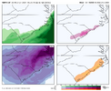
yeah the kuchera maps are really hitting hard with this storm; 15:1 ratios at minimum it seems in and around the current bullseye area
Continue to think even if the LP or ULL don’t tick west, the precip shield will widen more and we will start seeing folks in the western carolinas seeing pockets of totals pushing what we see on the coast.View attachment 189825
uk should deepen more/throw more stuff inland, don't think these lobes of low pressure from convective feedback along the warm from verify
