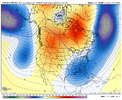
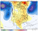
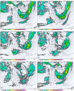
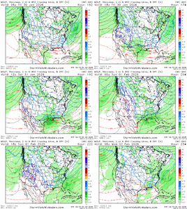
hearts for relating to this so much.. craving an actual decent snow over hereI’d give anything to feel excited about this. Instead I feel like I’m in the ER waiting on news about a loved one.
Sucks to miss out on the excitement. Need something joyful now. Ugh.
-
Hello, please take a minute to check out our awesome content, contributed by the wonderful members of our community. We hope you'll add your own thoughts and opinions by making a free account!
You are using an out of date browser. It may not display this or other websites correctly.
You should upgrade or use an alternative browser.
You should upgrade or use an alternative browser.
Pattern January Joke
- Thread starter SD
- Start date
That's insane. It needs to hang in the Southernwx.com hall of fameThis is starting to feel personal.
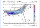
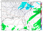
There is going to be another winter storm. I’d almost guarantee it View attachment 188173
Crazy 93 Blizzard my A$$ ain't got nothing on this
If I can keep my power loss under 48 hours I might be a little more bricked for it. It’s contingentThat's insane. It needs to hang in the Southernwx.com hall of fame
Last edited:
Since this is a family show ill refrain from a replyIf I can keep my power loss under 48 hours I might be a little more bricked for it. It’s contingent
Cad Wedge NC
Member
No, I don't think so this time. Completely different setup. Not going to be dealing with a Baja low.8 days out, Congrats Louisville, Again...
dsaur
Member
Just think if it as practice for when a big rock from space pushes us into a nuclear winter, and it's zr,ip and sn year around, lol. Throw in a lack of sun spots and it's another little ice age. We are in a space of extremes now with our weather. Way, way too hot in summer then bam comes an anomalous winter. Storm after storm...split flow, consistent blocking, cross polar flows. Good times by candle light.If I can keep my power loss under 48 hours I might be a little more bricked for it. It’s contingent
rburrel2
Member
We’re already too far north with this threat. Though the ensembles are pretty flat so I dunno.
broken025
Member
My 3 feet of snow turned into a trace of ice. Who do I talk to about this?
NWG_WX14
Member
Looks like the ole Great Lakes low made an appearance there with the threat next week.
GeorgiaGirl
Member
We’re already too far north with this threat. Though the ensembles are pretty flat so I dunno.
It looked fine initially to me but then spazzed out like the AI version of the GFS did.
Considering the large shifts we saw with this weekend's deal, we've got a long way to go and I'm so tired with this threat (even though I'm not in the main focus area) that I'm going to at least TRY to scale back.
It's like low pressures know when they get closing in on the Apps & immediately head North.
@MNGRMy 3 feet of snow turned into a trace of ice. Who do I talk to about this?
I pray it’s a coastal. Y’all can have it
coldspringsfarm
Member
One thing we have going for us is that the current storm is eating the Baja low for breakfast so we don't have to worry about that thing any more this winter. Thats how it works, right?
FYI....SD opened up a new Feb thread. Peace out!
iGRXY
Member
All I will say is one of you on this board must’ve got tired and sold your soul for this upcoming pattern. The board thanks you for your sacrifice
Cold ice this weekend and cold rain next! Rinse and repeat the patternAll I will say is one of you on this board must’ve got tired and sold your soul for this upcoming pattern. The board thanks you for your sacrifice
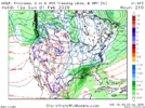
Truly incredible cold across a large swath of the country right now while we bask in mildness, at least for now. Negative temps from the northeast all the way back to the upper Midwest.
- Joined
- Jan 23, 2021
- Messages
- 4,596
- Reaction score
- 15,183
- Location
- Lebanon Township, Durham County NC
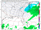
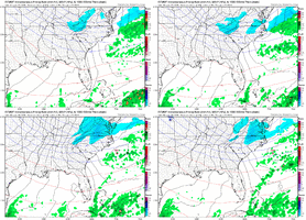
Canadian really likes that thing tooThursday thumper inbound View attachment 188461
I'm worried it ends up another Va snow but whateverCanadian really likes that thing too
- Joined
- Jan 23, 2021
- Messages
- 4,596
- Reaction score
- 15,183
- Location
- Lebanon Township, Durham County NC
We are going to get nammed at some point by this mid week clipper.
This certainly seems like the pattern this week where one of those can over perform and surprise us east of the mountainsWe are going to get nammed at some point by this mid week clipper.
It’s becoming quite obvious to me that the period ~1/15-2/8/26 is going to go down as an historic/very memorable winter period in the SE US due to a combo of winter storms and cold. This will be one of those historic periods that will frequently be referred to when talking about past great winter periods for the SE as a whole.
I took a walk ~an hour ago. With temps of only ~46 along with it being very windy, it was quite the cold, enjoyable walk.
I took a walk ~an hour ago. With temps of only ~46 along with it being very windy, it was quite the cold, enjoyable walk.
With the CAD overperforming, think we’ll hit those single digit or below zero numbers the models were throwing out a few days ago?
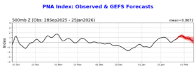
1. It looks like that after quite a negative start (~-0.9 for Jan 1-8), we’re most likely headed toward an ~+0.5 PNA for Jan, which will keep the long streak alive of -ENSO -PNA Decembers transitioning to +PNA Januaries that stretches all of the way back to 1983-4. I’ll revisit this when we get the final Jan #:
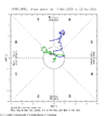
2. Well, the models did very well in predicting an obliteration of the old record long met. winter phase 6 MJO, which was 13 days (1/30-2/11/2011): the one this month was 17 days as it ran from Jan 5th through Jan 21st:

2. Well, the models did very well in predicting an obliteration of the old record long met. winter phase 6 MJO, which was 13 days (1/30-2/11/2011): the one this month was 17 days as it ran from Jan 5th through Jan 21st:

WEATHERBOYROY
Member
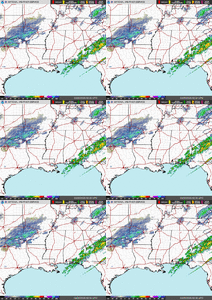
I know it is flurries at best, but an upper-level disturbance over texas has survived to enter western Ark and La tonight. I'm sure after the terrible ice storm all around Alabama, it is insignificant comparably speaking, but we have barely seen a snow flurry in north central Alabama this year. Just curious if the disturbance might get a moisture boost when it enters the track of the previous storm?

GiantBear
Member
Looks like it’ll struggle to make it east of the Ozarks based on what the radar is doing.I know it is flurries at best, but an upper-level disturbance over texas has survived to enter western Ark and La tonight. I'm sure after the terrible ice storm all around Alabama, it is insignificant comparably speaking, but we have barely seen a snow flurry in north central Alabama this year. Just curious if the disturbance might get a moisture boost when it enters the track of the previous storm?
Enjoy the frozen mud, turkey creek style. This has never been our kind of storm . We shall see what lies ahead, pattern is loaded.I know it is flurries at best, but an upper-level disturbance over texas has survived to enter western Ark and La tonight. I'm sure after the terrible ice storm all around Alabama, it is insignificant comparably speaking, but we have barely seen a snow flurry in north central Alabama this year. Just curious if the disturbance might get a moisture boost when it enters the track of the previous storm?
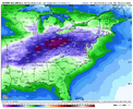
View attachment 189302
Pops
Member
We got pretty good flurries up here north of Florence nowI know it is flurries at best, but an upper-level disturbance over texas has survived to enter western Ark and La tonight. I'm sure after the terrible ice storm all around Alabama, it is insignificant comparably speaking, but we have barely seen a snow flurry in north central Alabama this year. Just curious if the disturbance might get a moisture boost when it enters the track of the previous storm?
View attachment 189302
shoalswxlady
Member
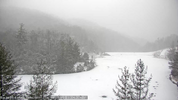
Look out the door and we are having very light snow, flurries blizzard lol. Didn't except that
WEATHERBOYROY
Member
PRAISE THE LORD!!! I'M SEEING SOME PRETTY SNOW FLURRIES!!I know it is flurries at best, but an upper-level disturbance over texas has survived to enter western Ark and La tonight. I'm sure after the terrible ice storm all around Alabama, it is insignificant comparably speaking, but we have barely seen a snow flurry in north central Alabama this year. Just curious if the disturbance might get a moisture boost when it enters the track of the previous storm?
View attachment 189302

