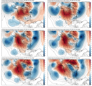
-
Hello, please take a minute to check out our awesome content, contributed by the wonderful members of our community. We hope you'll add your own thoughts and opinions by making a free account!
You are using an out of date browser. It may not display this or other websites correctly.
You should upgrade or use an alternative browser.
You should upgrade or use an alternative browser.
Pattern January Joke
- Thread starter SD
- Start date
GiantBear
Member
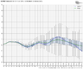
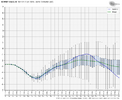
1043 High over Ohio and Kentucky is unlikely to verify so it would come north, all other things remaining equal (which they won’t)yeh she is lurking... View attachment 188108View attachment 188109
You have to think ICE pack and just how cold it’s going to be on top of it over the next week is going to play a big factor on this one. It will find the path of least resistance one way or another and that path appears to be very far south next weekend
My early hunch is we are all going to be screaming mercy before this is all said and done
My early hunch is we are all going to be screaming mercy before this is all said and done
GeorgiaGirl
Member
You have to think ICE pack and just how cold it’s going to be on top of it over the next week is going to play a big factor on this one. It will find the path of least resistance one way or another and that path appears to be very far south next weekend
My early hunch is we are all going to be screaming mercy before this is all said and done
Yep, as of now, I would be more concerned about suppression than NW. The reason why is not just about this coming storm, but apparently the blocking is going to be high.
But it does appear as if the Euro vaguely hinted again here.
Storm signal is definitely there and this will be another one to watch. Can we finally not be too far south or north for just one storm? So frustrating to track lately.
We've been backing up troughs all winter long. Don't stop now, except, of course, the GFS
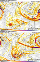
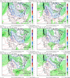
12Z runs: The Euro is a day later with its actual storm vs GFS/CMC. Euro has an earlier weak wave well offshore at same time as GFS/CMC storm that then gets combined with its main storm:
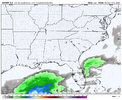
The Icon as was noted earlier at 180 has a precursor just a bit ESE of the same wave that GFS/CMC have and is well developed possibly heading for far SE suppression:
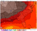
The UKMET has a precursor in a similar spot to the model consensus in the W Gulf at 168:


Keep in mind the neverending NW tendency is always lurking to do its thing, like it or not, due to models overdoing cold.
I would take a decade long break from model watching or following the weather if I get 36".
BKWRN29
Member
No you wouldn’t lol that’d just make you wanna do it that much more!I would take a decade long break from model watching or following the weather if I get 36".
Looks to me like the gefs and eps are both suppressed. We take that at this point but definitely still makes me nervous after going 0 for 2 the last two weekends but a long way to go and would be even more nervous to have overwhelming support. 
accu35
Member
Reason Euro has a 9/10 day storm is because it’s so suppressed before moving NW towards the east coast. Start off early as Friday in our westerns SW areas in TX before getting squashed. So if we can trend this north a little on the Euro then it would start as early as Thursday night or Friday back west gulf coast. Not long at all
I’ll be in California for work weds and thurs so if we need me to seed the system let me knowReason Euro has a 9/10 day storm is because it’s so suppressed before moving NW towards the east coast. Start off early as Friday in our westerns SW areas in TX before getting squashed. So if we can trend this north a little on the Euro then it would start as early as Thursday night or Friday back west gulf coast. Not long at all
broken025
Member
What did EPS show?
accu35
Member
If you don’t mind just time it right and will be goodI’ll be in California for work weds and thurs so if we need me to seed the system let me know
Maybe. I once caught a 38" redfish within 30 minutes of arriving to Jekyll Island. I never got the rod out the rest of the week so I might be content for a good bit.I would take a decade long break from model watching or following the weather if I get 36".
Make sure to check with BAM -- he needs to approve all cloud seeding trajectoriesI’ll be in California for work weds and thurs so if we need me to seed the system let me know
wow
Member
Drawing me in again... This is actually someone similar to our current storm with a wave dropping into the SW but with a PV building in over the Atlantic.. like 10 degrees further south than our current storm. If that's the case, then it ain't charging up the TN valley.
I can foresee the western lobe of the PV trend further west over time and bring this further north with a more amped low.. but not to the point of our current system if that PV remains in the area and doesnt trend east.
That would be a good trend for the Euro to come closer to the GFS scenario; with the western lobe drawing further west. Same trend as last Jan's storm and the current storm.
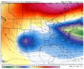
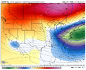


Just so we are on the same page. Amping bad, phasing bad, slowing down bad
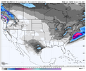
That's a hellova miller BThe EPS follows it's op to a T. You can see the footprint nose dive into Texas.. disappear then reappear off the East coast. View attachment 188132
BKWRN29
Member
It’s on to something.. getting more hopeful. I wish I could give myself a break this weekend and not track anything then start back Monday and see where we are. Not happening tho. This storm has my full attention.
I just want 6+ in of snow across Atlanta and Athens into Columbia SC.. we are so often pinched off
but i suppose everyone all over the SE can say that now and then.
Gotta rob peter to pay paul


but i suppose everyone all over the SE can say that now and then.
Gotta rob peter to pay paul
NBAcentel
Member
NBAcentel
Member
Literally not even a sniff of above normal anomalies after today on the EPS at 2M. We used to pray for times like thisThis is starting to feel personal.
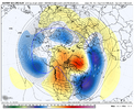
There is going to be another winter storm. I’d almost guarantee it View attachment 188173
and what a mistake that was FroLiterally not even a sniff of above normal anomalies after today on the EPS at 2M. We used to pray for times like this
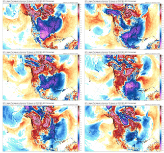
Damn AK is on fire!That reload at the end of the run is the knockout blow. There will be a glacier down the eastern seaboard by the time this is over View attachment 188178
Gonna be Fab Feb foreal!
LukeBarrette
im north of 90% of people on here so yeah
Meteorology Student
Member
2024 Supporter
2017-2023 Supporter
We gotta start the Feb threadLiterally not even a sniff of above normal anomalies after today on the EPS at 2M. We used to pray for times like this
I’d give anything to feel excited about this. Instead I feel like I’m in the ER waiting on news about a loved one.That reload at the end of the run is the knockout blow. There will be a glacier down the eastern seaboard by the time this is over View attachment 188178
Sucks to miss out on the excitement. Need something joyful now. Ugh.
LovingGulfLows
Member
- Joined
- Jan 5, 2017
- Messages
- 1,499
- Reaction score
- 4,100
I’d give anything to feel excited about this. Instead I feel like I’m in the ER waiting on news about a loved one.
Sucks to miss out on the excitement. Need something joyful now. Ugh.
Yeah, it's cool that we have a chance at snow next weekend(and possibly further than that), but it's so hard to look past this weekend's storm.
Call it SledbruaryWhatever name yall can give it to jinx the sh** out of it go ahead. Better yet let @RBR71 start the thread that should kill it
That bring the torch!
MichaelAndrews
Member
This would be the one time we can't jinx it, because it would be more painful for it to actually happen this go around when it's usually painful when it missesWhatever name yall can give it to jinx the sh** out of it go ahead. Better yet let @RBR71 start the thread that should kill it

