Brent
Member
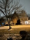
Looks like around 5 inches here. If the rates had been better this would have been historic here no doubt
Nah, should hit Greenville around 2:30. It’s sped up. Hrrr says we’re 24 when it hitsWhat’s the timing on that kidney bean now? Still 5pm?
Future cast looks nastyNah, should hit Greenville around 2:30. It’s sped up. Hrrr says we’re 24 when it hits

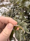
It’ll last a while based on the sleet reports in Georgia. IMOJust went outside I see we are sleeting like crazy. How long can it last though?
Just went outside I see we are sleeting like crazy. How long can it last though?
3hr accums over Clemson, Pickens, Easley..already over 1/4”It’ll last a while based on the sleet reports in Georgia. IMO

If it was snow yes. Very good. The best, even
I don’t think I can spike the football just yet, but my sleet accumulation forecast is looking pretty good right now, hahaYes, heaviest yet. Mega sleet. Will prob be some liquid mixed in with the heaviest stuff bc the water droplets are bigger and have a tougher time freezing though. We will see!
But still no signs of liquid mixing in here yet.
Tighten up for sure over the last 4 hours based on the SPC page.925 nose starting to break down on mesoanalysis, let’s see how she holds up
With the look on radar, the upstate of SC into the Piedmont of NC is about to get multiple inches of sleet. Some areas still reporting some snow.

I'm 55 and can't remember seeing any precip at 23 deg in Oconee. Fzr starting to mix back into sleet in Southern oconeeIt’s been a long time since I’ve seen winter precip at 21 degrees here. In fact, I’m not sure I ever have in the last 30 years.
We’ve done 23/24 several times, but not 21.

It’s been at least since 1988 for meI'm 55 and can't remember seeing any precip at 23 deg in Oconee. Fzr starting to mix back into sleet in Southern oconee
Sent from my SM-G960U using Tapatalk


You think we stay below freezing for the duration? Hrrr has that now. NWS mentions us going above freezing.This is an old style wedge bust. No modeling could see it being that cold View attachment 188934View attachment 188935View attachment 188936View attachment 188937View attachment 188938View attachment 188939
This is an old style wedge bust. No modeling could see it being that cold View attachment 188934View attachment 188935View attachment 188936View attachment 188937View attachment 188938View attachment 188939
Doubt it at this point, we are probably rather gonna be fighting to get out of the 20s during that convective lineYou think we stay below freezing for the duration? Hrrr has that now. NWS mentions us going above freezing.
This is an old style wedge bust. No modeling could see it being that cold
You think we stay below freezing for the duration? Hrrr has that now. NWS mentions us going above freezing.
I don't think we get above freezing in the CLT area either but we better pray we do, that line will be crushing as it moves throughDoubt it at this point, we are probably rather gonna be fighting to get out of the 20s during that convective line
I'm afaid that's what might take out the power. It may not add to the ice accrual that much with heavy rates and rising temps? In any case, I'm going to be ready when it comes through.Alan Huffman says that he believes the triangle will stay below freezing. He says if it changes over it will only be at the very very end.
Sent from my iPhone using Tapatalk
HRRR and RRFS has me to you and everyone in between below freezing for the duration. Including the "squall" line. Seeing how stout this CAD is, I tend to believe we stay below freezingYou think we stay below freezing for the duration? Hrrr has that now. NWS mentions us going above freezing.