Might be banter, what think about what?Makes you think
View attachment 187564
-
Hello, please take a minute to check out our awesome content, contributed by the wonderful members of our community. We hope you'll add your own thoughts and opinions by making a free account!
You are using an out of date browser. It may not display this or other websites correctly.
You should upgrade or use an alternative browser.
You should upgrade or use an alternative browser.
Wintry January 23rd-27th 2026
- Thread starter SD
- Start date
jim gandy set the precedent this morning showing the overnight icon and his thinking. if you're around CAE, probably prep. I know the euro was looking better for us, but now we are starting to get consensus down here. it took a shift south with the ZR and now the canadian/gfs... i think we are gonna set up a bit stronger on the wedge side and it's going to be hard to remove
i expect winter storm watches 3pm today for us around here, maybe they wait until tomorrow morning, but they're coming
our local office is noting that the ensemble members more than half are a bad situation for us
also, the NAM is struggling with the cold air and thinking the precipitation can't over come the dry, do not believe what it shows. the warm air advection that is being depicted will have no problem blossoming precip
The only time I can remember in this area seeing the warm nose this warm was during the February 1994 Ice Storm. That storm did have a long period of moderate to heavy sleet in the NC Piedmont, but I remember when things switched to ZR recorded 850mb temperature at GSO was 11cYou know how it goes. Speak incorrect info enough times and many people start assuming it is true even with no evidence. Unfortunately, it’s human nature to an extent. So, my goal in these cases is to try my hardest to do my part in attempting to reduce the spread of misinfo along with my own objective evidence if I’m able to post it.
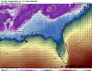
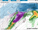
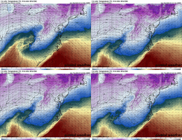
More on ICON precip types that have been mentioned. It on WxBell keeps on showing snowfall on Sunday for Columbia, Augusta, and Charlotte, but 850s are well above freezing! This is a common problem with WxBell Icon snow maps going back a ways:
View attachment 187568
850s at start: +4 to +9 in these cities
View attachment 187570
850s at end of period: +10 to +12
View attachment 187571
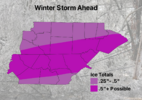
Just for reference, this is a half inch of ice:
And this particular storm (March 2014) didn’t even get a Winter Storm Warning until well after it started. It also had a ton of sleet. The Euro missed it, the GFS and NAM were the only ones to pick it up in the final couple days IIRC. We lost power for a few days IMBY. The good news is it was in the 60s a day or two later. It was in situ CAD, too, if I remember right. Another case where the wedge took longer to erode than the modeling suggested. I don’t think we got lower than 29 in the storm, either.
- Joined
- Jan 2, 2017
- Messages
- 1,566
- Reaction score
- 4,279
Current thinking:
Raleigh: 1-2” snow/sleet (mostly sleet), .5-.75” ZR
Charlotte: 1-2” snow/sleet, .5-.75” ZR
Greensboro: 2-5” snow/sleet, .2-.4” ZR
Upstate SC: 2-4” snow/sleet, .7-1” ZR
NE GA: .5” sleet, 1-1.25” ZR
Atlanta: .25-.5” ZR
Raleigh: 1-2” snow/sleet (mostly sleet), .5-.75” ZR
Charlotte: 1-2” snow/sleet, .5-.75” ZR
Greensboro: 2-5” snow/sleet, .2-.4” ZR
Upstate SC: 2-4” snow/sleet, .7-1” ZR
NE GA: .5” sleet, 1-1.25” ZR
Atlanta: .25-.5” ZR
The only time I can remember in this area seeing the warm nose this warm was during the February 1994 Ice Storm. That storm did have a long period of moderate to heavy sleet in the NC Piedmont, but I remember when things switched to ZR recorded 850mb temperature at GSO was 11c
Thanks. My point is that the ICON keeps showing snowfall when it’s really ZR. Perhaps some of this is really sleet, but it certainly isn’t snow. This is nothing new. Last year it also did this on a number of cases.
I posted this only because there were comments during the “warm bias” discussion about Icon precip type.
Hilarious differences in temps next week on modeling at the moment. Your guess is as good as mine
Webberweather53
Meteorologist
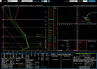
I do not buy the dry NAM. This is taken from a "dry" area. This is a freezing drizzle sounding:
View attachment 187507
Yep I do not either.
Moist upglide over the cad dome should keep at least shallow light and spotty precip going even in the dry slot, the models typically miss that.
That kind of precip is very efficient at producing freezing rain accumulations too
Just if we’re going to see a steady trend towards a colder CAD regions. That would reinforce ice storm concerns particularly north and east of AtlantaMight be banter, what think about what?
NoSnowJoe
Member
Probably a dumb question, but will there be any evaporative cooling with the system?
Yes a tonProbably a dumb question, but will there be any evaporative cooling with the system?
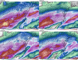
Has to be something with the GFS seeing some sort of sleetpack and dropping temps in response. I have no clue what to expect. Some of the Carolinas don't get above freezing from 7am Saturday through the start of February at least. Got to be wrong... right?Hilarious differences in temps next week on modeling at the moment. Your guess is as good as mine
NBAcentel
Member
DylanWx
Member
Makeitsnow
Member
at the surface? absolutely. there are large dewpoint depressions and very low wetbulbs area wide when precip arrives. Its one reason why the models will struggle and be a few degrees too warm in the end.Probably a dumb question, but will there be any evaporative cooling with the system?
Stormsfury
Member
The mesoscale modeling is the only thing picking this up right now. I would expect to see this expand as we get closer to the event and probably encourage a further push south on the southern edge of the wedge.Yep I do not either.
Moist upglide over the cad dome should keep at least shallow light and spotty precip going even in the dry slot, the models typically miss that.
That kind of precip is very efficient at producing freezing rain accumulations too
It seems like the deterministic models love to overdo the radiational cooling with a snowpack. It’ll be cold, and possibly record breakingly so, but some of it seems quite overdone to me. With many without power, it’ll be dangerous regardless.Has to be something with the GFS seeing some sort of sleetpack and dropping temps in response. I have no clue what to expect. Some of the Carolinas don't get above freezing from 7am Saturday through the start of February at least. Got to be wrong... right?
I don't think many people have a proper appreciation for the magnitude of what's coming.
I bet a lot of areas that are expecting a significant ice storm will end up with ALOT of sleet.
Stormsfury
Member
I'm going to say this right now. I think the particular upper level features won't see much change, but as we near to the actual event, I really expect a lot of surface temperature adjustments and expansion of the south press of the cold air damming. I have seen some of the strong cold air damming events push south and even extend offshore of SC to 100 miles banked up against the western wall of the Gulf Stream. Many a times when transfers occur further south (lacking the insanely amped solutions of now) where the transferred low materializes..
It's quite possible, the SURFACE cold press keeps pressing all the way to go time.
GSP must be buying into the cold the GFS is showing early in the week. They have CLT forecast a low of 8 Monday nightHas to be something with the GFS seeing some sort of sleetpack and dropping temps in response. I have no clue what to expect. Some of the Carolinas don't get above freezing from 7am Saturday through the start of February at least. Got to be wrong... right?
Agree, models tend to always underestimate sleet when they print these biblical ice maps. The issue will be areas where it’s more of a drizzle like Webb mentionedI bet a lot of areas that are expecting a significant ice storm will end up with ALOT of sleet.
CNCsnwfan1210
Member
I don't think many people have a proper appreciation for the magnitude of what's coming.
May have to go back a few pages on the winter storm database to find one similar
Sent from my iPhone using Tapatalk
Cad Wedge NC
Member
You're absolutely correct. If this happens as depicted, then it will be very bad for anyone in that heavy zr zone.I don't think many people have a proper appreciation for what's coming.
NVM figured it out. GFS counts all frozen in the snow depth map so it thinks there's like a foot of snow on the ground everywhere. Can't be trustedGSP must be buying into the cold the GFS is showing early in the week. They have CLT forecast a low of 8 Monday night
Sleet then freezing rain. We are going to become a glacier
And that’s probably gong to be accurate, but isn’t the GFS showing below zero temps?GSP must be buying into the cold the GFS is showing early in the week. They have CLT forecast a low of 8 Monday night
Great post RC. You’re right where I’m at. The problem is there have been splotchy isolated ice events over the years that get talked about in the small towns where they happened but no ones seen a widespread knockout blow like this in a quarter century. When the cannons start firing in the wood line on Sunday, they’ll know why they should have appreciated it a little more.I don't think many people have a proper appreciation for the magnitude of what's coming.
- Joined
- Jan 2, 2017
- Messages
- 1,566
- Reaction score
- 4,279
Ive seen these go both ways. Call for snow to start and never get a flake it would be all sleet. And ive seen mostly sleet and ZR forecast and it actually change over to snow early on and take all day to change back to sleet. Rates are going to be a factor in cooling the levels that the warm nose is prominent and could see some surprise snow amounts early on before the change over.I bet a lot of areas that are expecting a significant ice storm will end up with ALOT of sleet.
Great post RC. You’re right where I’m at. The problem is there have been splotchy isolated ice events over the years that get talked about in the small towns where they happened but no ones seen a widespread knockout blow like this in a quarter century. When the cannons start firing in the wood line on Sunday, they’ll know why they should have appreciated it a little more.
And the people that usually come to help won't be able to, because they too are incapacitated
Fascinated to see if the Euro comes in degree or two colder than the previous run. Are we just gonna have a slow realization of CAD and its strength here over the next 24-36 hours?
CltNative90
Member
It took 7 days in 2002 at the same house my parents still live in now. Old infrastructure with above ground lines, large trees, etc. A lot of linemen came in from out of state back then. With this storm affecting a much larger area central and southern US, resources will undoubtedly be spread thin.Yes. I wouldn’t expect any power until midweek. It will take a long time to restore power and recovery will likely be very slow. Snow, you can just clear it off the road and travel is safe within 36 hours of the precip ending. Ice, you just have to wait for it to melt
That usually seems to be what happens. I wish we had our 1053 high back to bully the pattern south again.Fascinated to see if the Euro comes in degree or two colder than the previous run. Are we just gonna have a slow realization of CAD and its strength here over the next 24-36 hours?
SnowNiner
Member
Great post RC. You’re right where I’m at. The problem is there have been splotchy isolated ice events over the years that get talked about in the small towns where they happened but no ones seen a widespread knockout blow like this in a quarter century. When the cannons start firing in the wood line on Sunday, they’ll know why they should have appreciated it a little more.
For this one, for MBY, specifically just for me...I see it either going one of two ways... getting a bunch of sleet, OR, the Euro trend continues and amps everything west limiting ZR precip and hardcore cold air. Either way for me it's not a extreme event, IMO for MBY.
I'm still watching though.
beanskip
Member
Larry Cosgrove is still getting counseling for underestimating CAD. Seriously, though, on major CAD events, isn't the post mortem almost always: "Man, the models sure did underestimate the strength, depth and longevity of the damming." ???I'm going to say this right now. I think the particular upper level features won't see much change, but as we near to the actual event, I really expect a lot of surface temperature adjustments and expansion of the south press of the cold air damming. I have seen some of the strong cold air damming events push south and even extend offshore of SC to 100 miles banked up against the western wall of the Gulf Stream. Many a times when transfers occur further south (lacking the insanely amped solutions of now) where the transferred low materializes..
It's quite possible, the SURFACE cold press keeps pressing all the way to go time.
This will be useful to check into off and on the next 2-3 days.That usually seems to be what happens. I wish we had our 1053 high back to bully the pattern south again.
And several, thinking they flip to plain rain, staying freezing rain longer. Cascading effect. I'm kind of jacked at seeing the end result of a pure sleet bomb with over an inch of qpf, perhaps 1.5+I bet a lot of areas that are expecting a significant ice storm will end up with ALOT of sleet.

