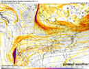
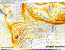
Still good to see where it’s lining up in comparison to the Globals at initialization and few hours after. .Shouldn’t the HRRR be used for very near term forecasts?
Sent from my iPhone using Tapatalk
Still good to see where it’s lining up in comparison to the Globals at initialization and few hours after. .Shouldn’t the HRRR be used for very near term forecasts?
Sent from my iPhone using Tapatalk


If that MT wave would just go straight toward NE.
Shouldn’t lighter precip also keep cad around longer?We’re trading volume of winter precip for ice accretion efficiency it seems even with these drier trends over NC
Lighter precip rates and focusing more of your lift into lower layers of the atmosphere where collision coalescence/warm rain processes dominate more means you’re going to get proportionally more bang for your buck in terms of QPF to ice ratios.
I think it's really about not having a big enough block in the right spot. It's close, but not quite. The Baja low has been playing a big role lately in the eventual evolution of the pattern/storm. But it's not the only thing.For all the changes at 500mb, particularly in the southwest, I'm struggling to find much difference in the sensible weather (which supports the "it's not about Baja" theory).
Shouldn’t lighter precip also keep cad around longer?
I’m thinking if the Baja is ejected later=weaker front slug, followed shortly by a colder and perhaps snowier 2nd wave
So then why with the less qpf trends, are we seeing the warm nose trend up?Yes that’s a key cad erosion process because your vertical sensible heat transfer from your warm nose to your cold nose below is weaker due to lighter precip rates. Heavier precip in the below freezing part of the cad dome also of course releases latent heating
Yeah, looks like it's leaving the Baja back longer and longer but there doesn't seem to be much change in SE confluence. Maybe as Rain Cold said, the block isn't strong enough to push down the cold or the MT energy causing problems? I don't anymore.
Baja and 50/50 are west
When there is snow on the line in the South, we pick and choose models we like , and break out models no one has ever heard of, if they show snow or ice! I’m just passing on informationShouldn’t the HRRR be used for very near term forecasts?
Sent from my iPhone using Tapatalk
So then why with the less qpf trends, are we seeing the warm nose trend up?
Yeah none of this makes sense anymore...how is it the closer we get the more confusing it all gets. Everything i know about this setup screams winter storm....the speed at which the models especially the Euro erode that wedge is nuts.There just no way around -14 degree dews in SVA
It doesn’t even matter what else is going on at 500mbView attachment 187261
The 00z NAM uses 18z GFS!Dumb question but if NAM runs off of GFS data, NAM should be spitting out a run with the new data from the hurricane hunters?
Is that good or bad
The 00z NAM uses 18z GFS!
Looks quite a bit lighter with the precip.. Seems to be a trend on some of the latest runs.View attachment 187264
Here’s where it ends up. Ignore weird splotches within and on edges of precip shield the nam12 does that. It is a good bit colder than the euro within the wedge. It is also the 84 hour NAM and I’m not sure why I posted it
question is this at noon (12z)? If so, it is coming in later than expected.View attachment 187264
Here’s where it ends up. Ignore weird splotches within and on edges of precip shield the nam12 does that. It is a good bit colder than the euro within the wedge. It is also the 84 hour NAM and I’m not sure why I posted it
When you move the whole system like this you’re not gonna have as much juice to squeeze. As some have outlined this may actually be worse for CAD zones ZR wise with more efficient accrual given lower ratesLooks quite a bit lighter with the precip.. Seems to be a trend on some of the latest runs.
12z is 7am eastern time and we’re roughly 12 hours into the precip by thenquestion is this at noon (12z)? If so, it is coming in later than expected.
I think someone said just the GFS and EuroWill the ICON/CMC/Ukie have the new data or just the GFS and Euro at 00z?
I am in ATL, it looks dry to me though for my area...ATL NE'ward is another story and it looks very light precip.12z is 7am eastern time and we’re roughly 12 hours into the precip by then
It also looks like the 18Z GFS, at least on the surfaceThe 00z NAM uses 18z GFS!
Sorry I was looking at it from a Carolina lens I should have read your location. I don’t really buy it’s precip depiction verbatim and you are probably 8-12 hours into the system by thenI am in ATL, it looks dry to me though for my area...ATL NE'ward is another story and it looks very light precip.
The answer on why they won't sample the northern stream. Interesting that we don't have the ability to gap-fill over land even in the year 2026.