• Hello, please take a minute to check out our awesome content, contributed by the wonderful members of our community. We hope you'll add your own thoughts and opinions by making a free account!

Misc General Banter Thread

I tell you what, presuming this isn't coming back south of the most CAD favored areas, they are set up perfectly for the Helene esque surprise from an ice storm in the future.

I saw old mates talking about their concerns about icing yesterday and the EMA had a meeting out of concern. But now it's going to be "ha! we overprepared for nothing."
 
Regression to the mean. If you see something HIGHLY anomalous and are disappointed unless exactly that scenario unfolds you are in for a world of disappointment. If it has never happened or almost never happens, it probably won't happen.*

*Unless you are in Florida in Jan 2025
it worries me a bit, because we need to figure out what happened to get so much consensus; i dont want these things to bust the other way... another event of any type

i mean you have winter storm watches out; media hoopla; now the media is scrambling and focusing on the northeast more

it looks silly
 
idk guys; the solutions were so unbelievable early on because they weren't accurate

winter weather in the teens and low 20s makes no sense in the deeper south, i-20 etc.

the clear trend is to not be as cold or "historical" and there is no refuting that at this point

gefs is starting to show rain for many areas on the individual members, first time since tracking, i expect it to continue to fold

it's funny that the ai models actually had an okay idea early on and then as they got more data started to fail along with the traditional ones
Huh?

2-3 inches of liquid falling with temps in the mid 20s the entire time isn’t historical? News to me
 
Huh?

2-3 inches of liquid falling with temps in the mid 20s the entire time isn’t historical? News to me
where? tell me where? in my area, it looks like it's not happening. maybe yours. lets not forget you guys were snow at one point

just 2 days ago we were looking at 1.5 inches of ZR + here. That just doesn't happen. Upstate/NC sure
 
I tell you what, presuming this isn't coming back south of the most CAD favored areas, they are set up perfectly for the Helene esque surprise from an ice storm in the future.

I saw old mates talking about their concerns about icing yesterday and the EMA had scheduled a meeting out of concern. But now it's going to be "ha! we overprepared for nothing."
Why are you talking like it’s not happening? Goodness… let’s see how it plays out first? I doubt euro ai/weathernext/gfs ai are wrong.
 
Why are you talking like it’s not happening? Goodness… let’s see how it plays out first? I doubt euro ai/weathernext/gfs ai are wrong.

Because I'm fairly certain it's not and for that matter our mets on the southern end of the CAD range are backing way off, including the CAE NWS south of the lakes.

For the record, Euro AI and Weathernext (tho I haven't seen the latest run) is early icing to rain probably.
 
where? tell me where? in my area, it looks like it's not happening. maybe yours. lets not forget you guys were snow at one point

just 2 days ago we were looking at 1.5 inches of ZR + here. That just doesn't happen. Upstate/NC sure
Columbia is on the edge of being major bc of the pre-frontal precipitation cutoff… but I think places like abbeville/greenwood/newberry are a lock for an incredibly bad ice storm.
 
Because I'm fairly certain it's not and for that matter our mets on the southern end of the CAD range are backing way off, including the CAE NWS south of the lakes.

For the record, Euro AI and Weathernext (tho I haven't seen the latest run) is early icing to rain probably.
I’m fairly certain you will get warning criteria freezing rain. Let’s see how it plays out and re-visit on Sunday
 
Columbia is on the edge of being major bc of the pre-frontal precipitation cutoff… but I think places like abbeville/greenwood/newberry are a lock for an incredibly bad ice storm.

that makes more sense. the models were biblically bad before with ice well down on the coasts in mass amounts and FEET of snow in NC. i mean .... idk it seems like they're just going back to reality. i do think people see winter weather but the trends are away from a complete monster in areas that don't make sense. i wouldn't want to be in central NC or even Upstate right now tbh

its just hard for me to buy those 2 + inch ice amounts even further north
I still think y’all get a bad ice storm too. Just my two cents. I mean even if you only get 1/4 inch of prefrontal light rain and drizzle… that’s all gonna accrete Sunday morning when you’re in the mid/upper 20s. And im not convinced y’all are above freezing when the main band comes through as well.
 
Regression to the mean. If you see something HIGHLY anomalous and are disappointed unless exactly that scenario unfolds you are in for a world of disappointment. If it has never happened or almost never happens, it probably won't happen.*

*Unless you are in Florida in Jan 2025
Even with Florida / Louisiana in January 2025, it wasn’t like they were getting run after run hammering them with the historic storm. The models were all over the place leading up to the event, some complete whiffs and most not nearly as significant as what they actually got.

I have heard the models were locked in in March 1993, but otherwise that doesn’t seem to be a common occurrence.
 
it worries me a bit, because we need to figure out what happened to get so much consensus; i dont want these things to bust the other way... another event of any type

i mean you have winter storm watches out; media hoopla; now the media is scrambling and focusing on the northeast more

it looks silly
I mean aren’t most areas under a watch currently progged to get warning criteria wintry weather still?
 
Also, funny how a still rather amped up/north storm, we start losing qpf.

Can't get even a slop storm/qpf bomb now lol
The issue is that if it goes too far north it basically becomes a frontal passage and we don’t get all the precip out ahead of the surface low. Thus, VA / northwards gets hammered and we get dry weather for a bit.
 
Again, their winter storm watches do not reflect their own analysis.
I truly don't know why you are so hung up on this. They initiated the watch the farthest north where wintry weather/snow is most likely at the onset, and not to be significantly further south than Birmingham/GSP NWS offices. Did you watch the video?
 
12z euro on hold?

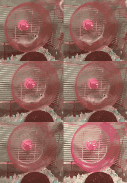
niclas-van-gerten.gif
poor hamster!
 
I truly don't know why you are so hung up on this. They initiated the watch the farthest north where wintry weather/snow is most likely at the onset, and not to be significantly further south than Birmingham/GSP NWS offices. Did you watch the video?
I did watch the video, and if that is their reasoning that makes even less sense. First of all, GSP has included their entire area, thus they can't go further south, so that point is garbage. But, the one county that is further south, Elbert, is included. Regardless, it does not match their own analysis.
 
Last edited:
I’m fairly certain you will get warning criteria freezing rain. Let’s see how it plays out and re-visit on Sunday

Because I'm fairly certain it's not and for that matter our mets on the southern end of the CAD range are backing way off, including the CAE NWS south of the lakes.

For the record, Euro AI and Weathernext (tho I haven't seen the latest run) is early icing to rain probably.
I agree with @GeorgiaGirl here @rburrel2... Our local mets are backing way off and already saying we escaped the big one most likely

Cold rain is truth here. We are not in a guarantee CAD benefitting spot like the upstate... Only the strongest, strongest, strongest of CADs could reach us. Euro now at 0.01 freezing rain for Augusta. And that's only for the tippy top most eastern part of the county.
 
Back
Top