Stormlover
Member
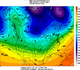
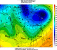
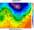
Wow. Early lean to a miller A type low from GSP..oofGSP
Key message 4: Guidance coming into better agreement that a storm
system affects the area this weekend but details remain highly
uncertain.
Another weak short wave crosses the area Friday in the nearly zonal
flow aloft. At the surface the frontal boundary from Thursday will
be slowly moving south of the area. A weak wave of low pressure may
develop along the front with enough moisture and forcing for a
chance of precipitation. If any precip develops with this, it would
be very light and mainly rain, possibly mixed with snow over the
higher elevations. No significant impacts are expected with this
wave.
The bigger story is a northern stream short wave diving into the
central CONUS Saturday with lowering heights for our area as it
swings across the eastern CONUS on Sunday. This produces a Miller A
type low which moves south of the area during the Saturday time
frame. Moisture and forcing ramp up Friday night through Saturday
with precip tapering off Sunday morning as the low moves east of the
area. There are some slight discrepancies in timing with this system
but the models are pretty close for this far out. Differences come
in with the track of the low and the depth of the cold air moving in
from the north. The GFS is farther south with deeper cold air and
mostly snow, the Canadian is farther north with shallower cold air
leading to more sleet and freezing rain. The GEFS ensemble mean is
more of a mixed bag with more snow for NC and more sleet freezing
rain for NE GA and the Upstate. The Canadian ensemble mean is
similar to its ops model but with a little more snow across NC. The
NBM has a 30% chance of warning snow for NC and a 30% chance of
warning freezing rain for NE GA and the Upstate. The previous ECMWF
and its ensemble mean showed a similar split. The air mass moving in
behind this system early next week is quite cold, so any wintry
accums that do develop would only slowly melt. All this to say,
right now is the time to focus on the trends, not the specific
deterministic forecast. The trends show that a significant winter
storm is possible for the area, but confidence in the details is
very low.
It is possible, especially on the back side of any rain/freezing rainBy score I meant like maybe a little bit of snow, like an inch or so, would that be possible?
A lot of the northern guys on twitter are grasping at straws. They were hugging the AI modeling and the euro and now are saying they are wrong after the trends at 12zOkay I made it pretty clear that I was thinking that the more northern solutions would verify but BAM said he thinks that the AI-GFS is too south? What a clown lol
more like a miller BWow. Early lean to a miller A type low from GSP..oof
I think this may be the first time that I have seen the RDU area on the WPC hazards map for heavy snow more than three days out.
Yeah where that coming from? This to me looks more Miller B??Wow. Early lean to a miller A type low from GSP..oof
I mean that’s what I’ve seen across modeling. Transfer type stuff. But they specifically mention miller A in that discomore like a miller B
Okay I made it pretty clear that I was thinking that the more northern solutions would verify but BAM said he thinks that the AI-GFS is too south? What a clown lol
I’ve seen hybrid thrown around. But I’ve seen a lot of B modeled. But here we have GSP mentioning a Miller A. So idk they said what they saidYeah where that coming from? This to me looks more Miller B??
Very true. However, verbatim, this one is different in that there is cold air damming on both sides of the mountains. Here, ENE of Atlanta, I could very well be where both NW and NE low-lovel flows converge.I’ve seen the NW suburbs of ATL get blanked with cold rain in CAD events while the SE side get ice. Cobb and points NW get nothing while Dekalb and down into Fulton get ice.
Feedback from progressively ejecting the whole Baja Feature out via kicker diving from the NW States. (Warm air advection at the surface)CMCE shifted quite a bit warmer at 12z. View attachment 185774
These boys don’t just make maps like this all the time. This is a high visibility, high impact winter storm that they will have the pro’s pros on.What a hazards outlook View attachment 185771
Warning shots?CMCE shifted quite a bit warmer at 12z. View attachment 185774
I don't know much about the CMCE or its reliability but I hope this run is a one off and the other models don't start a northward trend.Feedback from progressively ejecting the whole Baja Feature out via kicker diving from the NW States. (Warm air advection at the surface)

We've seen in the past where the CAD is so deep that areas in the traditional CAD zones get mostly snow, whereas the the mid south will get their ice from those shallow arctic boundaries from the northwest. When it comes to the ATL metro, we are generally dominated by the CAD in these setups, which sometimes can extend as far west as Anniston/Talladega mountains on very rare occasions. You just never know where those calm winds of slightly warmer air set up between NE and NW winds. The air could be so cold this time that even between the two you are well below freezing. I love reading this thread right now.Very true. However, verbatim, this one is different in that there is cold air damming on both sides of the mountains. Here, ENE of Atlanta, I could very well be where both NW and NE low-lovel flows converge.
Being local to you, I'll say this. Generally most CAD events like this we end up as majority snow, and often overperform the wedge a bit. However, it's really all up to how much of a warm layer we get around 850-700mb. Should it be stronger, yeah we get FZR or Sleet, should it be weaker, then we get snow. Difficult difficult situation to figure out. Regardless, this system is going to be historic somewhere.Having a hard time seeing how we get freezing rain and not snow here in the very far NE of Georgia. The temps seem quite low on the thermals being posted is it just a timing issue of when the cold hits relative to the precipitation?

I think it’s more about what they feel this is trending to and not what’s being shown now.I mean that’s what I’ve seen across modeling. Transfer type stuff. But they specifically mention miller A in that disco
Only if that high is weaker than shown by every other model. That high pressure is the flour in this biscuit. Without it, this is just another amped up cutter.Warning shots?
Do you have sleet maps perchance?
Looks like ZR field has crept north a little on this run.
I'm not sure what the FFC is thinking with Sunday showing a high of 38 following a Saturday night low of 20-24 with ice, sleet, and or snow on the ground. If Saturday happens as forecast, I'd bet the house Sunday remains below freezing in NE Ga.Geez 6 days out and this is NWS grid in Commerce, Ga

Sent from my iPhone using Tapatalk
My guidelines for our area:I’ve seen hybrid thrown around. But I’ve seen a lot of B modeled. But here we have GSP mentioning a Miller A. So idk they said what they said


I presume that would be the temperature at midnight Saturday night going into Sunday, so there would be overlap if they do their nightly lows after daytime highs just like TWC.I'm not sure what the FFC is thinking with Sunday showing a high of 38 following a Saturday night low of 20-24 with ice, sleet, and or snow on the ground. If Saturday happens as forecast, I'd bet the house Sunday remains below freezing in NE Ga.
I hope it's wrong this time. That's not much more than a few winter weather advisories around Atlanta.
Hope you'll be back !
So it’s just not picking up on the CAD being strong enough to push in to the west enough.View attachment 185787
Because that area ends up being mostly a cold rain.
