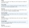
FFC from about an hour ago…
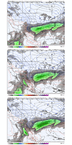
Global models are painting a concerning picture of what this
weekend could look like, with an increasingly strong signal for
ice storm potential across at least a portion of the County
Warning Area (
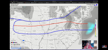
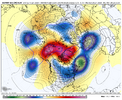
CWA). An arctic airmass will spill southward from
Canada across the central and eastern
CONUS, reaching as far south
as the Gulf Coast states. Gulf
moisture meeting up with and
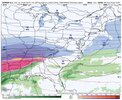
overrunning this cold airmass suggests the potential for a large,
generally east-to-west oriented corridor of wintry precipitation
across the Gulf Coast and Eastern Seaboard states. Where exactly
this
baroclinic zone (the boundary between the cold, dry arctic
air and warmer Gulf air) sets up will govern where precip
transition zones are located.
Other variables that will be at play include...
---> How strong is cold air damming (the wedge)? The cold,
surface-based airmass characteristic of the wedge could increase
frozen precip intensity/accumulations.
---> Will upper-level features like
jet streaks or shortwaves aid
in increasing frozen precip intensity/accumulations?
---> What path does a wave of low pressure take along the
baroclinic zone? This would largely determine if this event is
mostly freezing rain or if there is a
gradient of frozen and
liquid precip types across the state.
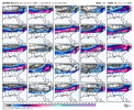
The above variables will
likely not come into better focus in
global guidance and regional/
hi-res guidance until 1 to 3 days
out. So, currently, we are leaning mostly on
ensemble model
guidance rather than deterministic model guidance to gauge the
potential for an impactful winter storm. Several pieces of
probabilistic forecast information from the NBM (National Blend of
Models) that suggest this event is something
watch closely
include:
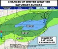
---> 20% to 60% chance for freezing rain accumulations greater
than 0.1" across much of north and central Georgia.
---> 15% to 45% chance for freezing rain accumulations greater
than 0.25" across much of north and central Georgia.
---> 15% to 45% chance for snow accumulations greater than 1"
along and north of the I-20 corridor.
The big picture at this point is that impactful wintry weather is
possible this weekend, and residents should monitor the forecast
closely through the week. Changes to the forecast are
likely, so
do not focus on predictions of accumulations or timing of precip
type transitions at this time.

forecast.weather.gov
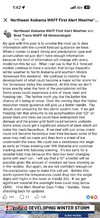
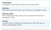
They already have rain/freezing rain in the forecast grid for Atlanta on Sat night/Sunday. (50-70% chance)

