-
Hello, please take a minute to check out our awesome content, contributed by the wonderful members of our community. We hope you'll add your own thoughts and opinions by making a free account!
You are using an out of date browser. It may not display this or other websites correctly.
You should upgrade or use an alternative browser.
You should upgrade or use an alternative browser.
Wintry January 23rd-27th 2026
- Thread starter SD
- Start date
Looks like living ITP Atlanta is the absolute worst spot to be in for this January. We barely missed last weekend's storm and appear to be staring at another close call, and if we do see winter weather, it will be a major blackout ice storm. Fun times!
Iceagewhereartthou
Member
Great to see the southward trend on the Euro, but we want this to continue. No only do we need several more jumps with the press we need breathing room. Also need to make sure the GFS holds serve and maybe trends colder too. The strength of the highs are going to be huge here to keep the warm nose at bay. Keep the high strong and the wave south and fairly weak.
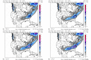

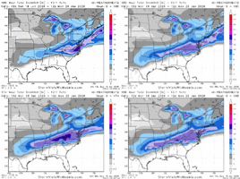
It would shift to Penscola and they will say it will shift to Ohio.Pretty funny. Get on Twitter and the north crew is explaining why that euro run indicates that the southern solution is on life support
That’s what, 8 days later? Wow.
This and what's possibly coming the week after remind me of December 2010. We had snow and ice covering the yard for 3 weeks after those two storms.
accu35
Member
If the Euro keeps trending south then it will put me in the ice risk like the gfs has me.
Pretty apparent that there is going to be a winter storm in the southern US. Big question is who gets the snow and who gets the ice. Somebody has got to take the ice. It'll be fun this week tracking ptype specifics.
Branch
Member
I’ve seen the NW suburbs of ATL get blanked with cold rain in CAD events while the SE side get ice. Cobb and points NW get nothing while Dekalb and down into Fulton get ice.
UNCSC
Member
Are they serious though, every model trended south on 12zPretty funny. Get on Twitter and the north crew is explaining why that euro run indicates that the southern solution is on life support
Cary_Snow95
Member
Yes go look at BAMAre they serious though, every model trended south on 12z
LukeBarrette
im north of 90% of people on here so yeah
Meteorology Student
Member
2024 Supporter
2017-2023 Supporter
Ignore BAM please, they are good Mets but sometimes can get feisty in one way or the other
Yeah, we have a long way to go. Best thing to do is to stay in the snow game right now, or as close to it as possible. But this could be one that gets talked about for a very long time. A major, extremely cold hi qpf winter storm. Like Webber said, you don't see this very often these days.
iwantsouthernsnow123
Member
Do you have the snowfall maps on weathenext?
if you call either ZR or cold rain 'scoring', then yes.Can Atlanta score here?
In terms of snow? Unlikely to get substantial snow in ATL.
iwantsouthernsnow123
Member
What's your thoughts on further NE, like toccoa generally?if you call either ZR or cold rain 'scoring', then yes.
In terms of snow? Unlikely to get substantial snow in ATL.
if you call either ZR or cold rain 'scoring', then yes.
In terms of snow? Unlikely to get substantial snow in ATL.
I'll take a Sleetier solution please. wishing
diamonddave
Member
That’s what I’d prefer. The ice storm in Augusta in 2014 crippled this area for days, that corridor from here to Columbia was devastated. Don’t need that again after we got hammered by Helene.At this point, it IS Possible for it to go more suppressed, but I wouldn't expect it to suppress all the way into the gulf. 'Most suppressed' scenario IMO is still snowy/icy for many. just with the heaviest snow falling along i20 instead of i40.
Far Northeast Georgia usually ends up with snow with this kind of setupWhat's your thoughts on further NE, like toccoa generally?
iGRXY
Member
I really think the upstate and Piedmont crew are going to love when we get in the short range and get the FGEN driven front end snow thump that tends to hold on much longer. Especially if we hold and trend to stronger confluence over the Atlantic. This has the potential to get a lot of people their first foot of snow in a really long time.
WolfpackHomer91
Member
I really think the upstate and Piedmont crew are going to love when we get in the short range and get the FGEN driven front end snow thump that tends to hold on much longer. Especially if we hold and trend to stronger confluence over the Atlantic. This has the potential to get a lot of people their first foot of snow in a really long time.
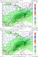
So if a MEAN is 10-20” Can someone post those member charts like Pack does ? For a MEAN to be that high has to have some absolute HAMMERS in there. 20-30” or all but a few are 8-20” only way it’s that high imo

Sent from my iPhone using Tapatalk
Stormsfury
Member
Pretty significant press ongoing. Reminds me of the old school models catching onto the low level cold leading up to the event.
accu35
Member
Trend is south so far. Between the gfs and Euro central bama willCold rain for BHM I suppose?
Probably see ice. Plus if it keeps the south trend
These maps are overdone. Dont pay attention to specific numbers. There’s a big time winter storm signal right now and that’s all we know for sureSo if a MEAN is 10-20” Can someone post those member charts like Pack does ? For a MEAN to be that high has to have some absolute HAMMERS in there. 20-30” or all but a few are 8-20” only way it’s that high imo
Sent from my iPhone using Tapatalk
- Joined
- Jan 2, 2017
- Messages
- 1,566
- Reaction score
- 4,279
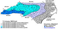
Man you are tugging at my heart strings!Basically this looks like a more amped version of January 1988
Warmer air aloft but colder air mass moving in at the low-levels, with of course more background moisture to play with as the tropics and the upstream oceans are warmer than they were then. Just upped ante across the board
Serviced my Generac today...im ready!
What's your thoughts on when we know if the Baja low stays disconnected or joins in? Wednesday evening?
WolfpackHomer91
Member
These maps are overdone. Dont pay attention to specific numbers. There’s a big time winter storm signal right now and that’s all we know for sure
Too late already posted it on my neighborhood FB page and told everyone to follow me for more info.
Sent from my iPhone using Tapatalk
Ward Cleaver
Member
I’m in Grenada this week and fly into Charlotte late Saturday night with a connection in Miami. Even if we can land at CLT from MIA, the drive up I-85 could be treacherous. It seems likely that we’ll be stuck in Miami Saturday night. I might start looking for a room around the Miami airport.
Webberweather53
Meteorologist
Man you are tugging at my heart strings!
Serviced my Generac today...im ready!
What's your thoughts on when we know if the Baja low stays disconnected or joins in? Wednesday evening?
If the Baja low joins in, this will force more warm advection over top of the Arctic front, leading to a more extensive area of sleet and freezing rain over the south and will try to shift the primary low north.
This setup is also real dependent on what the TPV does over southern Canada, those usually don’t like to play nice
can we cut this in half like the rule of thumb has always been?
Still a long way out though.
Honest question we are obviously going to see some changes, but what chance do yall see with us losing it?
Honest question we are obviously going to see some changes, but what chance do yall see with us losing it?
I’m in the minority but I love ice. I got a generator today
NCHighCountryWX
Member
- Joined
- Dec 28, 2016
- Messages
- 699
- Reaction score
- 1,918
Not sure you can do that if mid/low 20’s verifycan we cut this in half like the rule of thumb has always been?
What about precip rate? Generally heavier precipitation limits ice extentNot sure you can do that if mid/low 20’s verify
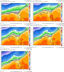
Absolute shambles when the video thumbnail is of the warmest model and it still shows a biblical wedge

