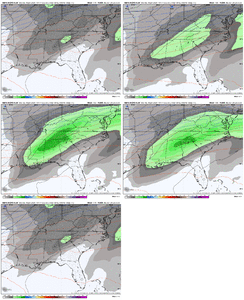
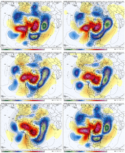
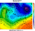
so this is just a difference in the connotation of "concerning". it has been so long since "concerning" hasn't mean "we are losing the storm" lolThis digging trend though is concerning for the southern regions that might see ice though, given its digging more, its bringing in a lot more WAA, and also giving more time for the high pressure to be out ahead of the shortwave and wedge areas east of the apps
-
Hello, please take a minute to check out our awesome content, contributed by the wonderful members of our community. We hope you'll add your own thoughts and opinions by making a free account!
You are using an out of date browser. It may not display this or other websites correctly.
You should upgrade or use an alternative browser.
You should upgrade or use an alternative browser.
Wintry January 23rd-27th 2026
- Thread starter SD
- Start date
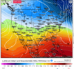
This is kinda my main point of hope for potentially (again, assuming we do have everything in place for wintry) allowing a more amped storm to not include quite as much mixing. Still, just a hollering ZR signal on the most reliable guidance. Have a hard time seeing a big ZR somewhere being avoided unless we get a flatter storm.This year, models have persistently tried to park the SE ridge and slowly eroded it away in the 120 to 216hr timeframe.
thats a good signThis year, models have persistently tried to park the SE ridge and slowly eroded it away in the 120 to 216hr timeframe.
iwantsouthernsnow123
Member
Actually concerning.. If this shows up still Tuesday or Wednesday. My preparations are starting whether we get something or not. Word needs to get out about this potential.This year, models have persistently tried to park the SE ridge and slowly eroded it away in the 120 to 216hr timeframe.
The amount of people cheering on a north trend on this app this week is gonna be insufferable
Well, on the other side of that coin,,
The amount of people cheering on a Southern trend on this app this week is gonna be insufferable.
Brent
Member
TWC with a potential winter storm already on Saturday. It's Sunday night
Yeah... What is happening haha
Yeah... What is happening haha
Maybe it is this....not so sure....maximizing ice potential rather than snowCan you share why that concerning? I don’t understand thanks. What is it showing?
Sent from my iPhone using Tapatalk
How the Digging Trough Affects Southern Ice Risk:
- Increased WAA/Moisture: As the trough digs, it often amplifies and forces warmer, moist air from the Gulf or Atlantic northward, creating strong warm air advection (WAA).
- Enhanced "Wedge" Setup: The digging process often coincides with high pressure building to the north, which drives cold, dense air down the eastern side of the Appalachian Mountains.
- Time for Cold Air Retention: A slower ("digging") storm system provides more time for this arctic high-pressure area to establish a shallow, cold layer (the wedge) east of the Apps.
- Ice Creation: When this persistent cold layer (sub-freezing at the surface) is hit by the warm, moist air (WAA) moving in from the south, it results in significant freezing rain, sleet, and ice.
rburrel2
Member
That’s a good point. Same for them trying to drop more troughiness in the Pacific Northwest.This year, models have persistently tried to park the SE ridge and slowly eroded it away in the 120 to 216hr timeframe.
If we can make minor adjustments there(on the ai models/euro) in the next few cycles(like what’s been happening all year), we can get back to a snowier look for the south.
it is a data point that anybody with a modicum of professionalism/legitimacy immediately began howling like a hit dog the moment the EPS snow accumulations hit the pressesTWC with a potential winter storm already on Saturday. It's Sunday night
Yeah... What is happening haha
Brent
Member
it is a data point that anybody with a modicum of professionalism/legitimacy immediately began howling like a hit dog the moment the EPS snow accumulations hit the presses
It definitely struck me to see the EPS that aggressive
But we gotta a long way to go because since 2021 everything hyped up here didn't pan out that great haha
iwantsouthernsnow123
Member
I'm still personally thinking it's going to at least go somewhat north, It's a very strong high pressure though so idk for certain. But given history of these setups I think it will. Your thoughts? I'd personally rather get a bunch of rain rather than 2" of FZR personally. If snow comes south I'd be happy but I do NOT want FZR.it is a data point that anybody with a modicum of professionalism/legitimacy immediately began howling like a hit dog the moment the EPS snow accumulations hit the presses
SimeonNC
Member
Unless things change I doubt NC/Upstate SC sees a crippling ice storm
Mahomeless
Member
With the coastal snow looks???huge performance last storm. we had our typical northwest nudges but those models accurately shut the door on today's event ever getting past nuisance level
iwantsouthernsnow123
Member
@Jimmy Hypocracy Theres 2 things that either need to happen for us.
1. Move that north and stop the chances of crippling ice. (More realistic than 2)
2. Bring it more south and set right in the snow bands. (Unlikely)
1. Move that north and stop the chances of crippling ice. (More realistic than 2)
2. Bring it more south and set right in the snow bands. (Unlikely)
when did the wheels fall off on that event? total kick in the gonads. if i remember there was similar consensus that just simply shifted west. i think this signal is a little better here than what we saw from that one. would be interesting to go back to that thread.It definitely struck me to see the EPS that aggressive
But we gotta a long way to go because since 2021 everything hyped up here didn't pan out that great haha
iwantsouthernsnow123
Member
About to personally try to look into it and see if I can figure out when that actually happened, because i am curious. If I recall correctly it was within 90 hours but its a while ago so I could be wrong.when did the wheels fall off on that event? total kick in the gonads. if i remember there was similar consensus that just simply shifted west. i think this signal is a little better here than what we saw from that one. would be interesting to go back to that thread.
Edit: Just realized this was almost 5 years ago, cant believe how long its been.
NBAcentel
Member
That signal fell off because the state of tropical forcing around that time in 2021, it was around the maritime continent, it resulted in a more retracted jet as we got closer to it and lower heights/more westward dumpingwhen did the wheels fall off on that event? total kick in the gonads. if i remember there was similar consensus that just simply shifted west. i think this signal is a little better here than what we saw from that one. would be interesting to go back to that thread.
Just for scientific purposes I went to check TWC just to see what it would say and said this for Raleigh. Now how accurate this is only time will tellTWC with a potential winter storm already on Saturday. It's Sunday night
Yeah... What is happening haha

Sent from my SM-S156V using Tapatalk
rburrel2
Member
One more reason against additional amplification on the euro ai…
We’re already at widespread 3 to 3.5 inches of liquid total in northern AL/GA/Southern TN, in mid January.
We really think this thing can trend more in that direction? I’d assume we will see some backing off if anything.
We’re already at widespread 3 to 3.5 inches of liquid total in northern AL/GA/Southern TN, in mid January.
We really think this thing can trend more in that direction? I’d assume we will see some backing off if anything.
i have a lot of thoughts, which may spur me to finally start that substack i've been putting off for years. my main one, personally i think ice will almost certainly happen. there is no easy on/off switch, no lever to pull, that will clean up the transition zones. a high that strong and robust and advantageously positioned is going to allow low level cold air to seamlessly bleed into the deep southI'm still personally thinking it's going to at least go somewhat north, It's a very strong high pressure though so idk for certain. But given history of these setups I think it will. Your thoughts? I'd personally rather get a bunch of rain rather than 2" of FZR personally. If snow comes south I'd be happy but I do NOT want FZR.
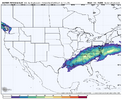
Thought about this too, there are some deviously high QPF members on the 18z EC AI ENS. This is a very high prob of 24h QPF >1.0 for a wintry system:One more reason against additional amplification on the euro ai…
We’re already at widespread 3 to 3.5 inches of liquid total in northern AL/GA/Southern TN, in mid January.
We really think this thing can trend more in that direction? I’d assume we will see some backing off if anything.
iwantsouthernsnow123
Member
Yeah I'm currently trying to find previous forecast of Feb 2021 and figure out where things went wrong and see how it compares with currently. I'll let you know what I findi have a lot of thoughts, which may spur me to finally start that substack i've been putting off for years. my main one, personally i think ice will almost certainly happen. there is no easy on/off switch, no lever to pull, that will clean up the transition zones. a high that strong and robust and advantageously positioned is going to allow low level cold air to seamlessly bleed into the deep south
is that a threat here? telling on myself but i have never really been a tropical forcing guyThat signal fell off because the state of tropical forcing around that time in 2021, it was around the maritime continent, it resulted in a more retracted jet as we got closer to it and lower heights/more westward dumping
hey guys, banter for historical storm talk
thanks
this thing is alrdy 13 pages long...... we are gonna have to start moderating more soon
thanks
this thing is alrdy 13 pages long...... we are gonna have to start moderating more soon
LukeBarrette
im north of 90% of people on here so yeah
Meteorology Student
Member
2024 Supporter
2017-2023 Supporter
Anyone else seeing a similar setup as Atlanta/Athens January 7-8 1973? I wish I had historical maps so I could dig deeper
iGRXY
Member
I do tend to think that a NW trend isn’t a thing right now. The last few years we have trended to a more progressive type of pattern with positively tilted troughs that have prevented NW trends like we are used to. That on top of the strength of of the surface high is just going to limit how far north this can realistically go.
NBAcentel
Member
HailCore
Member
You would think if a NW trend was feasible, there wouldn't be the tremendous model and ensemble agreement with a southern solution which we already have at this stage. In my opinion, that further locks in the forecast to an extent.I do tend to think that a NW trend isn’t a thing right now. The last few years we have trended to a more progressive type of pattern with positively tilted troughs that have prevented NW trends like we are used to. That on top of the strength of of the surface high is just going to limit how far north this can realistically go.
trackersacker
Member
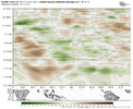
Yeah I’ve thought about this today also. Phase 8 should help I would thinkIt’s the opposite this go, we are pushing the MJO into phase 8, and extending the pacific jet as this storm is occuringView attachment 185306
NCWeatherhound
Member
Depending on the 850's, that looks like sleet for folks above RobCo, Bladen and Duplin. But I-95 from SOB down to about Santee in SC looks messy.
Webberweather53
Meteorologist
It's not everyday you see the influence of the MJO so clearly like this.
I can't remember seeing a potential winter storm with so many of the things needed to make it happen in place this far out. The one thing that worries me right now is suppression of the storm track for folks in North Carolina when all is said and done. This will be a fun storm to track no matter what happens in the end.
iwantsouthernsnow123
Member
It's not everyday you see the influence of the MJO so clearly like this.
You think this would cause it to go further north?
Stormlover
Member
It just goes by model outputTWC with a potential winter storm already on Saturday. It's Sunday night
Yeah... What is happening haha
I think you’re right. I will say it wouldn’t shock me at all to see this trend south over the next several days especially if models keep the forecast HP so strong. Then on the flip side of that it wouldn’t shock me to see some correction north in the last 72 hours or so after several days of south trends. That has been something that’s happened with a lot of our bigger storms over the yearsI do tend to think that a NW trend isn’t a thing right now. The last few years we have trended to a more progressive type of pattern with positively tilted troughs that have prevented NW trends like we are used to. That on top of the strength of of the surface high is just going to limit how far north this can realistically go.
wow
Member

