Makeitsnow
Member
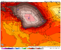
Dec 2002Idk the last time i've seen a high pressure that strong in a CAD. Been quite a while
Feb. 1996 look alike.

This is obscene. I mean, if you get a 1040 biblical CAD like is being shown and then amp a system like this you just will not avoid a massive ice storm for someoneView attachment 185106
Now, the trend is in the right direciton in terms of the CAD. But we definitely need to continue to trend to fix that warm nose for sure.
That is the craziest ice map I ever seen.
That's horrible. Only takes half inch of zr to cause power outages right? Hoping we can get this to be more sleet or snow depending on timing.
This would begin Saturday evening & wrap up around Sunday evening of next week for areas of GeorgiaSo this thread is just the Sunday storm and not the possible Wednesday one?
You won’t get them with a storm that sizeWe need colder 850s or it’s lights out.
Sent from my iPhone using Tapatalk
Wednesday one has trended very weak, unless it picks back up again in strength I don't think we need a thread for itSo this thread is just the Sunday storm and not the possible Wednesday one?
You won’t get them with a storm that size
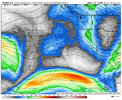
That’s what I was trying to say, I-85 seems to always be the border between different P-TypesThe warm nose is barely there for the 85 north to Highway 11 crew. My guess would be under strong returns you snow and in lulls it switches over. Even then it’s so thin you may still be able to snow the entire event. As cold as the 925s are it’s sleet from 85 all the way down to i20. But along and south of there would be a catastrophic ice storm
The problem is unlike those marginal 31/32 degree events...its well down into the mid 20s....so there would be major accretion without a lot of runoff. Throw in 25 to 30mph wind gusts and it's lights out for a long time for those unlucky to be in the freezing rain. I'm hopeful that with a wedge this stout sleet would be the primary precip type over north ga and the upstate at least. Of course this is still a long ways out but given the players involved and model agreement i don't feel as silly discussing such details.Hopefully modeled way over amped
Sent from my iPhone using Tapatalk
I’m thinking Jan 88 but with more ice than sleet. That was all overrunning however, not with all this CADFeb. 1996 look alike.
SV counts sleet as snow but not freezing rain. And doesn’t have Kuchera
I’m thinking Jan 88 but with more ice than sleet. That was all overrunning however, not with all this CAD


Thankfully it's still early and has time to change. Otherwise that type of zr would be lights out for weeks.Per WxBell precip type maps, that’s nearly all ZR at ATL and surrounding areas.
