-
Hello, please take a minute to check out our awesome content, contributed by the wonderful members of our community. We hope you'll add your own thoughts and opinions by making a free account!
You are using an out of date browser. It may not display this or other websites correctly.
You should upgrade or use an alternative browser.
You should upgrade or use an alternative browser.
Wintry January 23rd-27th 2026
- Thread starter SD
- Start date
wow
Member
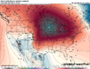
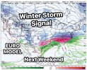
This is the EPS ? Holy mackerel
LovingGulfLows
Member
- Joined
- Jan 5, 2017
- Messages
- 1,499
- Reaction score
- 4,100
We in the Atlanta area just need the mid-level temps to cooperate to limit the ice and get more snow/sleet.
LukeBarrette
im north of 90% of people on here so yeah
Meteorology Student
Member
2024 Supporter
2017-2023 Supporter
Euro too flat 
Big winter storms start with rule number 1, non-negotiable: You must have a high pressure in a favorable location of sufficient strength.
My friends, this non-lala land setup for a winter storm not seen since the days of black and white photgraphs is picture perfect. Now archive the images.
Oh, and don't screw it up!
trackersacker
Member
That is absolutely unreal
BKWRN29
Member
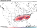
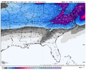
What is causing the rain to extend north on the Alabama Mississippi line but then it drops down to south central Georgia with frozen precip?
trackersacker
Member
Stop. I can’t handle anymore. Wow
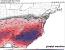
TBH I don't know if the WxBell maps will look the same, but that's semantics. This has suddenly become the best look in a while.This is the EPS ? Holy mackerel
I was referring to the 28th one, which I thought was still showing up?Wednesday one has trended very weak, unless it picks back up again in strength I don't think we need a thread for it
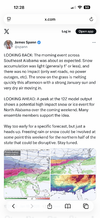
Spann starting to notice.
LukeBarrette
im north of 90% of people on here so yeah
Meteorology Student
Member
2024 Supporter
2017-2023 Supporter
Oh I'm not sure about that one. I thought you were talking about this coming WednesdayI was referring to the 28th one, which I thought was still showing up?
All you need is the high as modeled & a wave solution that doesn’t behave like a 100 year flood and it’s probably more snow than ice a bit further south
NEGaweather
Member
What is causing the rain to extend north on the Alabama Mississippi line but then it drops down to south central Georgia with frozen precip?
CAD
Sent from my iPhone using Tapatalk
When they are talking this many days out, there’s a reasonGSP is already using "winter mix possible at the least"
Heights begin to fall Saturday into Sunday as yet another short wave
dives south and moves across the area. A baroclinic zone, and a moist
low level easterly flow, sets up across the Southeast between high
pressure to the north and weak low pressure in the Gulf. This
combined with increasing isentropic lift and frontogenetical forcing
leads to precip developing across the area. The operational guidance
and most ensemble means are trending in this direction with temps
cold enough for at least a wintry mix across the area. That said,
the LREF mean and the NBM have little to no probability of even
Advisory level wintry precip. As usual in these types of situations,
confidence is very low given the model to model and run to run
inconsistency. Keep up with the latest forecasts as they are likely
to change going forward.
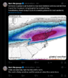
The weenie in me cannot WAIT to see the WxBell EPS maps. There's an 18-24 contour in Moyock at F342 
UNCSC
Member
The great part is we have almost every model show a great CAD storm. So this shows we have room for error much more than we have had in years. Somebody is gonna get hammered next week
Is it just me, or has the storm(s) around the 24th-28 been subtly shifting further and further south with each model run on all the major modeling? It seems like in this kind of setup, with shallow cold being fed in from such a strong Arctic high to the north, my local area would at least see steady temperatures in the 30s for a couple days. I don't think I can rule out freezing rain or sleet either (snow would be nice, but this one's for y'all in the upper south, I'm just thankful I might be part of the action in some way).
Not the mama
Member
Okay how many potential systems are we talking and what’s the time frame for each threat. There’s a lot going on here and I’m getting lost.
Yes, the HP has been trending stronger. We've seen this a lot the last 2 years in this timeframe.Is it just me, or has the storm(s) around the 24th-28 been subtly shifting further and further south with each model run on all the major modeling? It seems like in this kind of setup, with shallow cold being fed in from such a strong Arctic high to the north, my local area would at least see steady temperatures in the 30s for a couple days. I don't think I can rule out freezing rain or sleet either (snow would be nice, but this one's for y'all in the upper south, I'm just thankful I might be part of the action in some way).
LukeBarrette
im north of 90% of people on here so yeah
Meteorology Student
Member
2024 Supporter
2017-2023 Supporter
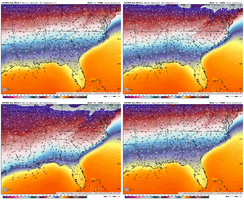
The ECMWF usually underestimates CAD, so that’s pretty impressive to see it that strong on the model
Yeah, that will shut down all of central AL. Huge deal.
iGRXY
Member
My worst fear, and it’s really not a fear more so it’s very likely to happen, is the ice potential here. Right now I feel okay for those of use along and north and west of 85 for likely all snow. South of that it’s probably a monster sleet and some ZR down to the i20 corridor. But alone and south of there has a very big potential more a biblical ice storm. Like Eve if you cut totals in half I’d still be over an 1” of ZR type of storm. This is a serious CAD and cold air layer.
BKWRN29
Member
This is a super strong signal! He has no choice lol I just hope it moves to further south area too!
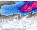
Well it must count frozen precip differently on WxBellView attachment 185128
Here it is through 264
I think the main focus should be on the period from the 25th through 26th after seeing that incredible Euro model run. This potential storm could be one for the record books if what the Euro was showing happens.Okay how many potential systems are we talking and what’s the time frame for each threat. There’s a lot going on here and I’m getting lost.
rburrel2
Member
iGRXY
Member
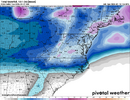
We’ve got 4” means down to 85 in SC and there’s a huge ice mean on top of that as well
iGRXY
Member
I think it separates snow from ice. There’s a massive ice signal in the CAD regions on top of these snow meansWell it must count frozen precip differently on WxBell


BHS1975
Member
Still to close to the mix line for me. I want all powder.
NBAcentel
Member
iwantsouthernsnow123
Member
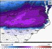
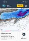
That's a very loud signal on Euro AIFS ENS. 2-4 inches across north georgia, south carolina 4.5-6.5 inches across north carolina. Curious to see how this signal changes overtime.
Euro ai mean… Wtf…. This is only through hr 168!
Does anyone know if the mean includes snow/sleet or snow/sleet/freezing rain on these 10:1 maps?
View attachment 185132
There’s something odd about the Euro AI WxBell clown maps because they keep showing snow over small pockets way out over the ocean/Gulf. The WxBell algos could be a problem. The Euro ens clowns are more normal looking.
iwantsouthernsnow123
Member

