iwantsouthernsnow123
Member
Idk the last time i've seen a high pressure that strong in a CAD. Been quite a while
Idk the last time i've seen a high pressure that strong in a CAD. Been quite a while
The AI models have done a better job this season locking in systems and then staying consistent over time most of the way to the event. However, its still too far out to make any conclusions, both AI models just had tad too much bump of the SE ridge and that is all.and this is the model we want showing this out of all of them correct?
It's skill scoring is best this fall/winter period if I understand correctly.and this is the model we want showing this out of all of them correct?
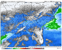
Believe it is counting all frozen as snow but either way WOW
SV counts sleet as snow but not freezing rain. And doesn’t have KucheraBelieve it is counting all frozen as snow but either way WOW
Stronger push of cold air (Uptrending) better CAD overall to filter down cold temps closer to the SFC.Might be banter (and sorry if it is), but what needs to happen to make this more of a snow/sleet then Freezing rain? Would love to see this trend colder at 850 temps. 6 to 7 days away.
Is that thing about to dig?
The 850s can't be too far north with that look unless really really shallow stuffView attachment 185088
Absurd 925mb looks on euro for a CAD system... Idk if i've ever seen this before.
More of a sleet than freezing rain threat look I think.View attachment 185088
Absurd 925mb looks on euro for a CAD system... Idk if i've ever seen this before.
Yeah, part of the problem is you get a large warm nose at the 850mb but that is downtrending slowly but surely.More of a sleet than freezing rain threat look I think.
Not banter at all. The surface cold air is there, no doubt. It comes down to the mid and upper level features. If the wave is too strong, then warm air advection in the mid levels will turn snow over to sleet or freezing rain. You want a weaker wave.Might be banter (and sorry if it is), but what needs to happen to make this more of a snow/sleet then Freezing rain? Would love to see this trend colder at 850 temps. 6 to 7 days away.
insane. and check out the wind gusts.View attachment 185088
Absurd 925mb looks on euro for a CAD system... Idk if i've ever seen this before.

Not even a grandpa or grandma wedge… this is a prehistoric caveman wedge View attachment 185090
Gets warm nosed, but euro is looking better and better overall.The 850s can't be too far north with that look unless really really shallow stuff
You have the NC pic of that handy?Talk about shutting down basically the entire southeast...
View attachment 185095
Biggest CAD I think I've ever seen in general on any model, maybe some past 300+ hours but never inside 180.That’s gonna be the biggest CAD event that I ever seen on the Euro.
Kylo It’s been 8 long years since I’ve saved a clown map to my fap folder. This one just went in. @SNOWMANN gear up
Let hope for a colder trend at the 850. That is nasty and historic! Hate to see the Freezing Rain map.

