NoSnowATL
Member
Guys….. please move the -------- to the brick thread. Thanks and let’s get you guys some snow!
More likely to be a surprise closer to the apps where the cold air has a chance to funnel through better. In the analogs shared by Webb and Johnathan, the spots that tend to outperform are north of the Triad if anywhere.I think this will be a major surprise for folks in the Triangle area. I think many areas in the Triangle and slightly east end up with 2-3".
its not so much an actual low track or anything of that sorts, these models are trying their best to give us a snapshot of a lot of moving parts at 500mb. in my opinion the moisture is under modeled, still, just due to the shear energy up there.How far have yall seen models push west or east within this time frame we have left.
You are correct, the UKIE was the first to show it.No. UK
Thank you. That’s a really helpful explanation.its not so much an actual low track or anything of that sorts, these models are trying their best to give us a snapshot of a lot of moving parts at 500mb. in my opinion the moisture is under modeled, still, just due to the shear energy up there.
but, with that said, on the eastern side of the mountains, there is always the risk of the cold not catching up in time without a true low pressure churning off the coast throwing moisture well back inland
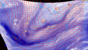
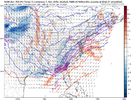
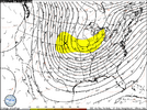
if you take a look at the frontogenesis charts, you generally want to be close to all the purple cirlces they show. that's where the best forcing is to allow heavy enough precipitation to dynamically cool the column if you're on the edge (like my yard is).
if you are in an area where the cold is in place, the precipitation field should in theory, look better than modeled at this point. but again, its so touchy in this type of setup and what's mainly causing it is not a storm so much as forcing/frontogenesis
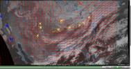
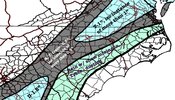
What’s this? And what’s it showing?
Oh man, thats quite a look... This thing is trying to overpreform.
My favorite part of a SE winter storm, other than actually seeing the snow fall once every 10 years, is the radar hallucination phase!I know saying this leads to heart break but radar looks more robust than modeled
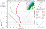
Well I I just looked at the sounding in NAM3km for location and it’s a fairly clear snow sounding from about 9 am on tomorrow. I can’t tell you how many times in the last 10-15 years, the NAM would be showing thermal issues for me 24 hours out while the GFS would be showing no issues only for the NAM to be right. Now they’re in pretty lock stop agreement.


My favorite part of a SE winter storm, other than actually seeing the snow fall once every 10 years, is the radar hallucination phase!
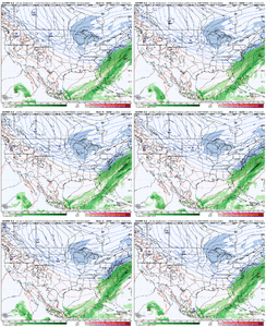
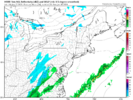
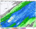
Clear win for the Euro AI model…wasn’t even close.What a huge difference between Euro AI v/s non-AI for the north east. This is inside day 3...
Rooting for the AI model..would be fun to watch the Pats/Texans snow game.
View attachment 184127View attachment 184128

They'd rather hear you whine about them wasting tax dollars then someone getting hurt from driving on a icy road.they are pre treating the roads in my county today?? Do they know something or wasting my tax dollars.
Actually you joke but to be honest I think the GFS really had the idea first that even the AI models had to adjust to at some point. Of course all of this needs to play out first before we can even draw such a crazy conclusionGFS was here first. Never forget
UKMET was actually first, UKMET is just an idiot and can't keep it.Actually you joke but to be honest I think the GFS really had the idea first that even the AI models had to adjust to at some point. Of course all of this needs to play out first before we can even draw such a crazy conclusion
Ukmet was 1st, as someone posted correctly. I even called,posted it when it happened, so can verifyActually you joke but to be honest I think the GFS really had the idea first that even the AI models had to adjust to at some point. Of course all of this needs to play out first before we can even draw such a crazy conclusion
The UK showed it 5 days ago or soActually you joke but to be honest I think the GFS really had the idea first that even the AI models had to adjust to at some point. Of course all of this needs to play out first before we can even draw such a crazy conclusion
New Englanders got more from this than us lmfao
The overall trends remind me quite a bit of 2017. Don't think it'll be exactly like it at all but It's going to probably overpreform somewhere. But whereView attachment 184645
I’m not gonna complain if I see a little wet snow in Blacksburg tonight.
I dont want to count chickens before they hatch but this is Pretty funny since we were confidently told the AI models had it all figured out 72 to 84 hours out and it was all but over for anyone north and west of the immediate coast. . I dont mean to sound like a jerk about it but the idea the AI models are near perfect is rather silly. I think folks should keep this in mind in the future.Actually you joke but to be honest I think the GFS really had the idea first that even the AI models had to adjust to at some point. Of course all of this needs to play out first before we can even draw such a crazy conclusion

What were the amounts forecasted for 2017 again? Not what fell but what did the mets forecast at firstThe overall trends remind me quite a bit of 2017. Don't think it'll be exactly like it at all but It's going to probably overpreform somewhere. But where