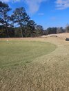
the shelby 4 year inch drought in jeopardyThe ugly warm gap filling in better. View attachment 184614View attachment 184615
-
Hello, please take a minute to check out our awesome content, contributed by the wonderful members of our community. We hope you'll add your own thoughts and opinions by making a free account!
You are using an out of date browser. It may not display this or other websites correctly.
You should upgrade or use an alternative browser.
You should upgrade or use an alternative browser.
Jan. 17-18, 2026 SE Winter Weather Threat
- Thread starter RBR71
- Start date
NCHighCountryWX
Member
- Joined
- Dec 28, 2016
- Messages
- 699
- Reaction score
- 1,918
Where the snow is at:

 www.facebook.com

20K views · 822 reactions | First light this morning over Banner Elk and our snow covered Blue Ridge Mountains! | Visit Banner Elk
First light this morning over Banner Elk and our snow covered Blue Ridge Mountains!
 www.facebook.com
It's pretty much acting like the NAM if it's going down like the Titanic it's going down swinging for the fences even if it's a wild swing and miss
Sent from my SM-S156V using Tapatalk
Tsappfrog20
Member
Interesting to see
Sent from my iPhone using Tapatalk
Sent from my iPhone using Tapatalk
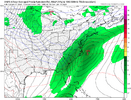
idk if anyone should put a lot of stock in a global when the system is 24-36 hrs awayThat's the furthest NW the GFS has modeled snowfall in N. Georgia since losing the storm the storm for us a couple of days ago. Can we keep this trend up into the night?
Well I I just looked at the sounding in NAM3km for location and it’s a fairly clear snow sounding from about 9 am on tomorrow. I can’t tell you how many times in the last 10-15 years, the NAM would be showing thermal issues for me 24 hours out while the GFS would be showing no issues only for the NAM to be right. Now they’re in pretty lock stop agreement.
it’s getting very rough out here and sadly i think more likely than not we don’t get accumulating snow out of this event. just too many things need to perfectly happen for us to get a chance. hopefully i’m wrong and we get a surprise coating to an inch tho!Egg I hope you’re right. I am still not holding my breath but hopefully at least some light snow in Shelby tomorrow. Then maybe a big dog Jan 27-29
HailCore
Member
Good news for my ATL snow lovers: HRRR 18Z might start showing a more widespread area of a changeover late tonight or at least within a corridor of heavier precip in the region judging by the 15Z RAP which usually plays out similar to the long-range HRRR runs 3 hours later. Still gonna be hard to get accumulations with this first wave, but some wet snow would be nice.
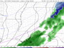

woahhhGood news for my ATL snow lovers: HRRR 18Z might start showing a more widespread area of a changeover late tonight or at least within a corridor of heavier precip in the region judging by the 15Z RAP which usually plays out similar to the long-range HRRR runs 3 hours later. Still gonna be hard to get accumulations with this first wave, but some wet snow would be nice.
View attachment 184618
Interesting to see
Sent from my iPhone using Tapatalk
For those who do see accumulation, probably one of those cases where the snow melts as it is falling. If you have high enough rates to overcome the melting, then you will at least get a car topper
Would have donated my leg to have this trend start 24 hours earlier. The precip just keeps inching closer and closer to central Alabama. Hoping for a major miracle that models are off on the precip fields but I gave up last night.
I just want some real accumulation for people to prove some local Mets wrong.
I just want some real accumulation for people to prove some local Mets wrong.
- Joined
- Jan 2, 2017
- Messages
- 1,566
- Reaction score
- 4,279
True. But, I prefer it ticking NW and colder rather than eastward and delayed CAA.idk if anyone should put a lot of stock in a global when the system is 24-36 hrs away
As each hour passes, models begin to take a back seat to radar and obs.
this nw trend we have going rn is certainly keeping me interestedAgree Egg. Probably Snow Showers unless the system can come another 50-100 miles west. Southern Foothills have had no luck the last 4 years. Hopefully that’s changing l!
Mahomeless
Member
The NW trend is really only beneficial if you are away from the Apps…CAA is going to be grossly delayed in NC.this nw trend we have going rn is certainly keeping me interested
GFS was here first. Never forget
Tsappfrog20
Member
For what it’s worth this was from the NWS Raleigh.

Sent from my iPhone using Tapatalk

Sent from my iPhone using Tapatalk
HailCore
Member
I would say the best shot at light winter weather would be somewhere around midnight, maybe plus or minus an hour or two. The initial precip will move in this evening, and if the cold catches it then a transition can happen briefly. The morning batch with accumulations will probably be in central GA around daybreak tomorrow and at this time will likely remain south of the city at this time, but any more northwest shifts and ATL might be in on the action with that round.When is this supposed to arrive in ATL area time frame wise?
yeah just hoping if we get heavier precip we could crash the column sooner. i’d rather have a shot than see areas 50 miles to my east scoreThe NW trend is really only beneficial if you are away from the Apps…CAA is going to be grossly delayed in NC.
saielA10462
Member
Of course, GFS thinks we get the NW edge of that second round in the morning hours once the cold should be here. But it’s the GFS… so not gonna hold my breath unless we see anything else back that up.I would say the best shot at light winter weather would be somewhere around midnight, maybe plus or minus an hour or two. The initial precip will move in this evening, and if the cold catches it then a transition can happen briefly. The morning batch with accumulations will probably be in central GA around daybreak tomorrow and at this time will likely remain south of the city at this time, but any more northwest shifts and ATL might be in on the action with that round.
Even still, GFS doesn’t think even that (mostly wet) snow will really stick much given the warm ground.
Getting it to snow is one thing. Getting it to stick is another.
Boundary layer, soil temps, and daytime insolation really cutting into the totals with this setup. Very slushy.
View attachment 184611
View attachment 184613
It'll stick. The snow depth maps had my house at like an inch or two before 2017. Let's just say that the slush accumulated 10 inches with surface Temps around freezing.
Those snow depth maps are garbage.
bud006
Member
GFS and HRRR are Lucy enticing me (Charlie Brown) with the football, again (sigh).
I’m not optimistic at all for my neck of the woods, but I’m intrigued just enough by this morning to start watching again.
—30—
I’m not optimistic at all for my neck of the woods, but I’m intrigued just enough by this morning to start watching again.
—30—
Smart forecast. No need to hype up a likely low impact storm, but doesn’t eliminate the potential of seeing flakes flying. No absolutes is good forecastingFor what it’s worth this was from the NWS Raleigh.

Sent from my iPhone using Tapatalk
Tsappfrog20
Member
Jonathan Wall shared this earlier.
Sent from my iPhone using Tapatalk
Sent from my iPhone using Tapatalk
HailCore
Member
I like seeing that trend on the GFS because if you look at it from a composite reflectivity perspective, it is basically showing what most other model guidance shows, maybe slightly more aggressively as light reflectivity will move back into the metro area in the morning. I would be more excited however if the GFS did not have all of that as virga, because the air the snow is falling into is very dry, much like the short range guidance, but the GFS depicts it at the ground as snow when in reality its not. Unless we see major short range guidance showing it this way, probably not something I would get your hopes up about.Of course, GFS thinks we get the NW edge of that second round in the morning hours once the cold should be here. But it’s the GFS… so not gonna hold my breath unless we see anything else back that up.
Even still, GFS doesn’t think even that (mostly wet) snow will really stick much given the warm ground.
GeorgiaGirl
Member
It'll stick. The snow depth maps had my house at like an inch or two before 2017. Let's just say that the slush accumulated 10 inches with surface Temps around freezing.
Those snow depth maps are garbage.
Yeah, I think it would be fair to use Kuchera here or just take the 10:1 map and slash 1/5th off.
HailCore
Member
Latest HRRR is a lot more puny, but we'll take whatever trends we can get and maybe magically the 18z will have colder environment and slightly more broad snow band like the RAP. Then again, the RAP lower resolution is probably to blame for a larger footprint. Bottom line is if trends keep steady, flakes are likely to fly somewhere in ATL tonightGood news for my ATL snow lovers: HRRR 18Z might start showing a more widespread area of a changeover late tonight or at least within a corridor of heavier precip in the region judging by the 15Z RAP which usually plays out similar to the long-range HRRR runs 3 hours later. Still gonna be hard to get accumulations with this first wave, but some wet snow would be nice.
View attachment 184618
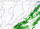
Jonathan Wall shared this earlier.
Sent from my iPhone using Tapatalk
That storm came to mind yesterday when thinking about this storm, but I wasn’t sure about the particular setup. I remember we got tons of rain that day before it finally changed over and we got a warning criteria snowfall in the Triad after dark. Of course, with BL temps and warm, wet ground impacts were not as great as you’d usually expect from a 3-4” storm (I think we only had a two-hour delay at college).
That makes since. It’s going to be a battle to get accumulation. I would consider an inch of snow a win.For what it’s worth this was from the NWS Raleigh.

Sent from my iPhone using Tapatalk
No. UKGFS was here first. Never forget
Raleighwxauthority
Member
I think this will be a major surprise for folks in the Triangle area. I think many areas in the Triangle and slightly east end up with 2-3".
Says the gentleman who lives in the Triangle area. An actual dictionary example of wishcastingI think this will be a major surprise for folks in the Triangle area. I think many areas in the Triangle and slightly east end up with 2-3".
NoSnowATL
Member
Guys….. please move the -------- to the brick thread. Thanks and let’s get you guys some snow!

