-
Hello, please take a minute to check out our awesome content, contributed by the wonderful members of our community. We hope you'll add your own thoughts and opinions by making a free account!
You are using an out of date browser. It may not display this or other websites correctly.
You should upgrade or use an alternative browser.
You should upgrade or use an alternative browser.
Pattern January Joke
- Thread starter SD
- Start date
LongRanger
Member
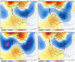
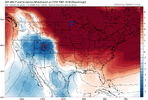
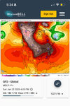
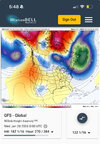
I think that 25th timeframe will be a much better pattern for a SE winter storm. Much better Blocking and Cold feed
That Mega high dominant look has been showing up on and off for the better part of a week. Across all modeling
foothillscrewzone
Member
Pump that western ridge a bit more and its a golden look
NCWeatherNow
Member
I second thisJust my opinion, and some might disagree, but if we don’t see the Southern stream get active it will be hard to trust any models showing any winter type qpf from a short wave!
rburrel2
Member
hr 216-300 is so loaded with opportunity it's insane.
In broad terms, it seems like very good agreement and on one or two West to East moving storms with cold air in place and lots of high pressure to the north. These setups are springing up all over the place on all the models and means in this timeframe.
In broad terms, it seems like very good agreement and on one or two West to East moving storms with cold air in place and lots of high pressure to the north. These setups are springing up all over the place on all the models and means in this timeframe.
LukeBarrette
im north of 90% of people on here so yeah
Meteorology Student
Member
2024 Supporter
2017-2023 Supporter
Scooter
Member
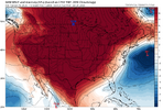
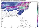
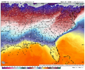
Love seeing that line of H's to the north. What we are missing for this weekends event.Oh yeah that could get the job done View attachment 184245
SnowNiner
Member
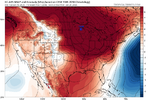
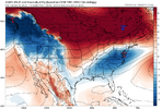
I really like your first post for next week (TPV south of Hudson Bay?!).....not sure I really like the second one though. But that's way out there and will change. Looks identical to early December; cold, but an Alaskan trough and a clipper fest for the NE. That's my fly in the ointment there.
SnowNiner
Member
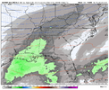
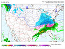
View attachment 184259
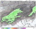
View attachment 184260
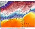
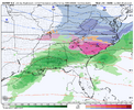
May be too early to say but two threats emerging. 22nd-23rd and 25th-26th
Not sure its too early to be talking about the first one, its 6ish days away...
They both look like cutters, but maybe we can -NAO bully them into a Miller B transfer CAD ice storm.
Oh yeh, the second one has a dry cold like @LukeBarrette mentioned. But we can trend that better. PLENTY of time for that.I really like your first post for next week (TPV south of Hudson Bay?!).....not sure I really like the second one though. But that's way out there and will change. Looks identical to early December; cold, but an Alaskan trough and a clipper fest for the NE. That's my fly in the ointment there.
LukeBarrette
im north of 90% of people on here so yeah
Meteorology Student
Member
2024 Supporter
2017-2023 Supporter
Pattern favors more of sliders and not cutters, but maybe we are saying the same thing haha. I bet this pattern finishes out with a miller B storm before the brief warm up in early Feb as many have discussed. The thing I like most about the upcoming pattern is that we actually have high pressure systems in place (@Jimmy Hypocracy approved) and not lake lows being little annoying b-words.They both look like cutters, but maybe we can -NAO bully them into a Miller B transfer CAD ice storm.
HailCore
Member
olhausen
Member
Stormlover
Member
SnowNiner
Member
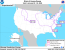
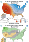
Here we go with a mid south threat area off the NOAA Risk of Heavy Snow:
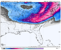
View attachment 184275
That matches the Euro AIFS snow footprint from 12z. Super clippers footprint. Need that footprint to shift down to a Miller B footprint.
Very much a nice indication of major icing where you see that drastic cut off of snow amounts. More than likely going to be dealing with a messy system that has all the whistles and gadgets. Super fun for local Mets I’m sureThat period around 24-28th is trying to tell us something...
5 day snow mean with 2-6" across NC-VA.
View attachment 184254
NCWeatherNow
Member
rburrel2
Member
rburrel2
Member
I’m so pissed off I will take the ice storm at this point. Been a while since we had to wishcast on soundings and pray for sleet to save our pine treesThis looks like it has mega-boom potential to me. Also wide goal posts with the blocked up Atlantic. Amazing how consistent this threat period has been staying too.
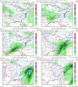
View attachment 184345
rburrel2
Member
NBAcentel
Member
SnowNiner
Member
This looks like it has mega-boom potential to me. Also wide goal posts with the blocked up Atlantic. Amazing how consistent this threat period has been staying too.
View attachment 184345
This is completely different than this weekend. Substantial -NAO, southern energy and high pressure to the north. Not quite there I think for the new thread timeframe. But it’s so early who knows.
But yeah pretty pink and purples in the eps ensembles this time frame.
I completely agree. Could be the "big one!" The parameters you look for are there. Just need the timing to be right. Lots of cold air, though!This is completely different than this weekend. Substantial -NAO, southern energy and high pressure to the north. Not quite there I think for the new thread timeframe. But it’s so early who knows.
But yeah pretty pink and purples in the eps ensembles this time frame.
Sent from my Pixel 10 Pro XL using Tapatalk
rburrel2
Member
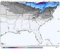
You’ll need a cigarette after seeing the 18z euro ai.
packfan98
Moderator
What site is this from
I mean like 2 weeks ago half the board were complaining about the lack of fantasy maps at all this winter. I don’t care if it’s 300+ out, still nice to see a bunch of fun clown maps again.
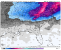
Only through 318hrs massive snow mean on 18z euro ai!
Sent from my iPhone using Tapatalk
packfan98
Moderator
packfan98
Moderator
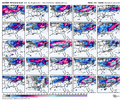
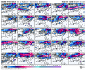
Wow! This is pinup material for winter weather lovers in the Southeast. It's been a while since I've seen an ensemble spread like this.Alright. Let’s have some fun. Get out your magnifying glasses. Feast your eyes on the AIFS Ensemble members. Loaded!
View attachment 184376View attachment 184377
LongRanger
Member
Giddy up the pattern for that 25th -28th is as good as it gets! If we don't see a big winter storm out of that we should all just give up. -NAO mega HP leads to a perfect Cold Feed. May lead to a Miller B Mixed Mess But there would lots of Snow in there as well

