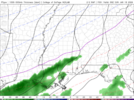
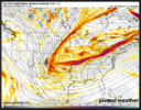
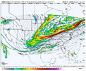
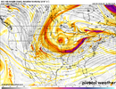
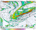
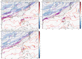
That's true. As someone that is in Atlanta, I have mostly been focusing on that northern edge which shifted SE quite a bit.. but yes, the main batch of moisture didn't move that much.looks like more of an orientation shift than anything
-
Hello, please take a minute to check out our awesome content, contributed by the wonderful members of our community. We hope you'll add your own thoughts and opinions by making a free account!
You are using an out of date browser. It may not display this or other websites correctly.
You should upgrade or use an alternative browser.
You should upgrade or use an alternative browser.
Jan. 17-18, 2026 SE Winter Weather Threat
- Thread starter RBR71
- Start date
Wulfer
Member
Seen this dog and pony act before when Nashville got last years snow. Snow was expected in Atlanta, I thought Chatttown was in a good place. The models all shifted the precept shield even more south than before, only to later correct about 250 - 300 miles north. Yea, we still have 3 days before this event. I learned from last time to wait until 48hrs before rushing to a sled! I believe this is why Morristown put up they were watching for two scenario's before laying blood to print in their forecast!That's true. As someone that is in Atlanta, I have mostly been focusing on that northern edge which shifted SE quite a bit.. but yes, the main batch of moisture didn't move that much.
Scenario's
Last edited:
Again, I do not hate this look right here at this stage. Hell of a lot better then what that gefs/gfs wanted to do. Fat lady may be warming up but she’s not performing yet.
Last Jan we had a similar situation where models had no qpf even over Myrtle and Charlotte saw snow. Not saying clt is getting 1-3” but it’s silly to think models have a storm nailed 72hrs out and yet we do this every year.
HailCore
Member
Yeah and obviously as others have mentioned we can usually expect to see precip more expansive to the north and west than what globals indicate.Last Jan we had a similar situation where models had no qpf even over Myrtle and Charlotte saw snow. Not saying clt is getting 1-3” but it’s silly to think models have a storm nailed 72hrs out and yet we do this every year.
Will the recon flights be in the usual spot on TT?
Yep, the idea that globals or hires has precip shield figured out 72 hrs out is laughable. Last year we saw massive shifts w with qpf inside 18hrs!Yeah and obviously as others have mentioned we can usually expect to see precip more expansive to the north and west than what globals indicate.
Searching for a nugget here, and I do find this interesting.
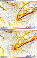
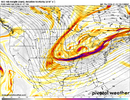
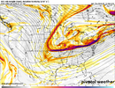
The 18Z EMCF 500Mb presentation more closely resembles the 6Z GFS than the drier 18Z GFS presentation at the same time stamp. If that vorticity bundle on the backside extends as far SW as both the 18Z Euro and 6Z GFS show, I maintain hope for some close-in surprises with SW swinging through the South Saturday night and Sunday. The last panel is the 18Z gfs for comparison.
It was clear when the 18Z GFS was running that we were in trouble 36 hours in.
How far west, and the strength of that vorticity at the base of the trough when it begins the pivot, are key. The first panel is the renegade NAM look that I'd love to see verified at 48 hours.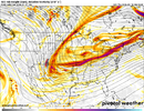


Yep, the idea that globals or hires has precip shield figured out 72 hrs out is laughable. Last year we saw massive shifts w with qpf inside 18hrs!
Forget 18 hours, it was like 6-8 hours going from 1-2" to 6-8" down here.
packfan98
Moderator
Tsappfrog20
Member
I have been away for a bit so sorry if this was already shared but the NWS RAL put out there official forecast.

Sent from my iPhone using Tapatalk

Sent from my iPhone using Tapatalk
rburrel2
Member
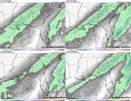
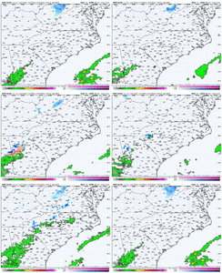
6hr panels are a bit deceiving since it’s sped up timing. It’s east of the last run but still very wet and very west overall.SREF trendsView attachment 183982
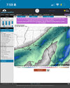
6hr panels are a bit deceiving since it’s sped up timing. It’s east of the last run but still very wet and very west overall.
View attachment 183983
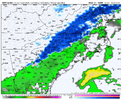
This is where I’d like all models to converge and look just Iike this leading up to 12z tomorrow for real
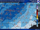
And a 90% chance of nuttin'Well, I’ve got a 10% chance of getting 3”. What could go wrong???
View attachment 183981
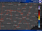
WEATHERBOYROY
Member
If it wereThis is where I’d like all models to converge and look just Iike this leading up to 12z tomorrow for real
Branch
Member
Maybe someone has posted but I’d be curious to know if the 2014 storm was still trending this far south with 2 days to go.
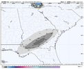
The 18Z Euro would be a dream come true for some S GA snow lovers with a max of 1.2” at Douglas (see below). I’m not betting on that much accumulating there but it would be exciting!
How often has Douglas received 1.2”+? Not very at all as the ~120 year wx history shows only 5 times meaning a 1.2” snowfall there would be ~1 in 25 year occurrence. However, all five have been since 1973 meaning that would be a ~1 in 10 year occurrence over the last 52 years:
2/10/1973: 3.0”
12/22-23/1989: 3.3”
2/13/2010: 1.5”
1/3/2018: ~3”
1/21-2/2025: 4.5”

@bouncycorn could give more insight here but it's not as simple as a list of models blended. It's model data from globals, short range, raw model data, corrected biases, models we don't have access to... I believe it's a complicated process. NWS relies on it for guidance but with that said, have no clue what data is causing the higher amounts so far southAnyone know what model(s) is showing amounts in Louisiana/Mississippi that are getting added and highlighted into the National Blend of Models? I’m surprised to see it so active in that area View attachment 183989
NBAcentel
Member
Mahomeless
Member
I still see this as being an extremely plausible, if not most likely, depiction of what we will see show up on the short range/hi-res models starting late tomorrow.Anyone know what model(s) is showing amounts in Louisiana/Mississippi that are getting added and highlighted into the National Blend of Models? I’m surprised to see it so active in that area View attachment 183989
I'm a little surprised my area is currently projected to have these totals too, considering today's model trends from all the major models. I am very curious to see what HRRR shows for how the system develops near Louisiana starting tomorrow's runs. It did a pretty good job depicting last January's crush job for our big snow in the lead up to the event, including the general precip shield and totals.Anyone know what model(s) is showing amounts in Louisiana/Mississippi that are getting added and highlighted into the National Blend of Models? I’m surprised to see it so active in that area View attachment 183989
Last edited:
Bigedd09
Member
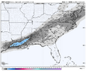
Go ahead and add the HRRR to the amp camp View attachment 183997
Typically the long range HRRR is pretty amped though right?
Sent from my iPhone using Tapatalk
Thanks. Fascinating. 0z is out and actually increased totals out west@bouncycorn could give more insight here but it's not as simple as a list of models blended. It's model data from globals, short range, raw model data, corrected biases, models we don't have access to... I believe it's a complicated process. NWS relies on it for guidance but with that said, have no clue what data is causing the higher amounts so far south
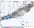
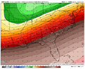
Through 45hrs, slightly sharper and deeper at H3 & H5 compared to 18z & 12z, in response heights a little higher over the SE. Nothing significant, just small changes.
iGRXY
Member
The leading finger of precip in Georgia and SC just fills in a little more each run on the NAM
iGRXY
Member
Bigedd09
Member

Sent from my iPhone using Tapatalk
iGRXY
Member
1st time ive noticed precip all the way back to the escarpment at Mt Airy, sw va. Makes sense with overunning
85 south riding the lightening. Partly cloudy downtown Greenville. Silver dollar flake fest
trackersacker
Member

