• Hello, please take a minute to check out our awesome content, contributed by the wonderful members of our community. We hope you'll add your own thoughts and opinions by making a free account!

Jan. 17-18, 2026 SE Winter Weather Threat

Nope, across the board, the AIFS/AIFS-ENS is the best publicly-available model suite available currently. AIGFS is quite a bit worse -- on par with the conventional ECMWF-IFS.

There will certainly be cases where the ECMWF data assimilation techniques probablistically get it 'wrong' which would impact all downstream models (ECMWF-IFS, AIFS, EPS, AIFS-ENS, GRAF).. but most of the time, ECMWF has superior data assimilation techniques. And, typically, if there are issues with the ECMWF DA, you'd see divergence between the ECMWF-based/initialized models and models that use different DA (GFS, ICON, CMC, UKM).

In this case, the GFS/AIGFS are on an island of their own.. so this makes me think that there could be data assimilation issues with GFS.
this is heavy stuff. reading your findings gives me a sense of, if the aifs is locked in, then why even bother with anything else
 
this is heavy stuff. reading your findings gives me a sense of, if the aifs is locked in, then why even bother with anything else
I get AIFS is definitely advancing but I'm not convinced there isn't any fail modes. Can't forget what happened last year

Sampling not long ago appears to look generally better for the south
 
I get AIFS is definitely advancing but I'm not convinced there isn't any fail modes. Can't forget what happened last year

Sampling not long ago appears to look generally better for the south
the siren song of advocating for a nw trend is alluring but hard to argue against bouncycorn's thesis. just gotta live through it to find out
 
EPS didn't really improve with regards to precipitation amounts

Roxboro was similar but just to your east in E NC had an increase, especially coastal areas. E SC/SE GA had a moderate increase to the best run yet, which is a surprise to me as I had expected a NW trend. There was actually a bit of a SE trend from 18Z. I still think the amounts are overdone considering borderline temps.
IMG_7112.gif

Members:
IMG_7110.png

IMG_7111.png
 
I get AIFS is definitely advancing but I'm not convinced there isn't any fail modes. Can't forget what happened last year

Sampling not long ago appears to look generally better for the south

I have to agree with you. I am very weary of buying the eastern solutions for this storm even if it’s for a model suite that’s supposed to be the best thing since sliced bread, which it’s not. The AIFS has its own issues and rarely gets the details right even if the pattern isn’t much different. The details are what will matter a lot here because of the positive feedbacks that happen between sloped moist ascent, warm advection, and the overall synoptic pattern/wave tilt.

If we had a big 50-50 low sitting to the NE I would be willing to bite on the eastern camp because we would have something to stop the northward advance of this event and a lot of times the GFS gets underestimates how much this can suppress things. Oth, there’s nothing stopping this from trending north to its heart’s content that is what worries me here for the Carolinas.
 
Good thoughts about the storm here in the Carolinas. I am hoping some stronger dynamics may be able to overcome some of the warm air advection, especially if it pivots and turns negative as it pulls away. There should be some good confluence with the PV in SE Canada, and 850s are like going to also crash quite cold after the pivot, so hoping it will be able to keep the mid levels and surface colder as long as we get heavier precipitation. Of course, this could be my inner weenie wishcasting 🤔

When you have an overrunning type event like this, the cold air usually needs to get here first or you need to have a way to viably transport it here to thwart the mid level warm advection and LHR aloft, we just do not have in this setup. We are waiting for the cold air to show up and bulldoze thru the mtns as the precip begins, much less at midday which will only slow up the front even more. That of course also causes a sudden north shift in this precip too because your primary forcing mechanism to generate it is tied to moist ascent over top the front itself. I just don’t like anything I’m seeing wrt cold air transport in the Carolinas.

We don’t have confluence to the NE, this is actually a very diffluent pattern over SE Canada with a ridge offshore Newfoundland and a trough axis that a farther away zonally over Manitoba than it is down south

IMG_7245.png
 
I could honestly see how a scenario like the RRFS happens. The cold air just takes too long to here in the Carolinas and the snow is mostly confined to the mtns, foothills, and western Piedmont, with AL-GA-MS cashing in

sn10_acc-imp.us_se.png

ref1km_ptype.us_se.png
 
I could honestly see how a scenario like the RRFS happens. The cold air just takes too long to here in the Carolinas and the snow is mostly confined to the mtns, foothills, and western Piedmont, with AL-GA-MS cashing in

View attachment 183622

View attachment 183623
Webb you believe the Euro will trend NW and send more precipitation for the gulf coast for Sat/Sun storm?
 
Hey Eric just wondering do you think it’s going to be a kinda split the difference between the gfs and euro in the end or is your expectation that all will trend towards the gfs and gefs


Sent from my iPhone using Tapatalk

I’ve made my opinion clear the last day or so. I do not buy the eastern solutions for a host of reasons
 
With overrunning events the cold air *has to* get here first and that’s just not the case in the Carolinas with this one. Totally different story in MS, AL, & GA
 
With overrunning events the cold air *has to* get here first and that’s just not the case in the Carolinas with this one. Totally different story in MS, AL, & GA
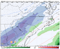
New 6z NAM looks snowy in the western half of the Carolinas!? Very snowy! And NAM usually underdone on precip! Gonna be a lot of happy people in the morningIMG_4289.png
 
I could definitely agree with Eric. And I hate that being in CAE. It does look like a warmer version of 2014. And many could easily lose this to the West. No cold air lock. It would be an odd set up win for the Carolinas if we win here.

If you think about it, a Western scenario would be common to what we’ve seen the last several Winters. A boundary setting up & most in here East of the Apps getting wiffed. Reminds me a little of the January 2024 storm for the Mid South also.

If that does end up happening, it’ll be a pretty bad wiff by the Euro & EPS. It’s about to be a battle in here on who is pulling for what. Sorry to be a buzzkill right when everyone wakes up. Here is to a good day of tracking!
 
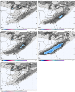
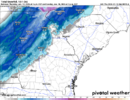
RRFS snowfall accumulations (10:1). This would be nice, and it gives me a bit of hope for ATL, but I am still very doubtful given the lack of strong non-GFS-family model agreement.

1768468285273.png
 
Again, for those us east of the apps I think there’s a solid chance for snow in this setup but it’s for the 85 North crew. Like Webber said, I think it’s going to be hard to get the cold to drive far enough south and east especially when the entire driver of this is WAA. If you look at most of these models the 85 corridor is close enough temps wise and location wise to get enough cold feed to get snow in this setup. The further you get away from the mountains and lose elevation it’s going to be really really hard to score here. In overrunning the issue isn’t the moisture you’ll see the precip shield as a whole get larger and larger until go time. The issue is and always will be do we have an established cold airmass in place first or some type of feeder. The good news is the opportunity for dynamic cooling is very real here with temps at or below freezing in the mid levels before the precip arrives so then its rate driven to get it down to the surface. But again, the best opportunity for that is along 85 and north where it’s established a few hours ahead of the initial moisture fetch.
 
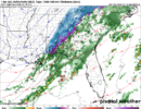
Woah icon with a lot more QPF this run. Pretty substantial shift west. Also mainly in the form of snow in the Carolinas


Sent from my iPhone using Tapatalk
 
I could definitely agree with Eric. And I hate that being in CAE. It does look like a warmer version of 2014. And many could easily lose this to the West. No cold air lock. It would be an odd set up win for the Carolinas if we win here.

If you think about it, a Western scenario would be common to what we’ve seen the last several Winters. A boundary setting up & most in here East of the Apps getting wiffed. Reminds me a little of the January 2024 storm for the Mid South also.

If that does end up happening, it’ll be a pretty bad wiff by the Euro & EPS. It’s about to be a battle in here on who is pulling for what. Sorry to be a buzzkill right when everyone wakes up. Here is to a good day of tracking!
Look at it this way. If that picture of the nam was true verbatim and that snow line cut our county in half, we would be dead center bullseye for accumulation due to shear amount of precip, even if the ratios werent great
 
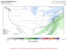
WeatherNext2, Google's private ensemble which scores the best in the world (even better than AIFS/AIFS-ENS), is a bit underwhelming for ATL. Light snow accums in the Carolinas.

084.png096.png
 
X

snku_acc-imp.us_state_nc_va.png
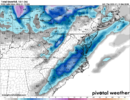
Just as an FYI, it’s still snowing in the upstate and NE Georgia here. Likely another 3-4 hours of it IMBY. Likely finishing with 3-6” along and north of 85 Kuchera ratio as shown above.
 
Back
Top