Southernwx
-
Hello, please take a minute to check out our awesome content, contributed by the wonderful members of our community. We hope you'll add your own thoughts and opinions by making a free account!
You are using an out of date browser. It may not display this or other websites correctly.
You should upgrade or use an alternative browser.
You should upgrade or use an alternative browser.
Misc General Banter Thread
- Thread starter Rain Cold
- Start date
SnowNiner
Member
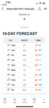
GSP says forget about snow for Sunday. My forecast here is sunny and cold. They are most likely right too.
Got to read the forecast discussion bro. They've left to door open for it. Just not enough evidence that it's real yet.
Key message 5: Winter precipitation is possible east of the mountains
early Sunday, however confidence with respect to timing and amounts
remains relatively low.
The synoptic pattern will remain progressive thru the latter half
of the weekend and into early next week. A deepening upper trof will
push a cold front thru the region late Sat with colder air returning
Sat night into early Sun. The associated digging upper shortwave could
induce some robust frontogenesis and isentropic upglide back over the
cold air east of the mtns Sunday morning. As such, if precip does deve-
lop over our eastern zones on Sunday it would likely be mostly snow.
The current fcst still only has a slight chance for precip and only a
few hundreths of an inch of QPF during this time frame. If precip
chances and/or amounts trend higher going forward, it`s more likely
that these areas could get some amount of snow. Otherwise, tempera-
tures are expected to cool well-below normal for Sunday and remain
below normal thru early next week.
A GFS whiff here may really put a lot of folks on the cliff and I am fearful that is what lies ahead. Thank goodness we are 96 hours out and not 48. Gotta love letting the emotions take over.
Depending on where some of us live this isn't a bad thingA GFS whiff here may really put a lot of folks on the cliff and I am fearful that is what lies ahead. Thank goodness we are 96 hours out and not 48. Gotta love letting the emotions take over.
ChattaVOL
Member
12z tomorrow its going to have a 962mb low over Atlanta
Please
Sent from my iPhone using Tapatalk
Tsappfrog20
Member
Let’s see what the good ole 18z GFS has to say….
Sent from my iPhone using Tapatalk
Sent from my iPhone using Tapatalk
WXinCanton
Member
Meltdowns incoming
Big timeMeltdowns incoming
Bigedd09
Member
Meltdowns incoming
No it’s happy hour. We will be happy!
Sent from my iPhone using Tapatalk
BrickTamland
Member
BKWRN29
Member
BrickTamland
Member
SnowNiner
Member
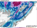
The big long finger strip look odd to anyone? Is this because it’s overrunning and not a miller a storm? Very strange looking.
BrickTamland
Member
- Joined
- Jan 23, 2021
- Messages
- 4,602
- Reaction score
- 15,197
- Location
- Lebanon Township, Durham County NC
I really want the GFS to be right. I really do.
It’s just never a good idea to bet against the Euro.
It’s just never a good idea to bet against the Euro.
- Joined
- Jan 23, 2021
- Messages
- 4,602
- Reaction score
- 15,197
- Location
- Lebanon Township, Durham County NC
Literally almost the same exact result as 12z.I smell a slight nod to the King.
Survive and advance
BrickTamland
Member
Check, please.
BrickTamland
Member
The snow we had last Jan 21-22 had the Euro the last one to jump aboard 3 days out. It had the precip too far SE and then finally shifted NW in line with the GFS.I really want the GFS to be right. I really do.
It’s just never a good idea to bet against the Euro.
LongRanger
Member
You need your nose checked, No changeI smell a slight nod to the King.
Bigedd09
Member
The snow we had last Jan 21-22 had the Euro the last one to jump aboard 3 days out. It had the precip too far SE and then finally shifted NW in line with the GFS.
Every other model is pretty far southeast too
Sent from my iPhone using Tapatalk
i see plenty of changes. it look like crap vs 12z at 500mb; totals are cut in half in mby even.
it looked nothing like 12z just in qpf amount alone
it is a nod to a possibly drier solution
it looked nothing like 12z just in qpf amount alone
it is a nod to a possibly drier solution
Bigedd09
Member
i see plenty of changes. it look like crap vs 12z at 500mb; totals are cut in half in mby even.
it looked nothing like 12z just in qpf amount alone
it is a nod to a possibly dryer solution
That’s what I had noticed. It’ll be just like the euro by 6z tomorrow
Sent from my iPhone using Tapatalk
I can’t wait to see this thing go negative tilt over Mississippi sometime over the next 24-36 hours. It’s gonna hit like crack
BrickTamland
Member
That’s what I had noticed. It’ll be just like the euro by 6z tomorrow
Sent from my iPhone using Tapatalk

i don't really think of this as a gfs vs euro showdown. they're not very far off. all things considered i think it's a tighter guidance envelope than usual (discarding the canadian, which i think doesn't have a clue). spann may be being too categorical; if this were long range sure but this event is only a hop and a skip away at this juncture
wouldn't be surprised if we had one more euro pain suite to go through where it goes even drier though lol
wouldn't be surprised if we had one more euro pain suite to go through where it goes even drier though lol
BrickTamland
Member
I can’t wait to see this thing go negative tilt over Mississippi sometime over the next 24-36 hours. It’s gonna hit like crack

ChattaVOL
Member
It’s really going to come down to northerly flow and strength/position of the coastal lowi don't really think of this as a gfs vs euro showdown. they're not very far off. all things considered i think it's a tighter guidance envelope than usual (discarding the canadian, which i think doesn't have a clue). spann may be being too categorical; if this were long range sure but this event is only a hop and a skip away at this juncture
wouldn't be surprised if we had one more euro pain suite to go through where it goes even drier though lol
SnowNiner
Member
I swear the gfs suite is trolling us. Can we get any other suite to agree? Ukmet? Canadian? Any AI model? Bouncycorn?
Cruel gfs not cool.
Cruel gfs not cool.
SimeonNC
Member
It really doesn't feel like we're only 3-4 days out from this storm lol.
JHS
Member
We need to get this one. If not, we are done for a while. At least into February and we all know how that month works. The biggest news though is how dry the models are. We are headed for a historic drought this spring and summer I'm afraid.
Pretty sure we have multiple chances coming upWe need to get this one. If not, we are done for a while. At least into February and we all know how that month works. The biggest news though is how dry the models are. We are headed for a historic drought this spring and summer I'm afraid.
American model rug pull going to be one for the hof
Webber is talking dirty to me right now.
JHS
Member
I'm afraid not. We will be lucky to get another drop of rain or a flake of snow this month if things go like I'm thinking. This event will probably trend back southeast so far that not even I-95 gets anything.Pretty sure we have multiple chances coming up

