rburrel2
Member
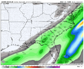
06z ukmet only goes out to 66hrs but it’s even more west with trough/energy dropping down from Canada.
Yea crazy the euro has a snow storm in Savannah and the euro ai has all rain for GSP.Moisture is obviously uptrending.. I mean you can call that a trend now. The wildcard is the cold vs warm scenario. That is a big battle with model guidance. The difference is pretty wild this close to the event. I mean for some runs to be showing a snow storm along the coast to some being to warm for EVERYBODY.
Hey now! I'm in Huntsville. I'd be happy if you guys score in Bham just to see ole James Spann eat some crow. "Zero chance of meaningful snowfall in Alabama. Zero"Honestly wish it was a little further south at this point in the game with all the changes unfolding
I think I’d cry if I saw Dothan and the gulf coast score big again but I’d cry harder if this turned into a Huntsville storm![]()
Part of its issue is its quicker with precip arrival.How warm is the Euro AI, is it a straight up torch or is it borderline?
Maybe it's just a blip and it can be fixed.
It's not quite far enough NW yet. There, I said it! I'm hoping everybody gets in on the snow, but sometimes everybody can't have it (So it's every man for themselves). This may not be my time. But I've got to root for an NW trend starting about Friday if it indeed looks like it's even going to happen.Hope folks realize, we got to walk a fine line here. Get to far west and amped up earlier, its gonna warm nose city coming from our sooutheast off the Atlantic.
That SW to NE stipe starting down in LA is what you wanna see. The EPS does not appear to be coastal/Atlantic dominant. Quick Atlantic development is a killer. There is clearly some good earlier lift taking place here
Nobody is safe. This is going to get real scary here very soon. Yes yes these maps are real pretty and inclusive right now but I think that’s going to change here pretty soon. Y’all know the drill. May the odds be ever in your favor.It’ll be classic if we wishcash this northwest and turn it into a rain storm for 85 south and Frosty gets a foot.

Yea, being in the bullseye now with the current trends is not where you want to be. I fully expect the SLP to form earlier and closer to the Alabama coast. If trends continue, this could very well run inland across southern GA, or even become an Apps cutter which would bury us in AL. Time will tell, but the I-20/59 crowd is sitting perfect.Honestly wish it was a little further south at this point in the game with all the changes unfolding
I think I’d cry if I saw Dothan and the gulf coast score big again but I’d cry harder if this turned into a Huntsville storm![]()
Great trend!
View attachment 183202

How warm is the Euro AI, is it a straight up torch or is it borderline?
Maybe it's just a blip and it can be fixed.
6z UKMet still trending west at the end of its range. West coast ridge inching west off into the pacific says this continues.
View attachment 183219
Hope that energy doesn’t start shearing off if this continues. It’s a fine line.6z UKMet still trending west at the end of its range. West coast ridge inching west off into the pacific says this continues.
View attachment 183219
Is this bad or good for winter weather fans?
Sent from my iPhone using Tapatalk
I think that ull exiting faster is the key to really get this thing to pop.Depends on where you are. With it inching west with the SW but also with the big low about the Great Lakes as well. Plus the big ULL exiting faster stage right over the far NE. The trend should be more tilt/amplification.
True but can put folks like my location in or awfully close to waa nosingIf you're rooting for a NW trend, these are exactly the type of systems you would find it in.
There's a south-based +NAO. Generally the trend has been +NAO = NW trend, -NAO = SE trend.
I also like the trend of the orientation of the h5 vort. It would promote a more juiced up system. And the more juiced up it is, the more NW it is.
Even in Northern VA, I'm excited for this system. I think you all will be very happy folks at 0z with the trends currently.
Good point but that is one intense air mass.If you're rooting for a NW trend, these are exactly the type of systems you would find it in.
There's a south-based +NAO. Generally the trend has been +NAO = NW trend, -NAO = SE trend.
I also like the trend of the orientation of the h5 vort. It would promote a more juiced up system. And the more juiced up it is, the more NW it is.
Even in Northern VA, I'm excited for this system. I think you all will be very happy folks at 0z with the trends currently.

The ratios on the NW side are going to be in that 12:1 range as well.Just to throw out more hope for us on the NW fringe, the gentle reminder that precip is usually farther NW than even depicted on the models in overrunning situations. In 2017 a lot of areas NW of the main precip shield got more snow that expected 2-5" VS 1-2 on models..
Yeah, this seems to be more similar to an overrunning scenario with warm advection coming from the southeast for those on the NW side of these depictions. This isn't a wound up Miller A. If current looks continue, I would think the precip shield would be a little more robust on the NW quadrant.Good point but that is one intense air mass.
Whoever is just west of that boundary….
View attachment 183220
Yep... I'm just skimming through stuff and the Ukie tries to really bomb this. Which for us down east is concerning haha. Someone getting a nice surprise Sunday I do believeYeah, this seems to be more similar to an overrunning scenario with warm advection coming from the southeast for those on the NW side of these depictions. This isn't a wound up Miller A. If current looks continue, I would think the precip shield would be a little more robust on the NW quadrant.