• Hello, please take a minute to check out our awesome content, contributed by the wonderful members of our community. We hope you'll add your own thoughts and opinions by making a free account!

Pattern December Doldrums 2025 🎄 ❄️

Kevin,
The MJO is in phase 8 per RMM, the most widely followed/analyzed MJO charts and which also has 50 years of historical stats to analyze. In addition, the daily model MJO progs that are widely followed and posted at wx forums are of these RMM charts.

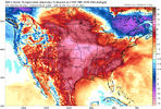
Phase 8 per RMM started on Dec 3rd. RDU had -8 F anomalies 12/3-7. In addition, the latest runs of the EPS have -8 for Dec 8th-17th. If that verifies, that would mean -8 anomalies for RDU for the 15 days Dec 3-17. That would tie it with 2002 for the 3rd coldest Dec 3-17th of the last 50 years with only 2010 (-13) and 1989 (-9) colder than 2025!

So, based on the last couple of EPS runs, RDU and much of the E part of the US will end up with one of the coldest periods on record for Dec 3-17, which is consistent in Dec with phase 8 more than any other phase:
View attachment 178563
Messenger_creation_2004D230-668A-4984-810F-20596DF57027.jpeg
 
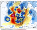
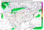
Looks like it's even better with it this run. We'd get a lot colder if the only model we had was the GFS

View attachment 178580
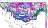
STJ bout to wake up a little bit. Those reds out there along the WC and north of AK just want to be there this year. We should just enjoy it. Doesn't happen very much these days.
 
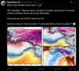
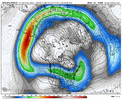
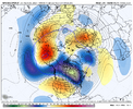
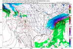
The thing is, the pacific jet is extended where it needs to be, but it’s extending into the appendage into AK, and keeps feeding into it, I really don’t know how we can get out of it unless we retract it and root the ridge in AK back into the subtropics or get the cutoff block strong enough to send the appendage back into the Pacific and replace it with a ridge bridge IMG_0630.pngIMG_0631.png
 
Yup. How about weakening Nino or the MJO or

The thing is, the pacific jet is extended where it needs to be, but it’s extending into the appendage into AK, and keeps feeding into it, I really don’t know how we can get out of it unless we retract it and root the ridge in AK back into the subtropics or get the cutoff block strong enough to send the appendage back into the Pacific and replace it with a ridge bridge

The thing is, the pacific jet is extended where it needs to be, but it’s extending into the appendage into AK, and keeps feeding into it, I really don’t know how we can get out of it unless we retract it and root the ridge in AK back into the subtropics or get the cutoff block strong enough to send the appendage back into the Pacific and replace it with a ridge bridge View attachment 178586View attachment 178587
Where there is a will, there is a way!
 
The thing is, the pacific jet is extended where it needs to be, but it’s extending into the appendage into AK, and keeps feeding into it, I really don’t know how we can get out of it unless we retract it and root the ridge in AK back into the subtropics or get the cutoff block strong enough to send the appendage back into the Pacific and replace it with a ridge bridge View attachment 178586View attachment 178587


DT swears the apendage, because its hooked to the pac jet and not a result of the block itself. Cant get , just flow right on into western Canada, disrupting the ridge bridge. All models keep trying to say it will med to LR and after couple of days, have to re correct. Atleast that was what he was saying a few days ago. Packfan posted his video. Honestly made sense. So if that theory still holds water, then we will most likely see dec 15-24 forecast start changing back to appetizing setup, keep flow coming down from Canada like it has been. Working well for NC, VA, most part.
 
For my destination in NW GA this weekend, it went from potentially being in the 30’s to upper 50’s in a couple days for the Saturday I’ll be there, lmao barf.

I’m guessing that’ll probably be it on the movement though because that’s already above average.
 
563177db942eb571c52cae6be1784231.gif

GEFS 48hr H5 trend the beginning of Christmas week.


Sent from my iPhone using Tapatalk
 
Man phase 8 and not a bit of cold in sight.
We will be below normal through at least next Wednesday. Which means we will have spent 15 straight days in December @ Greensboro Below Normal. So phase 8 technically has delivered up here. Even put down some frozen in spots that don't normally get it. But I get your drift, Phase 8 hasn't done anything for folks not in the upper south / Apps-eastward.
The appendage from the pac jet, nosing up off Alaska, Fro was talking about last night. Has really screwed the pooch, from all the SE just getting plastered with winter wx. If it will relax, get out of way, then 2cnd half of December would present a really good window for cold and frozen precip. I'm hoping the ensembles/ models have a change of tune day 8-15 , here in the next few cycles. Been happening repeatedly since Fall. The models usually try to overplay how it interferes with the ridges trying to connect. Which is what we want, so the Cold Canada gets a straight shot down toward us all, not just VA/NC catching the table scraps. It would also help NS energy/vorts to come down further west and have a chance to amplify. Right now its just been weak sauce that spits out a couple tenths of qpf.
 
Yeah regardless of how much we warmup this first week of December has been one of the coldest on record here

Even if Christmas is warm(which I mean it's still 15 days who knows) and it's dry til then winter will be back I'm sure... Most of the time it's in January here anyway
 
Back
Top