lexxnchloe
Member
Allan will be putting out his first guess map after church!
Sent from my iPhone using Tapatalk
Allan will be putting out his first guess map after church!
Sent from my iPhone using Tapatalk
Things don't work like they used to thoughRemember a few years back, where we got two/three events that were focused from Raleigh up towards your area. You were the snow king that year.
I was kind of worried about those increasingly diggy trends halting or reversing slightly as we move in. It will be rate dependent, as we know. Hopefully, it can stay juicy enough to overcome the dry air as that moves in. But I think overall, the Euro has the right footprint.Definitely juicier but also shifted slightly north, warning shots. It did have a little coastal action though noted with slight enhanced accums near coast. Maybe this will trend better, but may only help my area out, sorry not sorry. Hopefully thermals are better and that rn/sn line comes back south
View attachment 178344


Maybe that's a good thing, long range HRRR sucks anyway right? Lol Yeah it still looks ok for you, but mostly a Va storm, lack of precip in NC, except for some slight coastal enhancement (which I'm getting doubtful of).Newest HRRR has a weaker system overall
The 9z RAP (compared to 3z) was a drop for NC folks as well. Virginia looking good. But, still have hope for northern NC.
You give up too soon.Yeah this one is over for most in NC. Unfortunate but hopefully we’ll have some more chances down the road
Sent from my iPhone using Tapatalk

I know people have their thoughts about the NBM, but NWS does rely heavily on it, the blend also did fairly well with the last system (showing very little accums in NC). So with that said, I'm not throwing in the towel just yet....
View attachment 178350
It is, does not have the 6z suites in it yet. So yeah could definitely level off or reverse unfortunately, also has models in the suite we don't have access too if I'm not mistakenthat actually Increased a made a more broad area across more of NC. My question is, is the NBM normally 1-2 cycles behind ? Or did I just dream I read that once ?
Sent from my iPhone using Tapatalk


Great post. I don’t know why we do not discuss the NBM more often, it is like an ensemble mean for all of the models. I suspect it is not posted as much since it will never give a specific poster that big snow amount a specific model may show.I know people have their thoughts about the NBM, but NWS does rely heavily on it, the blend also did fairly well with the last system (showing very little accums in NC). So with that said, I'm not throwing in the towel just yet....
View attachment 178350
As been mentioned many times, NAM does fairly well with thermals, especially within 48 hrs. So if it's in your camp it's not a bad thing at this range imho.NAM continues to look good imo, this time it has snow all the way down to Northern SC(Rock Hill, Fort Mill, ect). Waiting for the 3K to update.


They need to put you on the payroll at the NWS or WPC if you aren’t already
Low-level forced ascent from a crashing Arctic frontal boundary combined with DPVA aloft should be enough to get the job done on Monday w/ at least some scattered light snow showers across NC and VA.
Makes me feel a little more hopeful.3K NAM looks good!!

Sent from my iPhone using Tapatalk


Cold advection over top of fresh snow cover in VA + melting snow aloft lowering the freezing level + sensible heat transfer from said snow and cold rain falling into the BL + of course layer lifting will eventually flip things to snow across much of NC if there’s real precip

Do we ever see the broadcast mets go against the euro when it comes to winter weather in NC very often?GFS and NAM have been consistent with showing a good storm for a lot of NC. Would be nice if they are right and the Euro is just being stubborn. Just don’t want to see tbis fall apart 24 hours out when yesterday it looked pretty positive.
I don't think so.Do we ever see the broadcast mets go against the euro when it comes to winter weather in NC very often?
Can the amount of precip on the NAM be trusted?We’re 24 hours from this event transpiring, we should not be focused on global models at this point.
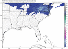
RGEM looking pretty good for northern NC. Best run yet for many.

Gets snow further North into Virginia as well.
RGEM stepping it back, a nice wetter trend IMO
Sent from my iPhone using Tapatalk