-
Hello, please take a minute to check out our awesome content, contributed by the wonderful members of our community. We hope you'll add your own thoughts and opinions by making a free account!
You are using an out of date browser. It may not display this or other websites correctly.
You should upgrade or use an alternative browser.
You should upgrade or use an alternative browser.
Pattern December Doldrums 2025 🎄 ❄️
- Thread starter SD
- Start date
LukeBarrette
im north of 90% of people on here so yeah
Meteorology Student
Member
2024 Supporter
2017-2023 Supporter
I’ve been really busy with classes and my internship this semester but now that Thanksgiving break has come around I can jot down some thoughts for y’all. Want to make it clear that I’m not a long range expert by any means…
Some things that have me intrigued right now:
Phase 8 is coming
Cold will become bottled up in Canada for awhile, build that snowpack!
Polar vortex becoming weakened will help with spilling cold air further south.
Now for some red flags:
Did a little can kicking but it looks like finally we have locked in on a timeframe. Just don’t like can kicking too much.
SE Ridge
Lack of correctly placed (more west based) +PNA.
Late in modeling things seem to go cold but more of a zonal look.
Bottling up cold and a mean trough in Canada before we get to our favorable pattern may burn us. Switch may happen too late and the cold will move to the other side of the world.
I’m sure there are some things I’m forgetting but I’m not as enthusiastic about things as I have been in the past. Seems like more red flags than green flags. I think more than anything though we have to be patient. Let’s get to Dec 10 and then see what lies ahead…
wow
Member
Getting the PV over SE Canada is a good step in the right direction + an upper low over the SW kicking east will set up a nice boundary layer up somewhere... possible overrunning event?
Of the list of red flags in Luke's previous post the one that is the biggest fly in the ointment to this amateur weather watcher, at least, is that persistent SE ridge. As long as we have that, we are not going to get the cold air feed and precipitation needed to produce any winter weather other than the passage of dry cold fronts from time to time.
wow
Member
Which is why trending toward low heights over SE Canada keeps it in check. It's why my forecast in W NC dropped like a rock with CAD forecasted in the beginning of Dec. Hopefully the trend continues.Of the list of red flags in Luke's previous post the one that is the biggest fly in the ointment to this amateur weather watcher, at least, is that persistent SE ridge. As long as we have that, we are not going to get the cold air feed and precipitation needed to produce any winter weather other than the passage of dry cold fronts from time to time.
Webberweather53
Meteorologist
Getting the PV over SE Canada is a good step in the right direction + an upper low over the SW kicking east will set up a nice boundary layer up somewhere... possible overrunning event?
That would definitely be fitting if we’re following along with 2013-14 here
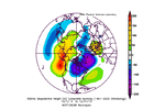
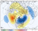
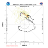
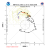
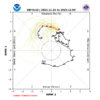
Managed to get a sneaky little NW Piedmont ice storm in early Dec 2013

That would definitely be fitting if we’re following along with 2013-14 here
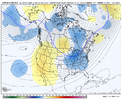
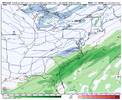
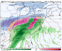
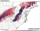
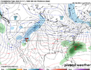
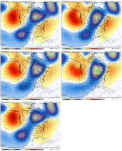
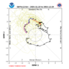
View attachment 177151
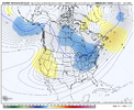
View attachment 177152
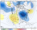
Managed to get a sneaky little NW Piedmont ice storm in early Dec 2013
View attachment 177153
Lol
The latest ext EPS (11/23) is predicting an 11 day long phase 8 for 12/14-24 averaging ~2.0 amplitude. The latest ext GFS is predicting a 12++ day long phase 8 for 12/13-24++ but with a much lower avg amp that with extrapolation would likely be headed to a sub 1.5 amp for the full phase 8 avg.
Regarding the EPS prog, there hasn’t been an 11+ day phase 8 since back in Feb of 2010 (2/7-17).
Regarding the GEFS prog of 12++ days, there hasn’t been a 12+ day long one since way back in Dec ‘75-Jan ‘76 (12/19-1/5)! There have been only two on record of 12+ days: the just mentioned one of 18 days and a 13 day long one 1/19-31/75.
Also, the 15 long phase 8s (8+ days) have followed long phase 7s (9+ days) only twice out of the 15 cases although the two that did were two of the coldest.
So, needless to say, I’m taking these very long phase 8 progs with a huge grain for now.
Of the 15 long phase 8s, the ones averaging an amp of <1.8 (like GEFS has) were significantly colder in the E US on avg than those with an avg amp >1.8 (like EPS has).
The GEFS-like sub 1.8 amp cases include the very cold outbreaks of Jan of 1985, Jan of 1988, Dec of 1989, and Feb of 2010 with 3+” snows (including historic snow in 2010) for all 4 in Baltimore for example. The other 3 sub 1.8 amp phase 8s had either BN (1) or NN (2) temps at Baltimore. So, even a GEFS-like moderate long phase 8 hasn’t always been cold at Baltimore but rather in most cases and with no mild cases.
But half of the >1.8 amp phase 8s were warmer than normal! So, if there’s actually a very long phase 8, I’ll be rooting for one closer to the lower amp of GEFS than the higher amp of EPS due to better prospects for cold per long phase 8 history.
11/23/25 ext-EPS prog: 11 day long high amp phase 8

11/23/25 ext-GEFS prog: 12++ day moderate amp phase 8
Regarding the EPS prog, there hasn’t been an 11+ day phase 8 since back in Feb of 2010 (2/7-17).
Regarding the GEFS prog of 12++ days, there hasn’t been a 12+ day long one since way back in Dec ‘75-Jan ‘76 (12/19-1/5)! There have been only two on record of 12+ days: the just mentioned one of 18 days and a 13 day long one 1/19-31/75.
Also, the 15 long phase 8s (8+ days) have followed long phase 7s (9+ days) only twice out of the 15 cases although the two that did were two of the coldest.
So, needless to say, I’m taking these very long phase 8 progs with a huge grain for now.
Of the 15 long phase 8s, the ones averaging an amp of <1.8 (like GEFS has) were significantly colder in the E US on avg than those with an avg amp >1.8 (like EPS has).
The GEFS-like sub 1.8 amp cases include the very cold outbreaks of Jan of 1985, Jan of 1988, Dec of 1989, and Feb of 2010 with 3+” snows (including historic snow in 2010) for all 4 in Baltimore for example. The other 3 sub 1.8 amp phase 8s had either BN (1) or NN (2) temps at Baltimore. So, even a GEFS-like moderate long phase 8 hasn’t always been cold at Baltimore but rather in most cases and with no mild cases.
But half of the >1.8 amp phase 8s were warmer than normal! So, if there’s actually a very long phase 8, I’ll be rooting for one closer to the lower amp of GEFS than the higher amp of EPS due to better prospects for cold per long phase 8 history.
11/23/25 ext-EPS prog: 11 day long high amp phase 8

11/23/25 ext-GEFS prog: 12++ day moderate amp phase 8

Last edited:
Thanks for this man. This is really good stuff brother! Especially the info on the longevity of phase 8 during that time in Feb of 2010. What a period that was for us here in Central SC.The latest ext EPS (11/23) is predicting an 11 day long phase 8 for 12/14-24 averaging ~2.0 amplitude. The latest ext GFS is predicting a 12++ day long phase 8 for 12/13-24++ but with a much lower avg amp that with extrapolation would likely be headed to a sub 1.5 amp for the full phase 8 avg.
Regarding the EPS prog, there hasn’t been an 11+ day phase 8 since back in Feb of 2010 (2/7-17).
Regarding the GEFS prog of 12++ days, there hasn’t been a 12+ day long one since way back in Dec ‘75-Jan ‘76 (12/19-1/5)! There have been only two on record of 12+ days: the just mentioned one of 18 days and a 13 day long one 1/19-31/75.
Also, the 15 long phase 8s (8+ days) have followed long phase 7s (9+ days) only twice out of the 15 cases although the two that did were two of the coldest.
So, needless to say, I’m taking these very long phase 8 progs with a huge grain for now.
Of the 15 long phase 8s at Baltimore, the ones averaging an amp of <1.8 (like GEFS has) were significantly colder in the E US on avg than those with an avg amp >1.8 (like EPS has).
The GEFS-like sub 1.8 amp cases include the very cold outbreaks of Jan of 1985, Jan of 1988, Dec of 1989, and Feb of 2010 with 3+” snows in all (including historic snow in 2010) for all 4 in Baltimore for example. The other 3 sub 1.8 amp phase 8s had B or N temps.
But half of the >1.8 amp phase 8s were warmer than normal! So, if there’s actually a very long phase 8, I’ll be rooting for one closer to the lower amp of GEFS than the higher amp of EPS due to better prospects for cold per long phase 8 history.
11/23/25 ext-EPS prog: 11 day long high amp phase 8
View attachment 177155
11/23/25 ext-GEFS prog: 12++ day moderate amp phase 8
View attachment 177156
Someone forgot to tell the eps mby was going to super torch.
NBAcentel
Member
Like lasts night 00z run, the AIFS has a nice SE Canada vortex with a wave that gets “handed off” from the trough out west and produces a small event for NC 
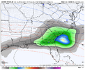
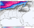
But what’s interesting is the AIFS continuing a signal for a deep vortex in SE Canada/the NE around this timeframe. With that you can make something work if times right, even with a poor pacific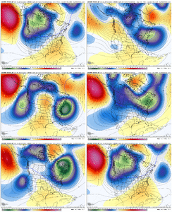


But what’s interesting is the AIFS continuing a signal for a deep vortex in SE Canada/the NE around this timeframe. With that you can make something work if times right, even with a poor pacific

NBAcentel
Member
LukeBarrette
im north of 90% of people on here so yeah
Meteorology Student
Member
2024 Supporter
2017-2023 Supporter
Great callout here
MRKEVIN7575
Member
Larry, I hope the models and ensembles adjust to the mjo phases if it's that big of a game changerI didn’t pick up on this earlier and don’t know if anyone else posted this. Today’s GEFS has phase 8 starting on Dec 8th, which is about 5 days earlier than any other run:
View attachment 177168
trackersacker
Member
NBAcentel
Member
Brent
Member
Model watching in the SE be like
Lol even out here not everyone is convinced it's happening
One too many snow holes since 2021 I guess
Last edited:
Webberweather53
Meteorologist
We've nearly leveled our torch to start December.
We've nearly leveled our torch to start December.
Maybe this is gonna be one of those very rare years where stuff actually trends in our favor as we get closer instead of going off the rails.
Cad Wedge NC
Member
Yeah, that western trough, as depicted, will be a ridge when we get into that timeframe. Model is not accounting for the phase 8 forcing.Come on Man: Rag Tag CFS sending a bag of coal for Christmas. CFS is always good for one or two 4 week out white Christmas paste jobs every year, that obviously never verify.
View attachment 177186
GAWX WITH THE SMOKE THIS MORNING OHHHH LAWWWWD
Always love to see the apocalyptic CMC ice maps.
CNCsnwfan1210
Member
Looks like the GEFS was trying its best to raise heights over Greenland, sure would be nice to have a little taste of -NAO
Sent from my iPhone using Tapatalk
iGRXY
Member
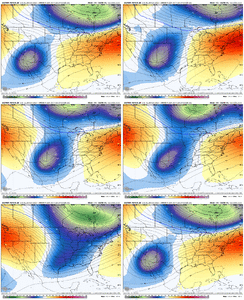
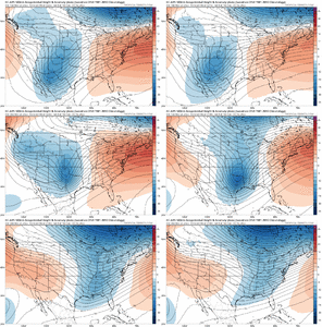
Starting to poke a -NAO, dropping the TPV south near the great lakes with an active subtropical jet? This isn't far from something worth tracking storm wise. Still needs to continue to improve, but it's getting there quickly.
Brent
Member
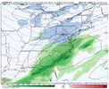
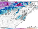
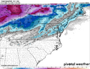
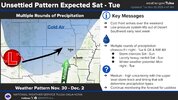
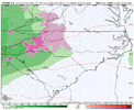
Looks like the Dec 2013 ice storm on the GEMThis is wild stuff. Suddenly we have a timeframe of interest a week from today. We were supposed to be in full blow torch mode. Lmaooo
View attachment 177179View attachment 177180View attachment 177181
Starting to poke a -NAO, dropping the TPV south near the great lakes with an active subtropical jet? This isn't far from something worth tracking storm wise. Still needs to continue to improve, but it's getting there quickly.
Yeah, that map is on the verge of playing with fire.
SnowNiner
Member
how active the pattern is is really what I'm noticing more than anything whether the cold air actually lines up for a storm or not. It's not just a one off or a brief window it appears View attachment 177189
When all is said and done Brent, I think you're the winner winner chicken dinner for December. Cold air will likely be at least in the center of the country, with various degrees of SE ridge (until we can get into phase 8 mjo). This will cause the storm track to lift to the SE's north but you'll probably get alot of storms riding the boundary. Send pics!!
Yesterday’s Euro: phase 8 starts 12/14:
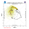
Today’s Euro: phase 8 starts 10 days earlier, 12/4, (with a 6+day long phase 8 implied) although I’d want to make sure it isn’t curling back into 7 and staying there. Note that the last time there was a 6+ day long phase 8 in Dec was way back in 1995 (12/20-25):
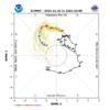

Today’s Euro: phase 8 starts 10 days earlier, 12/4, (with a 6+day long phase 8 implied) although I’d want to make sure it isn’t curling back into 7 and staying there. Note that the last time there was a 6+ day long phase 8 in Dec was way back in 1995 (12/20-25):

Brent
Member
When all is said and done Brent, I think you're the winner winner chicken dinner for December. Cold air will likely be at least in the center of the country, with various degrees of SE ridge (until we can get into phase 8 mjo). This will cause the storm track to lift to the SE's north but you'll probably get alot of storms riding the boundary. Send pics!!
Yeah well see I'm kind of concerned it's an ice storm next week tbh
Like the Euro AI crashes the front through Sunday... Thats an ice setup
Unless the second wave really pans out
LukeBarrette
im north of 90% of people on here so yeah
Meteorology Student
Member
2024 Supporter
2017-2023 Supporter
Bigedd09
Member
Man the ICON was so close to something next tuesday

