• Hello, please take a minute to check out our awesome content, contributed by the wonderful members of our community. We hope you'll add your own thoughts and opinions by making a free account!

Pattern December Doldrums 2025 šŸŽ„ ā„ļø

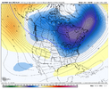
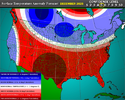
Going to be a long wait around here, from the looks of things. The models look pretty bad lately for that fast start to winter that was being widely depicted a week or so ago.

IF the MJO gets to P8 around mid-December (the way it looks now), the pattern likely won't reflect that for the next few days after. Then again, all of this could change back tomorrow.

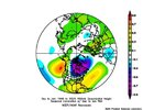
View attachment 177045
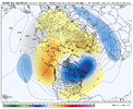
View attachment 177046

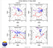
Something I didn’t pick up on a few weeks ago but have noticed lately is the fact that your upper level wind component of the MJO (zonal 200mb winds) is really lagging behind in phase 6-7.

I think that’s important here because the upper level winds is what ultimately links the MJO to extratropical teleconnections.

https://ncics.org/portfolio/monitor/mjo/RMM/
IMG_6666.jpeg
 
Are things still trending towards a week La NiƱa/more neutral conditions? Sorry for the noob question- lots to learn here from just reading and trying to connect the dots of cause/effect.
 
Are things still trending towards a week La NiƱa/more neutral conditions? Sorry for the noob question- lots to learn here from just reading and trying to connect the dots of cause/effect.

Looks like. I saw someone just talking about El Nino next year for hurricane season lol so yeah
 
Something I didn’t pick up on a few weeks ago but have noticed lately is the fact that your upper level wind component of the MJO (zonal 200mb winds) is really lagging behind in phase 6-7.

I think that’s important here because the upper level winds is what ultimately links the MJO to extratropical teleconnections.

https://ncics.org/portfolio/monitor/mjo/RMM/

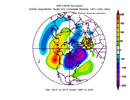
View attachment 177047
That's unfortunate. Why can't the upper level winds lead for once. šŸ˜†
 
Going to be a long wait around here, from the looks of things. The models look pretty bad lately for that fast start to winter that was being widely depicted a week or so ago.

IF the MJO gets to P8 around mid-December (the way it looks now), the pattern likely won't reflect that for the next few days after. Then again, all of this could change back tomorrow.

View attachment 177045
View attachment 177046
It's worth remembering that we are not yet in phase 7. I'm not so sure that a slow progression in phase seven on the doorstep of eight is a bad signal.

While the SE ridge will no doubt be an issue, with so much cold air forecasted to be on our side of the planet, I suspect that while we may average above average in the first 2-3 weeks of December, we will likely see some big mid-latitude cyclones that drive the cold into the SE more than one would expect. Big variability rather than sustained warmth or cold is what I think is most likely.
 
I'm all good with this thing being delayed until mid December, Christmas to mid January is our coldest temps by average.

What would be nice is a storm ride that SE ridge either on the front side or the back side pattern shift right along the coast and up.
 
While interesting, it probably isn't going to help the pattern for the southeast that much. Correct? idk 🄓
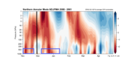
We haven't had very many of these early warmings that reach, or get close to, SSW level....but the ones that have this type of look have tended to produce a blocking period down the line that maximizes, say, 3-5 weeks later. But if this goes all reflective with just some SPV stretching, then that lowers the probability of the strat contributing to a blocking pattern - though it could still help with western ridge / conus cold pattern as MJO improves.

From Dec 2000, black line here is when the warming approached, but didn't quite reach, 0 zonal winds (SSW). Blue boxes are blocking in the troposphereNov 22 2000.png
 
I'm all good with this thing being delayed until mid December, Christmas to mid January is our coldest temps by average.

What would be nice is a storm ride that SE ridge either on the front side or the back side pattern shift right along the coast and up.
Mid December is fine. I just don’t want it to be delayed until January. It would suck for the entire holiday season to be warm.
 
We haven't had very many of these early warmings that reach, or get close to, SSW level....but the ones that have this type of look have tended to produce a blocking period down the line that maximizes, say, 3-5 weeks later. But if this goes all reflective with just some SPV stretching, then that lowers the probability of the strat contributing to a blocking pattern - though it could still help with western ridge / conus cold pattern as MJO improves.

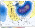
From Dec 2000, black line here is when the warming approached, but didn't quite reach, 0 zonal winds (SSW). Blue boxes are blocking in the troposphereView attachment 177048
Thank you for the reply on this. Very interesting, especially since I never even heard of this kind of SSW "reflective"
 
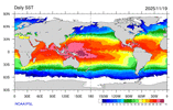
When the warmest mean SSTs are ~160E in the equatorial pacific, you’re often going to get spammed with +TNH. The MJO is really just reinforcing that lower frequency/seasonal tendency very heavily of course atm

IMG_6668.gif

IMG_6589.jpeg

IMG_6592.png
 
Even a few weeks ago, I definitely underestimated just how quickly this winter would dip into the ā€˜ol well of -EPO/+TNH patterns we’ve seen so frequently the last 10-15 years.

This pattern is honestly only going to get stronger and more frequent later in winter when the polar vortex intensifies (makes wave reflection more effective) & the warm pool starts zonally advecting east in response to our current MJO-driven westerly wind burst

IMG_6670.png

IMG_6669.jpeg
 
Even a few weeks ago, I definitely underestimated just how quickly this winter would dip into the ā€˜ol well of -EPO/+TNH patterns we’ve seen so frequently the last 10-15 years.

This pattern is honestly only going to get stronger and more frequent later in winter when the polar vortex intensifies (makes wave reflection more effective) & the warm pool starts zonally advecting east in response to our current MJO-driven westerly wind burst

View attachment 177058

View attachment 177059
I’m calling the authorities
 
Even a few weeks ago, I definitely underestimated just how quickly this winter would dip into the ā€˜ol well of -EPO/+TNH patterns we’ve seen so frequently the last 10-15 years.

This pattern is honestly only going to get stronger and more frequent later in winter when the polar vortex intensifies (makes wave reflection more effective) & the warm pool starts zonally advecting east in response to our current MJO-driven westerly wind burst

View attachment 177058

View attachment 177059
2 Points:

1 - Looking at the MJO in 13-14, it was really quiet from Nov to Feb (mostly COD). So, those warm WPac SSTs were running the show it looks like

2 - I would think that Jan would be the best month for +TNH cold influence in the SE with the winter wavelengths being longest / broadest then
 
Even a few weeks ago, I definitely underestimated just how quickly this winter would dip into the ā€˜ol well of -EPO/+TNH patterns we’ve seen so frequently the last 10-15 years.

This pattern is honestly only going to get stronger and more frequent later in winter when the polar vortex intensifies (makes wave reflection more effective) & the warm pool starts zonally advecting east in response to our current MJO-driven westerly wind burst

View attachment 177058

View attachment 177059
So if I'm understanding you correct, get use to the current pattern? Another sucky winter.....
 
2 Points:

1 - Looking at the MJO in 13-14, it was really quiet from Nov to Feb (mostly COD). So, those warm WPac SSTs were running the show it looks like

2 - I would think that Jan would be the best month for +TNH cold influence in the SE with the winter wavelengths being longest / broadest then

February could be interesting this year and has a chance to break the stereotypical nina mold if the warm pool advances east quick enough.

If you divide up Nina winters into +PNA and -PNA febs, the +PNA group is warmer in the central pacific/has a more eastward shifted warm pool. We will have to see how much the ocean responds to this MJO event. I can imagine it’s probably going to be a big response given the IOD collapse and how prolonged and strong this WWB event is
 
2 Points:

1 - Looking at the MJO in 13-14, it was really quiet from Nov to Feb (mostly COD). So, those warm WPac SSTs were running the show it looks like

2 - I would think that Jan would be the best month for +TNH cold influence in the SE with the winter wavelengths being longest / broadest then

Yeah I also suspect the westerly QBO played a major role in keeping the MJO suppressed in 2013-14. This year is very different in that regard.
 
February could be interesting this year and has a chance to break the stereotypical nina mold if the warm pool advances east quick enough.

If you divide up Nina winters into +PNA and -PNA febs, the +PNA group is warmer in the central pacific/has a more eastward shifted warm pool. We will have to see how much the ocean responds to this MJO event. I can imagine it’s probably going to be a big response given the IOD collapse and how prolonged and strong this WWB event is
05-06 was one of my favored nina analogs this year. February went snowy that year, but most of my analogs are mild February
 
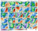
Euro Weeklies vs yesterday:

12/1-7: very slightly cooler but still torchy/strong SER
12/8-14: very slightly warmer/still mild/weaker SER
12/15-21: slightly cooler; NN to slightly AN
12/22-28: very slightly cooler N NC/still NN
12/29-1/4: ~same/still NN

Summary: still mild 1st half Dec; still cools to NN 2nd half into very early Jan
Thank you my brother
 
Record high of 81 today in Birmingham. I’m thankful we got that cold snap and freeze back around Halloween or we would be mowing grass into December.

I've still seen things flying around here even after that

And the lawn guys were out at my complex the other day
 
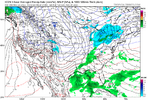
We still good? Or do we suck??View attachment 177069

It may be short lived(because it's so early) but yeah there's a lot more chatter locally than there has been

Even some of the people who said no way are caving already and it's still 9 days away

It sounds like typical Arctic air here tbh aka the models will struggle and it will come in faster

Also AccuWeather is pretty chilly and active later in December considering it usually doesnt show anything interesting at that range. It just hangs close to average and never shows any real weather but it is now
 
Last edited:
I am not even close to sold that this trough to kick start December is going to drop as West as we thought. 06 Euro AI continues to show a shifting East. Been flirting with it for a day or so now.

Yeah I kind of find it hard to believe it basically stops around here if the models are right about how significant it is

We know the history of Arctic air and the models anyway... It's a famous tale here... They are always too slow
 
Yeah I kind of find it hard to believe it basically stops around here if the models are right about how significant it is

We know the history of Arctic air and the models anyway... It's a famous tale here
I think this pattern coming up is extremely volatile.
 
Back
Top