• Hello, please take a minute to check out our awesome content, contributed by the wonderful members of our community. We hope you'll add your own thoughts and opinions by making a free account!

Pattern December Doldrums 2025 🎄 ❄️

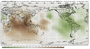
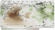
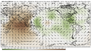
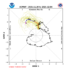
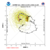
Goodness gracious that’s a big phase 7 MJO event, might be about to eat my words about the GEFS forecast from yesterday over amping this …

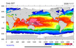
Given the warmest water on the entire globe is sitting around the 160E in the Equatorial Pacific and we’re about to have a long and strong westerly wind burst over it, this probably spells the end of La Niña in 3 months or so.

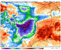
View attachment 176859

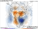
View attachment 176860

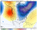
View attachment 176861

I don’t know if this is related but fwiw since it’s the highly volatile CFS:
———————-

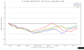
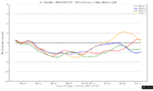
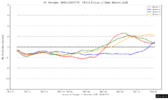
AAM forecast (CFS ensemble): big change for mid Dec vs forecast from two days earlier (warning: these are highly volatile on right side of graph):

11/18/25 AAM forecast: suggests it may go + (El Ninoish) in mid-Dec?!?
IMG_5518.png

11/16/25 AAM forecast:
IMG_5454.png

11/11/25 AAM forecast:
IMG_5314.png
 
I don’t know if this is related but fwiw since it’s the highly volatile CFS:
———————-

AAM forecast (CFS ensemble): big change for mid Dec vs forecast from two days earlier (warning: these are highly volatile on right side of graph):

11/18/25 AAM forecast: suggests it may go + (El Ninoish) in mid-Dec?!?
View attachment 176862

11/16/25 AAM forecast:
View attachment 176863

11/11/25 AAM forecast:
View attachment 176864

The tropical troposphere looks very El Niño like right now with big westerly wind anomalies in the upper troposphere

IMG_6636.jpeg

IMG_6637.jpeg
 
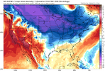
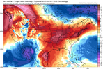
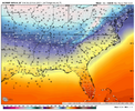
Man the Euro AI is taking names with sniffing out these cold fronts. Picked up on the one heading here next week & it's sniffing out the Arctic air dropping into the middle of the country the last days of November into December. GFS just made a huge adjustment. gfs-deterministic-central-t2m_f_dprog-4547200.png
 
NAO/AO aside, I'd argue that the AI has been doing better with the pattern at range than the EPS.

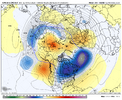
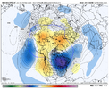
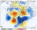
Now this looks a little more like Phase 7, doesn't it?

View attachment 176856
View attachment 176857

Probably doing better, but I’d argue the theme is similar. Big artic -EPO intrusion in the middle of the country, with resistance heading east. I agree that shows phase 7 pretty well. Death to the resistance! (queue darth vader theme).
 
ens show the cold coming down. Question/ debate is does it dump out west or east. gefs is east at 12z , eps out west. long way to go before we know.

View attachment 176884

This is related and is a good post imho as it mirrors my own thinking as the forecasted MJO and the timing of the lag after an SSWE have been suggesting mild dominated til we get to ~12/15.

IMG_5521.jpeg
 
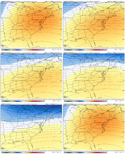
Most ens have the MJO in the pacific/WHEM (phase 7 entering 8) at the end of there respective runs, you can see on all the ens towards the end now with the pattern responding and the southeast ridge getting squashed with the TPV dropping south. A cold pattern for the EC is inevitable at this point IMG_9952.pngIMG_9953.pngIMG_9954.pngIMG_9955.pngIMG_9956.pngIMG_9957.pngIMG_9958.png
 
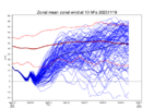
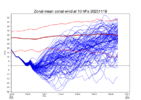
Today’s Euro Weeklies 10 mb 60N zonal wind isn’t as weak as recent runs:

Today’s run (11/19):
IMG_5522.png


Yesterday’s (11/18):
IMG_5492.png

Does anyone else see what I’m referring to? I’m not just talking about whether it actually reverses. I’m talking more about the period afterward. That’s a notable change in the stronger direction.
 
Last edited:
Today’s Euro Weeklies for Dec are little changed and continue with a strong mean SE ridge/warm Dec 1-7 followed by a slow weakening with a weaker mean SE ridge hanging on possibly til ~Dec 20 (similar to yesterday’s run delaying the end of the SER).
 
Today’s Euro Weeklies 10 mb 60N zonal wind isn’t as weak as recent runs:

Today’s run (11/19):
View attachment 176895


Yesterday’s (11/18):
View attachment 176896

Does anyone else see what I’m referring to? I’m not just talking about whether it actually reverses. I’m talking more about the period afterward. That’s a notable change in the stronger direction.
For sure. And not just the long term, either.
 
Today’s Euro Weeklies 10 mb 60N zonal wind isn’t as weak as recent runs:

Today’s run (11/19):
View attachment 176895


Yesterday’s (11/18):
View attachment 176896

Does anyone else see what I’m referring to? I’m not just talking about whether it actually reverses. I’m talking more about the period afterward. That’s a notable change in the stronger direction.

The EPS (and other modeling) was trying to quickly flip from the Wave 1 precursor pattern (left side of image) to the Wave 2 precursor pattern (right side of image) with tall ridging up thru Alaska trying to connect with ridging over the URALS region in NW Russia. This would have kept the pressure on for supplemental SPV weakening...but that changed over the past 2 days. The models are fluid and will flip around with this of course. I'd personally like to see the SPV as weak as we can get it, but how important that is given prior similar cases is debatable.

Nov 7 5 Precursor.png


Nov 19 Euro SPV.gif
 
The current global tropics SST configuration w/ the warmest water in the means ~160E in the Tropical Pacific is a +TNH/-EPO machine.

This west pac MJO event is really reinforcing that


IMG_6644.jpeg


Yeah the SE US ridge makes sense at the end of November here.

Anything that can generate appreciable and consistent convective heating west of the international dateline is going to be very effective at producing a -EPO/+TNH pattern a lot of the time.

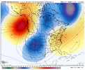
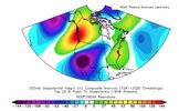
Here’s what Dec-Jan-Feb phase 7 composite of the OLR MJO Index (OMI) OLR (shaded) & 200 hPa streamfunction anomalies looks like. Notice the wave train that arcs away from the West Pac heating anomalies with ridging over Alaska & a deep trough near the Hudson Bay.
View attachment 176590


This is reasonably close to what the EPS weekly forecast shows in the first week of December

View attachment 176591


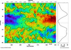
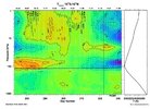
I also regressed the University of Maryland OLR monthly dataset onto the CPC’s EP/NH index (a close cousin to the EPO). Notice the significant -OLR anomalies between 150-180E over the equatorial Pacific

View attachment 176593


Typically, the kind of winters that are the most efficient at producing -EPO patterns like the one we are seeing in early December are ones where the low frequency ENSO state in the Pacific is somewhere between a “modoki”/central Pacific El Niño & La Niña, or has +SSTa focused west of the Int’l dateline ~150E-180E.

A lot of the time, you’ll also notice many of these winters with big -EPOs are followed by El Niño in the subsequent year because this subtle eastward shift in the warm pool that forces them can be favorable to the onset of El Niño.

2013-14 is a quintessential example of this.

Notice the +SSTa focused west of the International Dateline and the corresponding -OLRa centered around 150E longitude in the equatorial Pacific. This

View attachment 176596


View attachment 176595
 
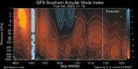
I definitely suspect that simultaneously warming both the northern and southern hemisphere polar stratospheres is playing at least some role in the increasingly amplified MJO here.

It’s rare enough as it is to have a sudden stratospheric warming event this early in the cold season in the N Hemisphere, but seeing another one occurring in the Southern Hemisphere is even rarer still.

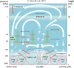
The combined effect of these is likely supercharging the Brewer Dobson Circulation, with much stronger adiabatic lift/cooling of the tropical stratosphere. Much like how the easterly QBO can give the MJO a boost thru enhancing cloud radiative feedbacks, these warming events in both hemispheres are likely helping the MJO at least somewhat here.

IMG_6646.png

IMG_6647.png

IMG_6649.png


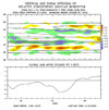
The tropical lower stratosphere has cooled a few degrees already with likely much more cooling on the way as our N Hemisphere stratospheric warming event begins to take shape.

IMG_6648.jpeg
 
I definitely suspect that simultaneously warming both the northern and southern hemisphere polar stratospheres is playing at least some role in the increasingly amplified MJO here.

It’s rare enough as it is to have a sudden stratospheric warming event this early in the cold season in the N Hemisphere, but seeing another one occurring in the Southern Hemisphere is even rarer still.

The combined effect of these is likely supercharging the Brewer Dobson Circulation, with much stronger adiabatic lift/cooling of the tropical stratosphere. Much like how the easterly QBO can give the MJO a boost thru enhancing cloud radiative feedbacks, these warming events in both hemispheres are likely helping the MJO at least somewhat here.

View attachment 176907

View attachment 176908

View attachment 176911


The tropical lower stratosphere has cooled a few degrees already with likely much more cooling on the way as our N Hemisphere stratospheric warming event begins to take shape.

View attachment 176912
Eric, sadly I believe this SSW is going to be close but no cigar. Hoping we get one sometime in winter🙂
 
Eric, sadly I believe this SSW is going to be close but no cigar. Hoping we get one sometime in winter🙂
Not Eric, but the cold is still coming , whether a meteor, arctic sea ice, Juda Cohens deep thunder, Bouncycorn in house experimental models, moondust, Ricky Bobby, brings it, it’s going down ! IMG_3305.png
 
Not Eric, but the cold is still coming , whether a meteor, arctic sea ice, Juda Cohens deep thunder, Bouncycorn in house experimental models, moondust, Ricky Bobby, brings it, it’s going down ! View attachment 176922
The models will adjust if we get a ssw in a few weeks and right mjo progression. We shall see. 0zgfs looks like it's speeding up the cold air.
 
Back
Top