• Hello, please take a minute to check out our awesome content, contributed by the wonderful members of our community. We hope you'll add your own thoughts and opinions by making a free account!

Pattern December Doldrums 2025 🎄 ❄️

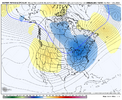
Today’s Euro Weeklies 2m temp changes vs yesterday aren’t good for the SE US overall if you prefer cold though 3 of the 5 weeks unchanged

Dec 1-7: a torch in SE with even warmer due to even stronger SE ridge

Dec 8-14: ~unchanged/slightly AN

Dec 15-21: warmer SE/slightly AN vs NN prior run

Dec 22-28: similar/NN

Dec 29-1/4: similar/NN
Unfortunately the writing is already on the wall.
 
Today’s Euro Weeklies 2m temp changes vs yesterday aren’t good for the SE US overall if you prefer cold though 3 of the 5 weeks unchanged

Dec 1-7: a torch in SE with even warmer due to even stronger SE ridge

Dec 8-14: ~unchanged/slightly AN

Dec 15-21: warmer SE/slightly AN vs NN prior run

Dec 22-28: similar/NN

Dec 29-1/4: similar/NN
LAWWWWWWDDD WITH THR BREAKDOWN SIR
 
Cold air is gonna dump. Who is it gonna take a dump on.
I think we can have some level of expectation that somewhere is more favored for it (not the southeast, because the pattern looks to favor SER based on analogs and mjo), but you just cannot say with any real degree of certainty at this range. I know I’m not saying anything groundbreaking but it’s a good reminder
 
this is why we can’t get too worked up about stuff man. Sure maybe it’ll flop right back. Maybe it won’t. We’re just looking for general guidelines and those can be wrong

It’s not like we haven’t seen this model trend to more western ridging in the medium range 100 times this fall already.
 
Maybe the AIFS will give happy hour a legit meaning


Sent from my iPhone using Tapatalk

As hard as it is to get a good snow (4”+) in NC, it’s damn near impossible in this part of NM. Having seen this trend play out so many times this fall and knowing that the base state is favoring a more extended jet, that makes me a bit nervous, apart from other things. I’m sure we will find a way to screw it up in the end.
 
FUGLY.


Sent from my iPhone using Tapatalk


lol, cold forecast….for everyone but the southeast. Thanks BAM. Anybody have confirmation on his wave reflection theory? I usually don’t put any faith in the strat stuff, but he seems to say it has a specific impact on the troposphere where we lose blocking. First I heard of that.
 
lol, cold forecast….for everyone but the southeast. Thanks BAM. Anybody have confirmation on his wave reflection theory? I usually don’t put any faith in the strat stuff, but he seems to say it has a specific impact on the troposphere where we lose blocking. First I heard of that.
I’ve never really heard that either. From studies that I’ve read, SSW’s tend to help improve or solidify blocking. The fact is we continue to see a very weak SPV even with out the effects of a SSW so far. Also modeling continues to back off on any sustained +AO or NAO the closer it comes to verification
 
I’ve never really heard that either. From studies that I’ve read, SSW’s tend to help improve or solidify blocking. The fact is we continue to see a very weak SPV even with out the effects of a SSW so far. Also modeling continues to back off on any sustained +AO or NAO the closer it comes to verification
Yeah, I always thought it help establish blocking? But if there's something up there, out there, to screw the Southeast it will rear it's ugly head. And that you can take to the bank!!!
 
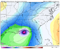
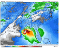
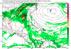
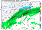
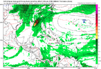
If you enjoyed this week’s edition of “Thanksgiving Snowstorm Map For Everyone” you’ll wanna be sure and stay tuned for “Deep South December Hurricane Threatens Millions” compliments of our very best model the GFS!

I’m sure nobody’s gonna post this on TikTok or Facebook. Nobody.
 

Attachments

  • DE564006-40CE-466D-AC75-57F0217D800A.png
    DE564006-40CE-466D-AC75-57F0217D800A.png
    151.6 KB · Views: 37
  • ACA78D3A-F394-4520-B477-F5AB3E00D830.png
    ACA78D3A-F394-4520-B477-F5AB3E00D830.png
    187.1 KB · Views: 37
Difference between reflection vs. absorption with the SPV (from the interwebs)...

Reflection occurs when upward-propagating planetary waves encounter a specific condition within the stratosphere that acts as a barrier, forcing them back down into the troposphere.

Absorption (often leading to a major Sudden Stratospheric Warming, or SSW event) occurs when waves are able to propagate into the stratosphere, where their energy dissipates and converts into heat and momentum, disrupting the polar vortex.

Feature
AGU Publications1763785992567.pngAGU Publications +6
Stratospheric ReflectionStratospheric Absorption
Wave interactionPlanetary waves traveling upward from the troposphere encounter a "reflecting surface" (a specific condition in the polar vortex) and are forced back down into the troposphere.Waves lose energy as they propagate into the stratosphere, where that energy works to decelerate the polar vortex and warms the surrounding air.
Polar VortexThe polar vortex remains strong or quickly re-establishes itself after a minor disruption.The polar vortex is significantly weakened or split apart due to the sustained transfer of wave energy, leading to a major SSW event.
Tropospheric ImpactThe downward-traveling waves amplify existing weather patterns in the troposphere, which can lead to specific surface climate anomalies, such as cold spells over North America or blocking patterns over the North Pacific.The event has a longer timescale and a larger-scale impact on the general atmospheric circulation, often leading to a negative phase of the Arctic Oscillation, which can bring widespread cold air outbreaks to mid-latitudes.
CauseTypically associated with shorter, more transient pulses of wave activity from the troposphere.Associated with longer, more persistent periods of planetary wave activity (eddy heat flux) propagating upward from the troposphere.
In essence, reflection involves waves bouncing off the stratosphere and returning to influence the troposphere, while absorption involves waves being 'taken in' by the stratosphere, fundamentally changing its circulation and indirectly influencing the troposphere with a more persistent, widespread effect.
 
Todays 12z Euro EPS looks like it wants to establish some sort of +PNA rex block over the West. That's the only justification for it's depiction. Othersise a equatorward Jet Extension would strongly argue for a strong PNA ridge as we head towards the second week of Dec. though a -ENSO phase 7 MJO would argue for the former.
 
If you enjoyed this week’s edition of “Thanksgiving Snowstorm Map For Everyone” you’ll wanna be sure and stay tuned for “Deep South December Hurricane Threatens Millions” compliments of our very best model the GFS!

I’m sure nobody’s gonna post this on TikTok or Facebook. Nobody.
1763788837460.png

Where was that Bermuda high in AUG/SEPT?
 
Difference between reflection vs. absorption with the SPV (from the interwebs)...

Reflection occurs when upward-propagating planetary waves encounter a specific condition within the stratosphere that acts as a barrier, forcing them back down into the troposphere.

Absorption (often leading to a major Sudden Stratospheric Warming, or SSW event) occurs when waves are able to propagate into the stratosphere, where their energy dissipates and converts into heat and momentum, disrupting the polar vortex.

Feature
View attachment 177033View attachment 177033AGU Publications +6
Stratospheric ReflectionStratospheric Absorption
Wave interactionPlanetary waves traveling upward from the troposphere encounter a "reflecting surface" (a specific condition in the polar vortex) and are forced back down into the troposphere.Waves lose energy as they propagate into the stratosphere, where that energy works to decelerate the polar vortex and warms the surrounding air.
Polar VortexThe polar vortex remains strong or quickly re-establishes itself after a minor disruption.The polar vortex is significantly weakened or split apart due to the sustained transfer of wave energy, leading to a major SSW event.
Tropospheric ImpactThe downward-traveling waves amplify existing weather patterns in the troposphere, which can lead to specific surface climate anomalies, such as cold spells over North America or blocking patterns over the North Pacific.The event has a longer timescale and a larger-scale impact on the general atmospheric circulation, often leading to a negative phase of the Arctic Oscillation, which can bring widespread cold air outbreaks to mid-latitudes.
CauseTypically associated with shorter, more transient pulses of wave activity from the troposphere.Associated with longer, more persistent periods of planetary wave activity (eddy heat flux) propagating upward from the troposphere.
In essence, reflection involves waves bouncing off the stratosphere and returning to influence the troposphere, while absorption involves waves being 'taken in' by the stratosphere, fundamentally changing its circulation and indirectly influencing the troposphere with a more persistent, widespread effect.

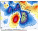
Interesting. I've read that stratospheric Absortions in Nov. are unprecedented save for one time(that failed to reach the surface). I could be wrong though.
 
Difference between reflection vs. absorption with the SPV (from the interwebs)...

Reflection occurs when upward-propagating planetary waves encounter a specific condition within the stratosphere that acts as a barrier, forcing them back down into the troposphere.

Absorption (often leading to a major Sudden Stratospheric Warming, or SSW event) occurs when waves are able to propagate into the stratosphere, where their energy dissipates and converts into heat and momentum, disrupting the polar vortex.

Feature
View attachment 177033View attachment 177033AGU Publications +6
Stratospheric ReflectionStratospheric Absorption
Wave interactionPlanetary waves traveling upward from the troposphere encounter a "reflecting surface" (a specific condition in the polar vortex) and are forced back down into the troposphere.Waves lose energy as they propagate into the stratosphere, where that energy works to decelerate the polar vortex and warms the surrounding air.
Polar VortexThe polar vortex remains strong or quickly re-establishes itself after a minor disruption.The polar vortex is significantly weakened or split apart due to the sustained transfer of wave energy, leading to a major SSW event.
Tropospheric ImpactThe downward-traveling waves amplify existing weather patterns in the troposphere, which can lead to specific surface climate anomalies, such as cold spells over North America or blocking patterns over the North Pacific.The event has a longer timescale and a larger-scale impact on the general atmospheric circulation, often leading to a negative phase of the Arctic Oscillation, which can bring widespread cold air outbreaks to mid-latitudes.
CauseTypically associated with shorter, more transient pulses of wave activity from the troposphere.Associated with longer, more persistent periods of planetary wave activity (eddy heat flux) propagating upward from the troposphere.
In essence, reflection involves waves bouncing off the stratosphere and returning to influence the troposphere, while absorption involves waves being 'taken in' by the stratosphere, fundamentally changing its circulation and indirectly influencing the troposphere with a more persistent, widespread effect.
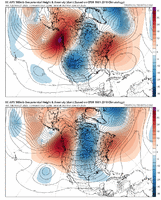
While interesting, it probably isn't going to help the pattern for the southeast that much. Correct? idk 🥴
 
Last edited:
Always a waiting game around these parts every year. I feel a good snow for us all coming this winter outside of the mountains but when. 2nd half of December, January, February or early March. It's always like this in the southeast every fall and winter. These models will drive you crazy if you let them. We need to just enjoy the ride along with the bumps that goes along with it. Our times coming this winter ❄️ 🥶
 
c627396b23e69e296a573ca0085b4865.gif

After losing it on the 00z run, the EC AI brings back the cold shot around 12/3.


Sent from my iPhone using Tapatalk
 
Oh goody the Euro has an ice storm here to start December 🤣 that's just fantastic

After the way this year has gone nothing would surprise me

And AccuWeather is very excited about mid December already apparently 👀 multiple winter events and very cold
 
Last edited:
Going to be a long wait around here, from the looks of things. The models look pretty bad lately for that fast start to winter that was being widely depicted a week or so ago.

IF the MJO gets to P8 around mid-December (the way it looks now), the pattern likely won't reflect that for the next few days after. Then again, all of this could change back tomorrow.

EMON.png
GMON.png
 
The reality is that we are going to have to wait another 7-10 days before we see any response on long range model guidance to what the MJO progression is showing mid month.. And that sucks. Requires patience, which I don't have a lot of. The swish through 7 is reflected nearly to perfection on model data between now & early Dec. Good thing is that we load up the cold & hopefully snow in the source region.

What we absolutely don't want to see is us losing the MJO as we move CLOSER to the mid month of Dec timeframe. If we start to lose 8 completely (not just delay it) then this could get bad fast. If we get to Dec 1st & the MJO progression stays around how it looks now, I think we will flip the game the second half of Dec. The weeklies were awful overnight. I am sure our boy GAWX will let us know that later this afternoon.
 
Back
Top