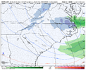
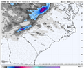
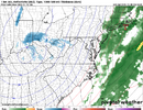
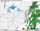
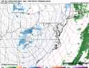
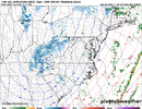
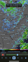
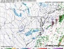
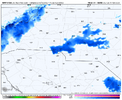
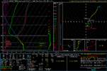
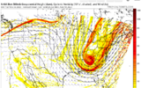
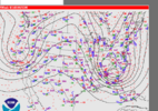
If it were a month later, I really would be excited about the prospect of snow showers breaking containment with that amount of energy. It’s just kinda hard to buy into in early November. I do recall however, a similar set up in November 2013 allowed widespread precip to come east of the mountains and it really kinda flared up east of I-77. I ended up with a solid coating on the grass from that and I think areas further east of me got more.
-
Hello, please take a minute to check out our awesome content, contributed by the wonderful members of our community. We hope you'll add your own thoughts and opinions by making a free account!
You are using an out of date browser. It may not display this or other websites correctly.
You should upgrade or use an alternative browser.
You should upgrade or use an alternative browser.
November 2025
- Thread starter packfan98
- Start date
- Joined
- Jan 23, 2021
- Messages
- 4,602
- Reaction score
- 15,197
- Location
- Lebanon Township, Durham County NC
Remember that day vividly. It was 68 at 2PM as I was leaving the government center uptown and snowing by seven.If it were a month later, I really would be excited about the prospect of snow showers breaking containment with that amount of energy. It’s just kinda hard to buy into in early November. I do recall however, a similar set up in November 2013 allowed widespread precip to come east of the mountains and it really kinda flared up east of I-77. I ended up with a solid coating on the grass from that and I think areas further east of me got more.
Can’t wait for the GRAF to make its appearance Sunday
Here are the progs for Nov 11th lows from the latest ICON/CMC/Euro/GFS/UKMET
1. GA
-SAV: 29/31/34/34/35
-NE ATL (Chamblee): 25/23/29/34/32
2. SC
-GSP: 23/21/29/27/29
-CAE: 28/32/33/32/34
3. NC
-CLT: 25/30/31/29/32
-RDU: 28/34/32/32/35
—————————
Average for each model for the 6 cities:
ICON: 26.3
CMC: 28.5
Euro: 31.3
GFS: 31.3
UKMET: 32.6
Any guesses for:
1. Which model for the 6 cities averaged out will do best?
2. Which model for the 6 cities averaged out will do worst?
———————
My guesses:
1. Best: Euro/GFS (tie)
2. Worst: ICON
Edit: I’m guessing that the average low for these 6 cities will be 30.5F.
Since I posted this (6Z), the GFS has gotten a few degrees colder most areas the last 2 runs and is now at the following for 11/7 7AM:
SAV 30 vs 34
PDK 32 (which is still too warm) vs 34
GSP 27 vs 27 (likely ~2F too warm)
CAE 29 vs 32
CLT 29 vs 29
RDU 30 vs 32
GFS AVG 29.5 (0Z) vs 31.3 (6Z)
Brent
Member
NBAcentel
Member
Iceagewhereartthou
Member
Wow, feels like Spring outside this morning; already in the 60s. I am so ready for this 2 day front to come through; just wish it would hang around! Leaves are gorgeous here!
JHS
Member
SPC Day 1 Outlook
Severe weather, tornado, thunderstorm, fire weather, storm report, tornado watch, severe thunderstorm watch, mesoscale discussion, convective outlook products from the Storm Prediction Center.
www.spc.noaa.gov
Severe chances slowly increasing across parts of the Carolinas today.
SimeonNC
Member
SimeonNC
Member
Someone is going to put up a big rain total tonight between KFAY and CAE
SimeonNC
Member
BrickTamland
Member
I’m tired of moyock View attachment 176211

- Joined
- Jan 5, 2017
- Messages
- 3,770
- Reaction score
- 5,969
.68" today. Looking at a temp forecast challenge for Monday/Tuesday. I need to go get my peppers this weekend. I've really let the garden go, so it's over-run with wild strawberries. I'm calling Monday morning at 33 here, and Tuesday morning 25.5. Monday night/Tuesday morning will be a hard freeze.
AJ1013
Member
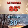
EPS mean for Tuesday in Miami is now 64/47. That would be the earliest <50F low since 1956 and the earliest <65F high since 1913. Wow!
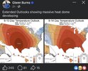
Bro purposely out here scaring the kidsGlenn Burns the heat mongerer is all in View attachment 176226
Drizzle Snizzle
Member
The heat wave coming up is going to have some staying power. Maybe 7 straight days of temps around 75 or higher.Glenn Burns the heat mongerer is all in View attachment 176226
accu35
Member
I can see the warm up within those dates but nothing that we can’t handle after this quick cold spell. Then after, fun and games begin come December.Glenn Burns the heat mongerer is all in View attachment 176226
Did I miss something? Is he ok?@Meteorologist1999 would 100% be tracking this one
GRAF has something for the NC weenies.
Drizzle Snizzle
Member
He was murdered in April.Did I miss something? Is he ok?
eps snowgrams are promising for some piedmont flurry-watchers at the moment
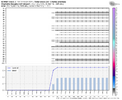
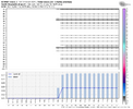
i also can't help myself but weenie about the little shallow streamer over upstate SC that had been on the euro for several runs (until the most recent one), best i can tell is it was forming downwind of some 850mb speed convergence/700mb divergence that appeared to be terrain-influenced somehow. pretty cool that modeling even tries to pick up things like that
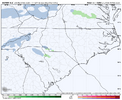


i also can't help myself but weenie about the little shallow streamer over upstate SC that had been on the euro for several runs (until the most recent one), best i can tell is it was forming downwind of some 850mb speed convergence/700mb divergence that appeared to be terrain-influenced somehow. pretty cool that modeling even tries to pick up things like that

GRAF has something for the NC weenies.
all hail the GRAF
SimeonNC
Member
NBAcentel
Member
rburrel2
Member
Just going off memory, but this looks like a potentially similar setup that produced 3-5 inches of November snow for a small area around Columbia, SC several years back.
rburrel2
Member
Bigedd09
Member
Did that particular event surprise people? Like was it showing up on modeling?I went and looked. 11/1/2014 was, of course, more potent looking. Still very similar though. We get a closed 5h low to pop and hold through the region on Monday and there could be some lucky people outside of the mountains.
View attachment 176248View attachment 176249
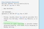
RAH discussion finally mentions some flurries. First sign?
"A minority of ensemble members particularly from the ECS
depict potential for a very light rain/snow mix or some flurries
across our NE counties with the shortwave on Monday night. However,
it will be fighting dry air and strong downsloping westerly flow. So
confidence is low at this time."
"A minority of ensemble members particularly from the ECS
depict potential for a very light rain/snow mix or some flurries
across our NE counties with the shortwave on Monday night. However,
it will be fighting dry air and strong downsloping westerly flow. So
confidence is low at this time."
Webberweather53
Meteorologist
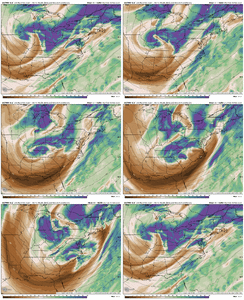
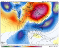
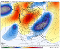
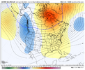
Man the Euro caving to the AI? Way to early to know, but the AI has not been wanting to stay warm. And that block the Euro gets to. Yowza! EPS has a strong signal for blocking too. Loving seeing that.
View attachment 176241
View attachment 176242
View attachment 176243
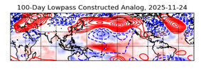
The base state just isn’t favorable for western troughing in late fall/early winter this year.
We might be getting one late next week, but we’re going to be doing a lot of kicking and screaming in the process.
rburrel2
Member
IIRC, it was a major surprise that it came down heavy enough to stick.Did that particular event surprise people? Like was it showing up on modeling?


