• Hello, please take a minute to check out our awesome content, contributed by the wonderful members of our community. We hope you'll add your own thoughts and opinions by making a free account!

Pattern Another Angry August: Broiled, Baked, and Bone-Dry

Just what we don’t need, still another batch of moderate to heavy rain moving in at 1PM!

Edit: This and other rain on 8/9 plus other rains after midnight on 8/10 during the late night added to ~0.9”. That gets me to ~9.9” MTD!
 
Last edited:
Well at least it was*cool* this morning, here in Topsail..

Contractor ONLY charged Me 1/2 the cost of replacing a roof vent, because It was soo cool!
71F this Morning, light NE Wind..

Estimate was.... 1500.00 ..
Charged only 750.00
WOOT, WOOT!
 
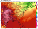
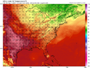
This may be the weirdest summer I’ve ever seen. it shouldn’t be hotter in Northern Michigan than in Atlanta.
Well we have a giant ocean next to us, they do not. So when we are lucky to get ENE winds, this is what happens.
 
You could feel a difference in temperature due to having a full day of sunlight today versus the previous three days but it was still tolerable outside and a nice day by August standards. I took advantage of it by cutting the grass and trimming some low hanging tree branches around the house with the pole saw. I broke a healthy sweat but the frequent breaks I need to take when the heat index is in the 100s were held to a minimum.
 
Since weather back home is amazing and kinda boring, I'm in Milwaukee for Triathlon National Championships and the weather yesterday and today was/is wicked. 2nd wettest day on record and historic flooding. Needless to say.... today was cancelled. Almost 4k athletes. Countless Water rescues
 
It’s too bad Atlanta hit 94 on 8/1 cause I’m beginning to feel like there may be a very small chance we don’t get back up to 90 again this month. Which would be insane
 
After having no rain throughout the daytime of 8/10, which allowed me to go to Tybee with some friends, rain showers (some heavy) coming off the ocean moving NW started at 11:30PM. It looks like per radar that periods of rain may last til after midnight.

Edit: I had already been up at 9.9” MTD before this rain started 11:30PM on 8/10!
 
Last edited:
After having no rain throughout the daytime of 8/10, which allowed me to go to Tybee with some friends, rain showers (some heavy) coming off the ocean moving NW started at 11:30PM. It looks like per radar that periods of rain may last til after midnight.

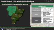
Followup: It turned out that several bands of rain, sometimes moderate or heavy, continued to come in from the SE over this area. There was heavy near and soon after midnight. And then while I was sleeping, this occurred, still another FF warning for still another band of heavy:

BULLETIN - EAS ACTIVATION REQUESTED
FLASH FLOOD WARNING
NATIONAL WEATHER SERVICE CHARLESTON SC
156 AM EDT MON AUG 11 2025

THE NATIONAL WEATHER SERVICE IN CHARLESTON HAS ISSUED A

* FLASH FLOOD WARNING FOR...
CHATHAM COUNTY IN SOUTHEASTERN GEORGIA...
JASPER COUNTY IN SOUTHEASTERN SOUTH CAROLINA...

* UNTIL 400 AM EDT.

* AT 156 AM EDT, DOPPLER RADAR INDICATED AN LARGE BAND OF SHOWERS
AND THUNDERSTORM WITH TORRENTIAL RAINFALL JUST OFF THE COAST OF
CHATHAM COUNTY. THIS BAND WILL MOVE ACROSS MUCH CHATHAM COUNTY
INTO PARTS OF JASPER COUNTY THROUGH 4 AM. THIS INCLUDES MUCH OF
THE SAVANNAH METRO AREA. AS MUCH AS 1 TO 3 INCHES OF RAIN COULD
FALL OVER A VERY SHORT PERIOD. THIS WILL RESULT IN URBAN FLOODING
AND FLASH FLOODING. ROAD CLOSURES ARE POSSIBLE, ESPECIALLY ACROSS
DOWNTOWN SAVANNAH.

HAZARD...FLASH FLOODING CAUSED BY THUNDERSTORMS.

SOURCE...RADAR INDICATED.

IMPACT...FLASH FLOODING OF SMALL CREEKS AND STREAMS, URBAN
AREAS, HIGHWAYS, STREETS AND UNDERPASSES AS WELL AS
OTHER POOR DRAINAGE AND LOW-LYING AREAS.

* SOME LOCATIONS THAT WILL EXPERIENCE FLASH FLOODING INCLUDE...
POOLER, BLUFFTON, TYBEE ISLAND, MIDTOWN SAVANNAH, DOWNTOWN
SAVANNAH, HUTCHINSON ISLAND, HUNTER ARMY AIRFIELD, WINDSOR FOREST,
WILMINGTON ISLAND AND COFFEE BLUFF.
————————

Then this statement was issued:

CHATHAM GA-JASPER SC-
326 AM EDT MON AUG 11 2025

...FLASH FLOOD WARNING REMAINS IN EFFECT UNTIL 4 AM EDT EARLY THIS
MORNING FOR CHATHAM AND JASPER COUNTIES...

AT 326 AM EDT, DOPPLER RADAR INDICATED MODERATE TO LOCALLY HEAVY
RAIN FALLING OVER MUCH OF CHATHAM COUNTY. WHILE THE MOST INTENSE
RAIN HAS SHIFTED NORTH OF THE AREA, THE RISK FOR FLOODING CONTINUES.
AS MUCH AS 1 TO 2.5 INCHES OF RAIN HAS FALLEN IN SOME AREAS SINCE 2
AM.

HAZARD...FLASH FLOODING CAUSED BY THUNDERSTORMS.

SOURCE...RADAR INDICATED.

IMPACT...FLASH FLOODING OF SMALL CREEKS AND STREAMS, URBAN AREAS,
HIGHWAYS, STREETS AND UNDERPASSES AS WELL AS OTHER POOR
DRAINAGE AND LOW-LYING AREAS.

SOME LOCATIONS THAT WILL EXPERIENCE FLASH FLOODING INCLUDE...
POOLER, BLUFFTON, TYBEE ISLAND, MIDTOWN SAVANNAH, DOWNTOWN
SAVANNAH, HUTCHINSON ISLAND, HUNTER ARMY AIRFIELD, WINDSOR FOREST,
WILMINGTON ISLAND AND COFFEE BLUFF.
 
Then this was in the forecast discussion this morning:

AREA FORECAST DISCUSSION
NATIONAL WEATHER SERVICE CHARLESTON SC
612 AM EDT MON AUG 11 2025

SYNOPSIS

A STATIONARY FRONT TO THE SOUTH OF THE REGION SHOULD DISSIPATE
TODAY. BY MID TO LATE WEEK, SURFACE HIGH PRESSURE WILL SHIFT
INTO THE ATLANTIC, WHILE WEAK TROUGHING FORMS INLAND.

NEAR TERM /THROUGH TONIGHT/

THE UPPER-LEVEL ANTICYCLONE THAT HAS BEEN POSITIONED WELL
OFFSHORE OF THE SOUTHEAST U.S. FOR THE PAST SEVERAL DAYS WILL
BEGIN TO BUILD WEST TODAY AND REPLACE THE MID-LEVEL WEAKNESS
THAT HAS BEEN IN PLACE SINCE LAST FRIDAY. THE ATMOSPHERE WILL
REMAIN MODESTLY UNSTABLE THROUGH THE AFTERNOON WITH A PLUME
RICH, TROPICAL MOISTURE FEATURING PWATS HOLDING IN THE
2.30-2.65". SIMILAR TO THE PAST FEW DAYS, PASSING BITS OF
VORTICITY PROPAGATING ALONG THE WESTERN PERIPHERY OF THE UPPER
HIGH WILL BRING SEVERAL MORE BANDS/WAVES TO SHOWERS/TSTMS TO THE
AREA.

and

THE HIGHEST RAIN TOTALS SINCE FRIDAY HAVE BEEN MOSTLY CONFINED
TO THE COASTAL COUNTIES WHICH SHOULD CONTINUE AGAIN TODAY.

***SOME
AREAS HAVE SEEN AS MUCH AS FOOT OF RAIN OVER THE PAST SEVERAL
DAYS ALONE WHICH IS DOWNRIGHT INCREDIBLE FOR AUGUST OUTSIDE OF A
TROPICAL CYCLONE.***

—————

I had been up to ~9.9” month to date through the period just before the rains returned at 11:30 PM last night. I don’t yet have my overnight total, but it was significant once again, quite possibly ~2”. I’ll update later.

Edit: I had 2.1” from 11:30PM through the rest of the night (8/11 AM) bringing me to 12” MTD!
 
Last edited:
Here we go again. Another batch with some heavy rain has just arrived from the south. Before this as of last night’s rains I had just made it to 12” MTD!

Edit: Good news was that this batch was short-lived and gave me only <0.1”.
 
Last edited:
Thursday before rain chances are supposed to drop and get down to 30% in my back yard, Sunday until it’s supposed to be mostly sunny.

Not sure I remember a summer month quite like this.
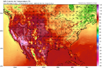
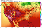
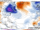
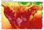
Yeah this is pretty crazy. If the LR is correct, we revert back to something like this again later on. Probably means we bake in September and fall gets here sometime late November.
 
Yeah this is pretty crazy. If the LR is correct, we revert back to something like this again later on. Probably means we bake in September and fall gets here sometime late November.
This looks a LOT like 1986. Hot and dry in July, then a rainy and cooler August. It did get hot and dry again for September, but it was about 5-6 degrees cooler than what we had in July. The winter after that that was one for the ages though. You would be setting pretty in the NC foothills. The Triad, Charlotte and GSP area did ok too. Raleigh not so much. We even had a big April snowtorm in the mountains.
 
Back
Top