-
Hello, please take a minute to check out our awesome content, contributed by the wonderful members of our community. We hope you'll add your own thoughts and opinions by making a free account!
You are using an out of date browser. It may not display this or other websites correctly.
You should upgrade or use an alternative browser.
You should upgrade or use an alternative browser.
Pattern Failboat February
- Thread starter SD
- Start date
Tsappfrog20
Member
Just to recap 12z runs:
Hammer jobs:
Icon: Major hit for many, another wave possibly coming post hr180.
CMC: Nuclear bomb for many.
Ukmet: Have to extrapolate post hr 168, but looks like a major hit incoming for most.
Misses:
GFS: Almost a complete whiff, some ice for Northern NC.
GEFS: Pretty ugly
Just a guess but I think the euro shows a hammer job for someone
Sent from my iPhone using Tapatalk
MichaelJ
Member
I would throw the GFS and Canadian out, let's see if Dr No makes an appearance soon
rburrel2
Member
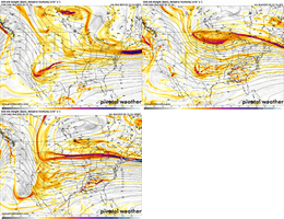
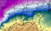
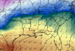
Just my two cents, but I don't see it that way. Ukmet hasn't pinched off a low over Minnesota which is the killer on the GFS. Mogreps should give a good indication of how it was going here in a bit.
Edit to add:
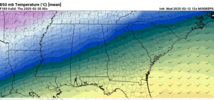
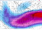
It's definitely gonna be warmer/ further north than the CMC. But just look at the starting point for 850s with the ukmet compared to the GFS at hr 168. Also the 850 temps/boundary is still pushing south from hr 162 to 168 on the ukmet.
SnowNiner
Member
It will be interesting to see which road the Euro goes down
Sent from my iPhone using Tapatalk
At this point I’m only paying attention to the ensembles honestly. EPS, CMC ENS, GEFS, in that order.
A lot of time the ensembles follow the op, so they matter, but yeah. More hits the better.
Bigedd09
Member
In all seriousness, what model do we want holding onto this storm? It seems like whichever model shows a strom is always wrong. EURO,GFS,CMC have all done that this winterThe last model I want holding on to this storm is the Canadian.
NBAcentel
Member
Bigedd09
Member
Both trending the complete opposite way lol
Tsappfrog20
Member

Just FYI!!
Sent from my iPhone using Tapatalk
Brandon10
Member
Gut tells me that 850s are too warm for anyone south of I40 in the Carolinas. Now if that airmass was as cold as January, it would be different.
We don’t want it phasing over Vegas, heights rising in the east. This isn’t a setup for a low tracking below us.Just my two cents, but I don't see it that way. Ukmet hasn't pinched off a low over Minnesota which is the killer on the GFS. Mogreps should give a good indication of how it was going here in a bit.
Edit to add:
It's definitely gonna be warmer/ further north than the CMC. But just look at the starting point for 850s with the ukmet compared to the GFS at hr 168. Also the 850 temps/boundary is still pushing south from hr 162 to 168 on the ukmet.
View attachment 168497
View attachment 168495
It’s one model run so whatever. It’s day 8.
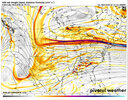
Good it would be nice if the Euro was down for a week and all we had was the CMC/Mogreps combo to ride into next week. This might be fun again.
Just FYI!!
Sent from my iPhone using Tapatalk
SnowNiner
Member
Good it would be nice if the Euro was down for a week and all we had was the CMC/Mogreps combo to ride into next week. This might be fun again.
Yeah at least it doesn’t kill our weenie cmc dreams for a cycle!
Tsappfrog20
Member
Tim is talking about next week…
Sent from my iPhone using Tapatalk
Sent from my iPhone using Tapatalk
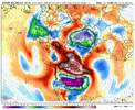
The cold air source with high pressure building in is actually quite nice (coldest anomalies in the northern hemisphere), but the challenge is getting the wave interaction and timing right to keep a storm from climbing too far north. 8 days out and things could continue to improveGut tells me that 850s are too warm for anyone south of I40 in the Carolinas. Now if that airmass was as cold as January, it would be different.
Tsappfrog20
Member
Looks like the ECMWF website is back up and working now. Not sure if the models are running yet
Sent from my iPhone using Tapatalk
Sent from my iPhone using Tapatalk
TheBetterDoge
Member
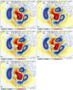
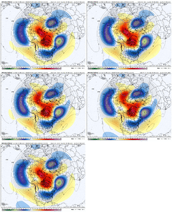
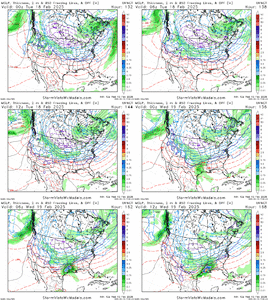
GEFS with a little weaker block in the day 6-8 and CMC-E hanging in.
View attachment 168507View attachment 168508I do however like that the TPV lobe south of Greenland is trending further west; that should provide us with a better cold air supply.
Bigedd09
Member
That looks decent to me. Is it not?
CNCsnwfan1210
Member


Several hits on the CMC ensemble on the 180/192 hr timestamps (including the deterministic/control)
Sent from my iPhone using Tapatalk
rburrel2
Member
rburrel2
Member
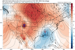
Just going off those 850mb temp maps. The mogreps lines up closer to the CMCE and is actually a touch colder for everyone. Nothing like the GEFS which is way warmer at 850mb.
- Joined
- Jan 2, 2017
- Messages
- 1,566
- Reaction score
- 4,279
NCWeatherhound
Member
NCWeatherhound
Member
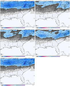
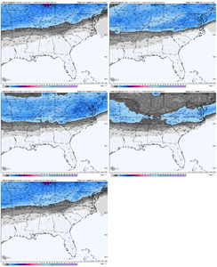
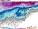
Here ya go:Anybody got the 12z Mogreps snow mean on pivotal? looks like it could be showing something based off the free maps. Here's hr180
View attachment 168513View attachment 168514View attachment 168515
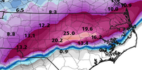
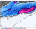
Use Kuchera and reduce your pain by ~50%. Or use a real model + Kuchera and reduce it even more.The CMC was a heartbreaker for our neck of the woods last time. But this NC cutoff takes the cake!
One inch for FAY, 20 inches for Lillington, two feet in Angier and 30 inches toward Fuquay-Varina? View attachment 168518
Tsappfrog20
Member

What was it people were saying that the CPC is almost always right about there predictions of where storms are most likely going to end up . I only say this because yesterday it looked completely different than today.
Sent from my iPhone using Tapatalk
Cary_Snow95
Member
This is puzzling to me. Surface temps on the cmc were in the low to mid 20sUse Kuchera and reduce your pain by ~50%. Or use a real model + Kuchera and reduce it even more.
View attachment 168524
Tsappfrog20
Member
These maps are rarely wrong. You can pretty much take this to the bank and quit model watching for this timeframe if you are out of this circle.
You were saying…

Sent from my iPhone using Tapatalk

What was it people were saying that the CPC is almost always right about there predictions of where storms are most likely going to end up . I only say this because yesterday it looked completely different than today.
Sent from my iPhone using Tapatalk
Yeah I said that after they had I-20 folks getting smoked but I watched the ocean get it. They are forever dead to me, as well as the CMC. I think we all get another shot but I’m a lot like 1300m these days, I’ll get excited if we get it within 12 hours though
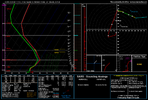
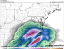
This model is so broken it's scary. I feel like a complete moron for entertaining it earlier this year. In 6 hours it outputs over 1.5" of precipitation and the model soundings on Pivotal suggest freezing rain/drizzle with the sounding not even fully saturated. There's so many suspect things in that one sentence I lost count.This is puzzling to me. Surface temps on the cmc were in the low to mid 20s
SnowNiner
Member

What was it people were saying that the CPC is almost always right about there predictions of where storms are most likely going to end up . I only say this because yesterday it looked completely different than today.
Sent from my iPhone using Tapatalk
CPC says we get cold smoked, let's RAGE!! lol.
I'm a weenie, I like being inside that circle. Completely unbiasedly (heh), I think that is the overall potential affected area based on recent ops and ensembles. I deem it accurate.
Tsappfrog20
Member
CPC says we get cold smoked, let's RAGE!! lol.
I'm a weenie, I like being inside that circle. Completely unbiasedly (heh), I think that is the overall potential affected area based on recent ops and ensembles. I deem it accurate.
I hope it is accurate.
Sent from my iPhone using Tapatalk
We're going to be model watching for a other month. It feels like it's been a long time since we've had a winter with so much potential. I know the rubber has to meet the road, but it's nice knowing that any model run at any point could show something interesting. Certainly beats the boring winters we've had of late.
And it's nice that these things are showing up on main models too. Keeps us from having to unearth the KMA, the Brazilian, and so on.
And it's nice that these things are showing up on main models too. Keeps us from having to unearth the KMA, the Brazilian, and so on.
NBAcentel
Member
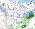
Like the 18z icon better. The killer for next setup would be pinching off over the northern Great Plains. Looks like it wouldn’t do that as much this run

