-
Hello, please take a minute to check out our awesome content, contributed by the wonderful members of our community. We hope you'll add your own thoughts and opinions by making a free account!
You are using an out of date browser. It may not display this or other websites correctly.
You should upgrade or use an alternative browser.
You should upgrade or use an alternative browser.
Wintry 1/9-12 Winter Potential Great Dane or Yorkie
- Thread starter SD
- Start date
RollTide18
Member
It looks now that the best chance (which seems to be growing smaller the past few days) for us along and south of US 80 at least in Alabama, would be on the wraparound, could be wrong though.
And we’ll prolly swing around some between now and then unless they want to play nice and lock on like they did for todays systemYeah, I feel like we'll get clarity around which scenario we're dealing with by 0z Tuesday. The reason for what you noted above is (checks notes - yep) excuse #6 - an important shortwave hasn't come ashore.I would think all the players should be on the field by 0z Tuesday.
Reminder. We may scale server resources up, if the site dies randomly, it'll be back shortly.
It's a touch a go process to get everything configured nicely.
It's a touch a go process to get everything configured nicely.
ForsythSnow
Moderator
I think once we clear this current storm, the models will really clear the energy and cold disagreements and come to consensus. I think in 48 hours, we'll know who's in, who's out, and who's a maybe assuming something crazy doesn't happen after.
We'll we could put it this way. In about 36hrs we'll see if the current storm pass has any positive effects on the next storm's track/temps.Yeah, I feel like we'll get clarity around which scenario we're dealing with by 0z Tuesday. The reason for what you noted above is (checks notes - yep) excuse #6 - an important shortwave hasn't come ashore.I would think all the players should be on the field by 0z Tuesday.
Six Mile Wx
Member
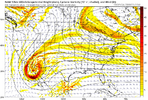
Depending on what time the global models get their sampling data, we could see overland sampling data in the 12z runs tomorrow for our “Baja low” energy as it enters in the NW.
NWGAStormDawg
Member
1st post here. I cover NW GA NE AL and SE TN in the Chattanooga tristate area. Watching closely for this coming week. Wish I had known about this site along time ago. Good resource.
Iceagewhereartthou
Member
Just catching up. I don't like the overnight trend to more amplification and that worries me going forward. The more recent runs hook us back into a little weaker and colder. Just something to keep in mind, if we amp and have to fight off an advancing warm nose, they tend to come in faster and stronger than modeled most of the time, especially NEGA and upstate. I think most of us will do better with the overrunning, weaker low, and colder scenario. Cold is always the biggest key.
- Joined
- Jan 23, 2021
- Messages
- 4,590
- Reaction score
- 15,179
- Location
- Lebanon Township, Durham County NC
iGRXY
Member
Really it’s a split between snow and ice. Most likely we will get both in this set up. Might as well get ready for thatJust catching up. I don't like the overnight trend to more amplification and that worries me going forward. The more recent runs hook us back into a little weaker and colder. Just something to keep in mind, if we amp and have to fight off an advancing warm nose, they tend to come in faster and stronger than modeled most of the time, especially NEGA and upstate. I think most of us will do better with the overrunning, weaker low, and colder scenario. Cold is always the biggest key.
NEGaweather
Member


Sent from my iPhone using Tapatalk
iGRXY
Member
SnowwxAtl
Member
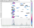
Can you do ATL or KATL?
UNCSC
Member
Nice. Could you post one for KFQD? OR DM me.
Thanks
iGRXY
Member
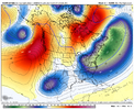
It's tucked in further SW too. There's a good chance it gets left behind on this run IMO.View attachment 159870Stronger S/W
Darklordsuperstorm
Member
Always know when it's about to snow in the SE...we get weird delays in models running...ICON way behind. Next will see the NCEP servers crash and GFS will be delayed hours.
He's talking about the 6z run, which is on the map.
NWGAStormDawg
Member
NWMSGuy
Member
Interesting take. Going to be interesting over the next couple days.
Stormlover
Member
iGRXY
Member
Just before we get into the full set of runs i don't think it's impossible we have one op run producing a memorable snowstorm while another is rain while a 3rd might be mediocre. With the wave interactions to our west please remember to not go way too high or too low today and overall trends that can be found are still more important than snow colors over your house.
Thanks
Thanks
- Joined
- Jan 23, 2021
- Messages
- 4,590
- Reaction score
- 15,179
- Location
- Lebanon Township, Durham County NC
Snowman63
Member
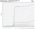
In Memphis It starts at 3 am Friday and finishes at 6pm with .45 qpf all snow.06z Euro AI shows it starts snowing in the upstate around 6-7am friday morning... rips all day and finishes up around 8-9pm Friday evening.
iGRXY
Member
GeorgiaGirl
Member
IMBY ha, but this run is basically inches away from being an ice storm for me.
Would be like, yeah, yeah, the ICON has a warm bias, but the thing is, is I wonder if whether it's been out to lunch as this is a big jump from what I think the 6z was PROBABLY going to look like if it continued.
Edit: Yeah, this isn't pretty if it had any chance of occurring:
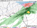
Would be like, yeah, yeah, the ICON has a warm bias, but the thing is, is I wonder if whether it's been out to lunch as this is a big jump from what I think the 6z was PROBABLY going to look like if it continued.
Edit: Yeah, this isn't pretty if it had any chance of occurring:

This coming weekend's storm is going to be a forecasting nightmare with so many solutions depending on the model you put your trust in. More will be known by Tuesday when the first system is out of the picture and some of the energy for the system in this thread can be sampled. Hopefully there will be plenty of snow pictures on this thread for some of us to enjoy and most of us will at least see some wintry precipitation.
iGRXY
Member
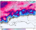
It turns into a big ice event in SC. All the way down to orangeburg
Icon looks a lot like the 6z euro no real dig from the northern wave very flat wave

