Off of the NC/SC coast
-
Hello, please take a minute to check out our awesome content, contributed by the wonderful members of our community. We hope you'll add your own thoughts and opinions by making a free account!
You are using an out of date browser. It may not display this or other websites correctly.
You should upgrade or use an alternative browser.
You should upgrade or use an alternative browser.
Tropical PTC8
- Thread starter SD
- Start date
Icon comes back SW it'll be interesting to see if we can get better consistency with this 0z suite. There has still been this wide window with the models kind of wandering around within it so far the 0z icon, nams and hires fv3 are close together.
I do think a system that can quickly organize may end to bring surprisingly impactful wrt to wind inland with the pressure gradient across the state
I do think a system that can quickly organize may end to bring surprisingly impactful wrt to wind inland with the pressure gradient across the state
Brent
Member
JHS
Member
2 runs now for the farther southwest track on the GFS. It may just turn out to be right. It now has .50 or better rainfall for much of western NC and SC, with the 2 inch line knocking on my door. The ICON is dry here but was southwest of the 18z run.
lexxnchloe
Member
2 runs now for the farther southwest track on the GFS. It may just turn out to be right. It now has .50 or better rainfall for much of western NC and SC, with the 2 inch line knocking on my door. The ICON is dry here but was southwest of the 18z run.
This GFS run (0Z) crosses the coast down at Georgetown. That’s the furthest SW landfall of any run since way back on 9/10 (12Z), which was similar and was the first run with this. Just 24 hours ago it came in at Cape Lookout. So, the 24 hour shift is ~200 miles meaning GFS track is far from settled.
0Z UKMET: Whereas 12Z initially moved W through Sun night before turning NE and staying offshore past Hatteras, the 0Z also initially moves W through Sun night but then turns NNE instead of NE thus bringing it inland NE of Wilmington, NC:
TROPICAL DEPRESSION 95L ANALYSED POSITION : 30.9N 76.6W
ATCF IDENTIFIER : AL952024
LEAD CENTRAL MAXIMUM WIND
VERIFYING TIME TIME POSITION PRESSURE (MB) SPEED (KNOTS)
-------------- ---- -------- ------------- -------------
0000UTC 15.09.2024 0 30.9N 76.6W 1009 29
1200UTC 15.09.2024 12 31.4N 77.6W 1009 34
0000UTC 16.09.2024 24 31.6N 78.5W 1007 41
1200UTC 16.09.2024 36 31.4N 79.2W 1007 35
0000UTC 17.09.2024 48 32.4N 78.3W 1008 29
1200UTC 17.09.2024 60 34.5N 77.6W 1009 29
0000UTC 18.09.2024 72 37.1N 78.1W 1008 25
1200UTC 18.09.2024 84 40.5N 78.4W 1010 29
0000UTC 19.09.2024 96 CEASED TRACKING
Downeastnc
Member
Models ( well the GFS ) seem to struggle with which area becomes the main system...things could be more interesting if the eastern area wins out as it is further away from land so obviously would have more time to do whatever it is going to do. It's also closer to where the lower surface pressures are...the reason the GFS was so different at 06 is it developed the western area...really do not see this amounting to much though you never know, regardless the gradient packing on the north side will cause over wash issues galore on the OBX though.
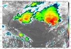

looks like the pressures are falling around the western area of convection which makes sense. Either way this doesnt look tropical at all
View attachment 091524.mp4
View attachment 091524.mp4
Downeastnc
Member
Still a pretty wide window here with the 12z runs
View attachment 151106
Yeah guess it depends which center the ensembles develop...only thing likely at this point is a bunch of rain...
itryatmanysportsespgolf70
Member
I like your chances to get some rain thereStill a pretty wide window here with the 12z runs
View attachment 151106
I think if the center goes to our south we will be much more windy. The HRRR was a lot of 40+ gustsYeah guess it depends which center the ensembles develop...only thing likely at this point is a bunch of rain...
Downeastnc
Member
I think if the center goes to our south we will be much more windy. The HRRR was a lot of 40+ gusts
Already 15 gusting to 25 here at PGV this afternoon, the western center is the one to watch....also it seems to have a decent LLC now and is tucking it closer to the MLC, if this had 36 hrs it would probably make a run at a weak cane.
Probably gonna be a PTC or even TD at 2 maybe if the plane can get there in time....
Brent
Member
Recon took off
lexxnchloe
Member
I'm interested to see what recon finds it's really doing a decent job organizing after that eastern low/convection started losing influenceAlready 15 gusting to 25 here at PGV this afternoon, the western center is the one to watch....also it seems to have a decent LLC now and is tucking it closer to the MLC, if this had 36 hrs it would probably make a run at a weak cane.
Probably gonna be a PTC or even TD at 2 maybe if the plane can get there in time....
12Z Euro: landfall Georgetown tomorrow night at 1006 mb
12Z UKMET : NC at 1009 but not til Tue afternoon:
TROPICAL STORM 95L ANALYSED POSITION : 31.4N 77.3W
ATCF IDENTIFIER : AL952024
LEAD CENTRAL MAXIMUM WIND
VERIFYING TIME TIME POSITION PRESSURE (MB) SPEED (KNOTS)
-------------- ---- -------- ------------- -------------
1200UTC 15.09.2024 0 31.4N 77.3W 1010 33
0000UTC 16.09.2024 12 31.4N 79.1W 1009 37
1200UTC 16.09.2024 24 31.8N 79.0W 1009 36
0000UTC 17.09.2024 36 31.8N 79.2W 1009 30
1200UTC 17.09.2024 48 33.3N 77.6W 1009 34
0000UTC 18.09.2024 60 35.4N 76.4W 1009 30
1200UTC 18.09.2024 72 38.1N 77.2W 1009 24
0000UTC 19.09.2024 84 39.5N 77.7W 1009 19
1200UTC 19.09.2024 96 CEASED TRACKING
Downeastnc
Member
at least one pretty well-defined LLC on recon
There is a pretty tight spin that appears per satellite/radar to be just SE of 32N, 78W. Is that at the surface? Is it tropical? Recon will tell us more. Could go straight to STS or TS.
12Z ICON appears to me to be too far east and GFS too far NE based on that spin.
12Z ICON appears to me to be too far east and GFS too far NE based on that spin.
lexxnchloe
Member
lexxnchloe
Member
49 kt SFMR and 49 kt FL winds, sufficient for a current intensity of at least 45 kt. If recon manages to find a center it'd be a direct upgrade.
Blue_Ridge_Escarpment
Member
49 kt SFMR and 49 kt FL winds, sufficient for a current intensity of at least 45 kt. If recon manages to find a center it'd be a direct upgrade.
It’s tricky because even if there were no LLC the high to the N would on its own be causing brisk winds though maybe not 49 knots.
Downeastnc
Member
There is a pretty tight spin that appears per satellite/radar to be just SE of 32N, 78W. Is that at the surface? Is it tropical? Recon will tell us more. Could go straight to STS or TS.
12Z ICON appears to me to be too far east and GFS too far NE based on that spin.
Recon seems a bit SW of the radar swirl with the SLC, its hard to tell how much though...though the winds at the surface under the mlc support a TS the fact they are 100 miles NE of the center support a more hybrid look still....
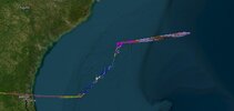
I think it's still strung out W to E looking at recon
Downeastnc
Member
Blue_Ridge_Escarpment
Member
The 18Z HRRR brings it onshore near Little River, SC and literally follows the state line and stalls it out near Gastonia, Nc.
LickWx
Member
Hopefully we get three times that, would be awesome if places that snagged over a foot from Debby snag another foot! Record wet year
Brent
Member
NHC will initiate advisories on Potential Tropical Cylone Eight, located offshore of the Southeast U.S. coastline, at 500 PM EDT (2100 UTC).
Was wondering if they will do that.NHC will initiate advisories on Potential Tropical Cylone Eight, located offshore of the Southeast U.S. coastline, at 500 PM EDT (2100 UTC).
Stormsfury
Member
If anything is upgraded. Subtropical. Its embedded upper level environment is purely cyclonic.Assuming I’m decoding recon data correctly, I’m seeing W winds at 20 knots at 31.6N, 77.7W and extrapolated SLP of 1007.4 mb. Should be enough for an upgrade to T or ST unless I’m misinterpreting.
Newest recon data suggests pretty tight LLC near 31.9N, 77.5W. Highest winds nearby at 48 knots? Extrapolated SLP 1006 mb. Is this right?
203200 3158N 07735W 8432 01547 0066 +188 +103 328038 041 041 005 00
203230 3156N 07734W 8426 01552 0063 +191 +097 309039 041 042 005 00
203300 3154N 07733W 8425 01554 0064 +193 +097 294039 040 041 004 00
203330 3153N 07732W 8430 01552 0073 +181 +102 297038 041 035 005 00
203400 3152N 07730W 8418 01564 0076 +174 +106 299038 039 /// /// 03
203430 3153N 07729W 8416 01562 0064 +189 +094 288041 042 022 005 00
203500 3155N 07728W 8435 01537 0066 +176 +104 296048 052 030 014 00
203530 3156N 07727W 8412 01545 0072 +131 //// 320026 051 045 038 04
Downeastnc
Member
Brent
Member
Not much strengthening expected
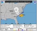
SUMMARY OF 500 PM EDT...2100 UTC...INFORMATION
----------------------------------------------
LOCATION...32.0N 78.0W
ABOUT 125 MI...200 KM ESE OF CHARLESTON SOUTH CAROLINA
MAXIMUM SUSTAINED WINDS...45 MPH...75 KM/H
PRESENT MOVEMENT...NW OR 320 DEGREES AT 7 MPH...11 KM/H
MINIMUM CENTRAL PRESSURE...1006 MB...29.71 INCHES
WATCHES AND WARNINGS
--------------------
CHANGES WITH THIS ADVISORY:
A Tropical Storm Warning has been issued from Edisto Beach, South
Carolina northward to Ocracoke Inlet, North Carolina.

W winds to 43 knots? Is that right? Extrap SLP 1010 mb there.
05
204730 3148N 07710W 8417 01578 0095 +162 +139 239037 041 033 008 03
204800 3147N 07711W 8431 01565 0099 +165 +129 260038 041 029 007 00
204830 3146N 07711W 8432 01564 0095 +172 +122 269040 043 029 008 00
204900 3144N 07712W 8417 01581 0099 +168 +114 262032 038 029 008 00
204930 3143N 07713W 8422 01576 0102 +163 +115 273029 031 026 008 00
205000 3142N 07714W 8436 01559 0105 +154 +129 269022 027 022 009 00
205030 3140N 07712W 8420 01579 0100 +166 +117 272025 027 022 003 00
205100 3139N 07711W 8431 01572 0103 +166 +129 266021 026 020 002 00
205130 3138N 07709W 8428 01575 0103 +172 +120 257023 028 020 000 00

