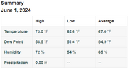
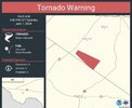
Looks cool to start in the E
-
Hello, please take a minute to check out our awesome content, contributed by the wonderful members of our community. We hope you'll add your own thoughts and opinions by making a free account!
You are using an out of date browser. It may not display this or other websites correctly.
You should upgrade or use an alternative browser.
You should upgrade or use an alternative browser.
Pattern June 2024
- Thread starter SD
- Start date
Most record lows around this area are probably too low to be threatened but upper 40s on June 1st is rare
Brent
Member
No end in sight to the unsettled pattern here... Oh well the longer the heat stays away the better
If the models hold, those troughs shown are gonna be rare for June.
Am I looking at June or November on last nights Euro?
NBAcentel
Member
It's a nice day
76/44 at 1:30 on the last day of May… doesn’t get much nicer than thatIt's a nice day
JHS
Member
We will probably pay for this later either with heat, severe weather, or a hurricane hitting somewhere close before summer is over. Right now, though, the big heat looks to stay to our south and west.76/44 at 1:30 on the last day of May… doesn’t get much nicer than that
Currently 80 and just saw the J,J,A, outlook, and it does look like the SE and S will suffer some above normal heat in the near future and could last through rest of summer!? Maybe the ground moisture can temper that some!!It's a nice day
Was just normal temps up here in that outlook!
The 18z is stupid cool for the first ten days of June. Would definitely be a candidate for Happy Hour run of the Year.
Yep. Looks like another cool down for late next week. Lots of highs in the low/mid 80s but the low humidity will be refreshing.
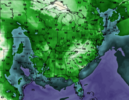
18z GFS for next Friday late afternoon:
View attachment 147906
The pattern at 500mb looks like winter. Sometimes I think the seasons are really shifting.
NBAcentel
Member
Drought gonna go boom with this Garbo pattern. Dry/warm days in the summer = perfect for drought
47.8 this morning
45, what a June morning!47.8 this morning
Iceagewhereartthou
Member
Only 92 days till Met Fall! 


So June 1st, mid-70s and a nice cool breeze. Am I am complaining, no sir.
Brent
Member
Even out here I'm seeing talk of a big front around mid month
Also we've only hit 90 once so far which is way behind schedule
Also we've only hit 90 once so far which is way behind schedule
Even out here I'm seeing talk of a big front around mid month
Also we've only hit 90 once so far which is way behind schedule
We’ve had 11 days in the 90s with 92 the highest.
Darklordsuperstorm
Member
End of this week, the rain train looks to shut of for quite awhile! NW flow and low humidity takes over for a week to 10 daysEven out here I'm seeing talk of a big front around mid month
Also we've only hit 90 once so far which is way behind schedule
2024 had the warmest spring on record for RDU.
Though the 12Z GFS is still slightly BN for this weekend overall, it has warmed a good bit since this post (which was based on the 6Z run of yesterday). The 12Z ICON remains several degrees warmer than the 12Z GFS.Looking forward to another cooldown to BN this weekend per latest GFS though 0Z Euro/CMC/ICON aren't as cool.
It'll rain again one day
Latest GFS (12z today) is warm with high temps (80s to near 90s low elevations east/south of Apps) but the dew points continue to look nice.Though the 12Z GFS is still slightly BN for this weekend overall, it has warmed a good bit since this post (which was based on the 6Z run of yesterday). The 12Z ICON remains several degrees warmer than the 12Z GFS.
12z dew points early Saturday morning:
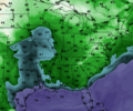
Atlanta is showing 90/44 for late afternoon.
TerribleLatest GFS (12z today) is warm with high temps (80s to near 90s low elevations east/south of Apps) but the dew points continue to look nice.
12z dew points early Saturday morning:
View attachment 147919
Atlanta is showing 90/44 for late afternoon.
Drizzle Snizzle
Member
It looks incredibly hot this weekend for some areas. Tallahassee forecast to hit 100 on Sunday.
Downeastnc
Member
Probably the first really hot days of this summer between 6/15-20. Eps mean is already 90+ most ens means have the ridge over or close to us.
- Joined
- Jan 5, 2017
- Messages
- 3,769
- Reaction score
- 5,966
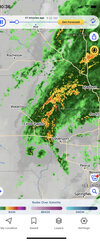
Everytime a line of thunderstorms and rain gets close to my location, it fades, weakens or misses to the north. So disappointing and it's getting abnormally dry now.
Last edited:
Shaggy
Member
Something tells me I'm gonna end up really appreciating the .45 inches of rain I got this morning once this ridge starts pressing on usProbably the first really hot days of this summer between 6/15-20. Eps mean is already 90+ most ens means have the ridge over or close to us.
Yeah I hope her get as much as possible through mid next week. Unless the models are too far east with the ridge we might be screwed for most of JuneSomething tells me I'm gonna end up really appreciating the .45 inches of rain I got this morning once this ridge starts pressing on us
Shaggy
Member
Wouldn't hurt for the cmc to be correct and little further north with heavy precip from the sloppiness off the coast next weekYeah I hope her get as much as possible through mid next week. Unless the models are too far east with the ridge we might be screwed for most of June
Nice little shower with some distant rumbles and flashes tonight. Summer in full swing
Used to get summer storms at least once a week in the 80s.Nice little shower with some distant rumbles and flashes tonight. Summer in full swing
.02

