Probably a decent amount of wind and severe weather
-
Hello, please take a minute to check out our awesome content, contributed by the wonderful members of our community. We hope you'll add your own thoughts and opinions by making a free account!
You are using an out of date browser. It may not display this or other websites correctly.
You should upgrade or use an alternative browser.
You should upgrade or use an alternative browser.
Severe Jan 8-11 2024 System Severe
- Thread starter SD
- Start date
- Joined
- Jan 5, 2017
- Messages
- 3,800
- Reaction score
- 6,048
JHS
Member
Hopefully the winds are being modeled too high, but if they are not, we are in for a rough ride Tuesday. The GFS shows gusts up to 70mph even outside of storms. 75 knot winds at 850 ahead of what would be a solid line of storms sweeping through. This is for most of SC and NC.
CannedHeat
Member
We can get rain, wind, and severe weather in winter but not snow. Our climate sucks.
JHS
Member
I look for that risk to be pulled back to the northwest at least 1-2 rows of counties unless models trends change. Most models kick the CAD out for most of us this time in the Carolinas.
Stormsfury
Member
Modeled wind fields could even get little low topped discrete showers spinning quickly. Increase CAPE values, and the Carolinas are in for one hell of an outbreak Tuesday.
Gfs with widespread 50-60mph gusts that's impressive to me since the gfs usually doesn't go crazy with the wind
JHS
Member
Th only saving grace from a big mess with severe storms and gradient wind right now is cloud cover and rain. I hate to think about what may happen if for some reason we get some sunshine on Tuesday. If we can readily mix up to 850MB we will be in trouble even away from storms from the gradient wind. As for CAD the GFS gets rid of it for most of us, while the Euro keeps it for a larger area. That boundary may well be a big trouble spot with this system.Modeled wind fields could even get little low topped discrete showers spinning quickly. Increase CAPE values, and the Carolinas are in for one hell of an outbreak Tuesday.
JHS
Member
This has been on the GFS for at least 2-3 days now. It is showing a small period of even higher winds as that big squall line goes through. Someone may see a 90+ gust or 2 if that line can become surface based.Gfs with widespread 50-60mph gusts that's impressive to me since the gfs usually doesn't go crazy with the wind

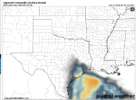
da hell is that map?

Is that background wind or wind associated with thunderstorms?
rburrel2
Member
Wedge will keep severe in check for most on this board.

That's just the max gusts I got leafing through the gfs run at each time stamp. It's more convection for the Carolinas and va, gradient to the S and WestIs that background wind or wind associated with thunderstorms?
will it stop straight line though?Wedge will keep severe in check for most on this board.
NBAcentel
Member
Not to sure about that, maybe the foothills/upstateWedge will keep severe in check for most on this board.


- Joined
- Jan 5, 2017
- Messages
- 3,800
- Reaction score
- 6,048
Yes. It will "ride" over the wedge until the wedge breaks. The wedge basically extends the boundary layer a few hundred feet higher. The wedge will have it's own gusts from the northeast, east and southeast but won't be as strong. However, heavy convection can lead to downbursts that punch through the wedge. Elevated thunderstorms are cool to watch.will it stop straight line though?
rburrel2
Member
Let’s circle back to this in a few days and see how it verifies.Not to sure about that, maybe the foothills/upstate View attachment 140100View attachment 140101View attachment 140102View attachment 140103
NBAcentel
Member
I mean most on this board is a lot….Let’s circle back to this in a few days and see how it verifies.
SPC outlook shows a lot of people in the game
iGRXY
Member
The northern upstate won’t see much in the way of severe. Just tons of rain. You can bet we will be sitting at 45 degreesLet’s circle back to this in a few days and see how it verifies.
They are really sounding the alarm about this.I mean most on this board is a lot….
SPC outlook shows a lot of people in the game
My goodness.png")


Last edited:
They should be. Kind of sad this thread is dead in lieu of chasing 786 hour model runsThey are really sounding the alarm about this.
Backing of the LL winds to the SSE and potential meso/secondary low formation is concerning for the the areas E of 85 in the Carolinasand especially the US1 corridor and east 
Good idea to make a thread. This one could easily over produce severe. From me in FL to you up there in NC.Backing of the LL winds to the SSE and potential meso/secondary low formation is concerning for the the areas E of 85 in the Carolinasand especially the US1 corridor and east View attachment 140198
Darklordsuperstorm
Member
The non thunderstorm winds are going to be cranking with this one.
Shaggy
Member
Think this one will be a sneaker type system as people tend to get tunnel vision in the winter only caring about snow. Models are hinting at a widespread high impact event for next week.The non thunderstorm winds are going to be cranking with this one.
It sure snuck up on me. Although, I'll likely miss the high winds here thanks to CAD.Think this one will be a sneaker type system as people tend to get tunnel vision in the winter only caring about snow. Models are hinting at a widespread high impact event for next week.
JHS
Member
Yeah, this looking serious if for nothing else but flooding and gradient winds. The GFS is still showing 50-60+ winds for many of us. Not sure about severe weather right now, at least in the CAD areas, but it could be a bigger threat farther east of course.They should be. Kind of sad this thread is dead in lieu of chasing 786 hour model runs
gawxnative
Member
The non convective gradient winds could gust to 50+ still though..It sure snuck up on me. Although, I'll likely miss the high winds here thanks to CAD.
JHS
Member
That is what I am worried about over here in SC. I'm hoping the NAM is right with a weaker and farther north low.The non convective gradient winds could gust to 50+ still though..
Edit. I did not see that 993 secondary north of INT on the NAM. That would change things a lot if that formed.
I doubt it. It will take some severe downdrafts to bring those winds to the surface here IMO. Wedge rules.The non convective gradient winds could gust to 50+ still though..
JHS
Member
The NAM and GFS both break the wedge for most of us though. They only keep it right up against the mountains. Hopefully they are breaking it too quickly, but I think they are right this time.I doubt it. It will take some severe downdrafts to bring those winds to the surface here IMO. Wedge rules.
NBAcentel
Member
Juicy 
Yeah, over your way does look windier than here.The NAM and GFS both break the wedge for most of us though. They only keep it right up against the mountains. Hopefully they are breaking it too quickly, but I think they are right this time.
NoSnowATL
Member

NoSnowATL
Member
