-
Hello, please take a minute to check out our awesome content, contributed by the wonderful members of our community. We hope you'll add your own thoughts and opinions by making a free account!
You are using an out of date browser. It may not display this or other websites correctly.
You should upgrade or use an alternative browser.
You should upgrade or use an alternative browser.
Tropical Hurricane Nicole
- Thread starter SD
- Start date
Avalanche
Member
You know I'm on board with the rain!!
lexxnchloe
Member
Impressive on the GFS for a storm coming from the east in November.


Brent
Member
lexxnchloe
Member
Luckily its not sept 06. Could be another andrew.
GFS runs what looks like a cat 1 cane through here. EURO looks like messy TS. looks like there could be some much beneficial rains to the SE though.
Shaggy
Member
Worried about a sharp turnaround and ejection to the east with that front swinging in. Lower southeast coast is good but SC and NC is a little more uncertain in my very unprofessional opinionGFS runs what looks like a cat 1 cane through here. EURO looks like messy TS. looks like there could be some much beneficial rains to the SE though.
80/90 as of 8 PM.Southwestern Atlantic:
An area of low pressure located more than 300 miles north of Puerto
Rico is producing a large area of disorganized showers and
thunderstorms. This system is forecast to move generally
northwestward over the southwestern Atlantic where environmental
conditions appear conducive for additional development, and a
subtropical or tropical storm is likely to form in the next day or
so. The system is then forecast to turn westward or
west-southwestward over the southwestern Atlantic by the middle
part of this week where additional development is possible.
Regardless of development, there is an increasing risk of coastal
flooding, tropical-storm-force winds, heavy rainfall, rough surf,
and beach erosion along much of the southeastern United States
coast, the Florida east coast, and portions of the central and
northwestern Bahamas beginning in the early to middle part of this
week. Interests in those areas should continue to monitor the
progress of this system as tropical storm, hurricane, and storm
surge watches could be required for a portion of these areas by
early Monday. Additional information on this system, including
gale warnings, can be found in High Seas Forecasts issued by the
National Weather Service and in products from your local weather
office.
* Formation chance through 48 hours...high...80 percent.
* Formation chance through 5 days...high...90 percent.
Belle Lechat
Member
- Joined
- Aug 29, 2021
- Messages
- 1,529
- Reaction score
- 1,215
Belle Lechat
Member
- Joined
- Aug 29, 2021
- Messages
- 1,529
- Reaction score
- 1,215
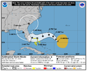
NHC mentions possibility of reaching hurricane strength before landfall, although official forecast does not show that just yet. Should be a long duration onshore, coastal flood/erosion event for SE as well as a good soaker for portions of the SE


Figures. Annual golf trip to MB is this weekend
I just want it east of Richmond by 8 am Saturday morning, which is starting to appear unlikely.... oh well should be a fun run!
- Joined
- Jan 23, 2021
- Messages
- 4,595
- Reaction score
- 15,183
- Location
- Lebanon Township, Durham County NC
Yeah, we've got VA Tech/Duke tix on Saturday and it's a 50/50 shot if it's east of us by noon.I just want it east of Richmond by 8 am Saturday morning, which is starting to appear unlikely.... oh well should be a fun run!
Going to be a fascinating watch over the next 48 hours from a weather nerd perspective as it sheds the front and becomes tropical. It could make a run at a formidable system if it can go tropical quickly
What do you think the ceiling is?Going to be a fascinating watch over the next 48 hours from a weather nerd perspective as it sheds the front and becomes tropical. It could make a run at a formidable system if it can go tropical quickly
980-985. Just not sure how quickly it's going to shed the non tropical characteristics and go to town. If the system were an independent tropical system and an independent upper low we could end up with a Kate 1985 scenario but I don't think we get that hereWhat do you think the ceiling is?
Last edited:
Euro landfall Wednesday night and then it races N/NE.... selfish nobody cares about my marathon post here, but I love this solution! Lol
smast16
Member
I'm supposed to go to Kitty Hawk area for their race this weekend. Wife doing 8k sat, and buddy doing Full on Sunday. We'll see.Euro landfall Wednesday night and then it races N/NE.... selfish nobody cares about my marathon post here, but I love this solution! Lol
I would agree with that. Maybe a 70-80 mph system980-985. Just not sure how quickly it's going to shed the non tropical characteristics and go to town. If the system were an independent tropical system and an independent upper low we could end up with a Kate 1985 scenario but I don't think we get that here
Euro landfall Wednesday night and then it races N/NE.... selfish nobody cares about my marathon post here, but I love this solution! Lol
Hope it will bring down the rest of the leaves.
Avalanche
Member
Damn great post right here!!!Hope it will bring down the rest of the leaves.
Blue_Ridge_Escarpment
Member
Been a shift west in the track and precip field on the models today.
Belle Lechat
Member
- Joined
- Aug 29, 2021
- Messages
- 1,529
- Reaction score
- 1,215
1:00 AM EST Tue Nov 8
...AIR FORCE RESERVE HURRICANE HUNTERS INVESTIGATING THE LARGE WIND FIELD OF NICOLE...

...AIR FORCE RESERVE HURRICANE HUNTERS INVESTIGATING THE LARGE WIND FIELD OF NICOLE...

Blue_Ridge_Escarpment
Member
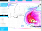
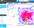
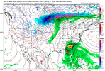
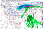
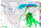
0Z euro and 6Z GFS follows suit.If the 0z GFS, Nicole’s heavy precip , avoids the triangle and Shetley, like the plague! ??View attachment 123536View attachment 123537View attachment 123538
Euro,Ukmet,GFS all paint 1.7-2.0 qpf here for MBY. Euro an ukmet right on top of each other with inland track. GFS within 75 miles , but lining up.
Slowly putting itself together overnight and into this morning.
Shaggy
Member
Yeah looks far better this morning.Slowly putting itself together overnight and into this morning.
ForsythSnow
Moderator
I'm liking these trends too seeing how dry we've been here in N GA as well. A couple inches will at least slow the dry up we've been dealing with.0Z euro and 6Z GFS follows suit.
Hurricane watches up and probably get updated to warnings later today. Looking more and more tropical, nice little burst of convection right over the center and it accelerates quickly after lf getting out of here by Saturday morning


Definitely looking more Tropical now. Recon showing winds picking up as well. maybe the West turn to have start? Either way, today should tell us a lot.
That is a very wide field to the north of the center. If that continues you would be seeing TS force winds to about Myrtle Beach… even as it’s making landfall in central FloridaHurricane watches up and probably get updated to warnings later today. Looking more and more tropical, nice little burst of convection right over the center and it accelerates quickly after lf getting out of here by Saturday morning

I wonder if we will see that taper off as it consolidates more and becomes full on tropical, however, it's still going to be extremely breezy along the coast thanks to pressure gradient anyway.That is a very wide field to the north of the center. If that continues you would be seeing TS force winds to about Myrtle Beach… even as it’s making landfall in central Florida
I would expect it to shrink some, but I also expect that it will be making its transition to extra-tropical by the time it’s making landfallI wonder if we will see that taper off as it consolidates more and becomes full on tropical, however, it's still going to be extremely breezy along the coast thanks to pressure gradient anyway.
lexxnchloe
Member
JB da Man! Im going 110mph at landfall.

