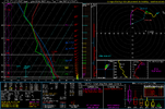
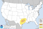
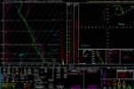
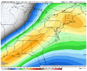
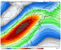
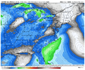
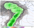
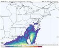
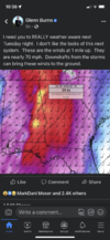
Still some question marks but spc has already outlined parts of the region
-
Hello, please take a minute to check out our awesome content, contributed by the wonderful members of our community. We hope you'll add your own thoughts and opinions by making a free account!
You are using an out of date browser. It may not display this or other websites correctly.
You should upgrade or use an alternative browser.
You should upgrade or use an alternative browser.
Severe 3/21-3/24 Severe Weather
- Thread starter SD
- Start date
Darklordsuperstorm
Member
Yeah. When was the last time we saw a day 8 outlook?
It's been a while. The big question to me is the kinematics. We shouldn't have a problem with moisture return and a large area of dews 60-65+ but I'm interested to see how the main upper energy acts. The 12z icon and 0z euro were more threatening than the 12z gfs imo but the gfs does raise the threat level with the trailing northern stream energy around 200hrs as it digs in and potentially invigorates secondary cyclogenesisYeah. When was the last time we saw a day 8 outlook?
Spann mentioned today that it has only occurred 6 times since 2012. Last time was in 2019.Yeah. When was the last time we saw a day 8 outlook?
Psalm 148:8
Member
- Joined
- Dec 25, 2016
- Messages
- 343
- Reaction score
- 787
Out of those 6 times, I wonder how many verified as a true threat several days later?
Marycrowley
Member
It was actually 5 times before now (now making the 6th time) but wondering the same!Out of those 6 times, I wonder how many verified as a true threat several days later?
Z
Zander98al
Guest
The GFS has a pretty legit setup in Mississippi and Alabama. For this event. Lapse rates are pretty steep, ehi is forecast around 4 on a global model, large scale upper air lift, height falls
Z
Zander98al
Guest
Poor lapse rates = heavy rain event incoming here...
DadOfJax
Member
This may be a big one…..rarely see alarms this far out.
NWMSGuy
Member
Any more thoughts regarding this time frame?
BHAMWX
Member
Does this particular set up have a greater potential for a PDS to be issued ?
Depends on how it ejects. The GFS is far more concerning than the Euro for the SE.Does this particular set up have a greater potential for a PDS to be issued ?
Z
Zander98al
Guest
NBAcentel
Member
NoSnowJoe
Member
NEW SPC DAY 4
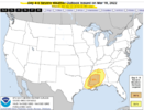
ZCZC SPCSWOD48 ALL
ACUS48 KWNS 190900
SPC AC 190900
Day 4-8 Convective Outlook
NWS Storm Prediction Center Norman OK
0400 AM CDT Sat Mar 19 2022
Valid 221200Z - 271200Z
...SEVERE WEATHER OUTBREAK POSSIBLE ON D4/TUE...
...DISCUSSION...
Latest deterministic and ensemble runs of the medium-range global
models continue to depict likelihood of a continuation of
potentially substantial severe-weather event across the central Gulf
Coast states Tuesday and into Wednesday. This includes a reasonable
probability of a regional-type tornado outbreak centered over
central and southern Mississippi for Tuesday.
As strong upper low/trough over the central and southern Plains
region shifts gradually eastward, a belt of very strong mid- and
upper-level southwesterlies will likely extend from east Texas
across the Tennessee Valley, atop a 60 kt southerly low-level jet.
The resulting/anticipated degree of veering and increasing flow with
height falls within high-end parameter space for significant
tornadoes.
In addition, the strong low-level southerlies will persistently
advect high theta-e Gulf air (dewpoints averaging in the upper 60s)
northward into the pre-frontal warm sector, which -- despite limited
heating due to cloud cover and potentially ongoing convection in
some areas -- will combine with modestly steep mid-level lapse rates
to yield what should prove to be ample CAPE at least as far north as
central Mississippi, and later central Alabama.
Overall, given very strong shear, the strength of the upper system,
and the Gulf warm sector expected inland, a high-end environment
appears likely to exist across a geographically-focused area
centered over the central Gulf Coast states, supporting potential
for a substantial outbreak of severe/supercell storms.
Severe weather potential will likely continue into Wednesday, though
the upper system appears likely to become somewhat sheared/elongated
as the upper low/jet streak shift northeastward across the Ohio
Valley, while secondary energy digs southward across the southern
Rockies and into northern Mexico. Thus, while an amply
moist/unstable environment and still-strong shear will exist across
southeastern Alabama/southwestern Georgia/the Florida Panhandle, and
possibly expanding during the day into parts of South Carolina
supporting continued potential for severe storms, the risk will be
lesser than Tuesday's event, and should diminish with time into the
evening hours. Still, all-hazards severe weather will be a
possibility through the first half of the period across this portion
of the Southeast.
By Thursday, models begin to diverge in terms of pattern evolution;
while the cold front may remain onshore, prior to advancing into the
western Atlantic, prospects for severe weather remain questionable,
and thus no outlook area will be issued at this time. Once the
front moves offshore overnight Thursday, as the upper system shifts
eastward, severe-weather potential should end over the Southeast.
With large-scale ridging to gradually expand across the U.S. into
the weekend, severe weather potential appears minimal a this time.
..Goss.. 03/19/2022
ALSO THE LATEST FROM NWS BIRMINGHAM
.LONG TERM...
/Updated at 0355 AM CDT Sat Mar 19 2022/
Monday through Saturday.
A broad region of high pressure is forecast to establish across the
Eastern US on Monday, generally centering near the Mid-Atlantic.
This will promote easterly winds initially, before veering with time
to a southeasterly component as deep-layer ridging amplifies along
and east of the Mississippi Valley, with a trough digging from the
Central and Southern Rockies into the Central and Southern Plains.
Thus, I expect a mostly sunny, warm day for Monday, with dry weather
across Central Alabama. However, with an amplifying pattern aloft,
forthcoming dynamic weather is expected. While we`re warm and dry
here, a large area of severe convective weather is forecast to our
west where an establishing warm sector across eastern TX interacts
with the ejection of a shortwave trough across the Southern Plains.
By Tuesday, the ridge axis is now to our east, and the Plains
trough/occluding storm system is now moving east. A region of upper-
level divergence should now near the mid/lower Mississippi Valley as
southerly low-level flow strengthens along the Gulf Coast toward the
Tennessee Valley. Warm, moist advection will occur across Central
Alabama as a 60-70 kt low-level jet moves across the Deep South,
establishing warm sector conditions. Height falls begin to occur
during the afternoon, and I expect showers and thunderstorms to
gradually increase in coverage from the west as a result. With the
presence of abundant wind shear and increasing instability, severe
weather appears to remain a distinct possibility in some fashion
Tuesday afternoon into Tuesday night.
Latest operational guidance is in agreement that kinematics will be
quite high on Tuesday. A strong low-level jet will be in place, as
well as broad hodographs and decent veering in deep-layer wind
profiles. This includes SSE to SE surface winds amidst ongoing
pressure falls toward the northwest. Effective bulk shear will
increase to 50-60 kts as a result, along with MLCAPE of 500-1,000
J/kg owing to dewpoints increasing into the low to mid 60s. This
parameter space will support supercell thunderstorms along/ahead of
an advancing synoptic cold front, across MS, on Tuesday
afternoon/evening. Convection will have additional support from
dynamics aloft, as a shortwave perturbation ejects from southeast
Texas toward the Ohio Valley. This is supported on medium-range
guidance, which also show evidence of an EML on their respective
forecast soundings. Nonetheless, severe convective weather should
approach our forecast area from the west Tuesday afternoon/evening.
We will maintain our HWO status, perhaps with an increase in
confidence. All modes of severe weather will be possible, and we
will work to refine & fine-tune forecast details in forthcoming
updates.
In addition to severe weather, locally heavy rainfall is possible.
Current storm total QPF Tue-Wed suggests 1-2" with locally higher
amounts. This could lead to flooding of low-lying/poor-drainage
areas. Also, non-thunderstorm wind gusts up to 40 mph will be
possible on Tuesday afternoon into Tuesday night, generally ahead of
the advancing complex of strong/severe thunderstorms. This is due to
the presence of the strong low-level jet, as well as the progged 10-
12 mb pressure gradient across Central Alabama. We`ll add these
items to the HWO.
Lingering showers and thunderstorms are forecast across the
eastern/southeast portions of Central Alabama into Wednesday
morning. Severe weather threats should have gradually diminished by
then, however. Dry mid-level air should move in from the west behind
the cold front, though flow aloft will remain southwesterly for some
time as the trough aloft becomes elongated and positively tilted,
stretching from the Great Lakes toward the Southern Rockies. Stable
weather is expected for the rest of the period with cooler diurnal
temperatures.
Z
Zander98al
Guest
"Tornado outbreak possible" ?
YUP. KINDA CONCERNING THIS FAR OUT AND THEM USING THIS TYPE OF LANGUAGE"Tornado outbreak possible" ?
Z
Zander98al
Guest
Still a lot can change, but it's definetly big when on a synoptic scale it's supportive of a tornado oubtreak. Once you get into the CAMS range paramters will probably look downright silly.YUP. KINDA CONCERNING THIS FAR OUT AND THEM USING THIS TYPE OF LANGUAGE
Z
Zander98al
Guest
I'm surprised at the lack of activity on this thread by the Alabama people, considering we are looking at a tornado oubtreak for Alabama and Mississippi. This could be a pretty big event.
100% NO DOUBT, IM GOING TO HOLD OFF ON POSTING ANY MODELING UNTIL CAMS DO COME OUTStill a lot can change, but it's definetly big when on a synoptic scale it's supportive of a tornado oubtreak. Once you get into the CAMS range paramters will probably look downright silly.
Z
Zander98al
Guest
Got a question for the better versed in technical weather knowledge. The nws and spc, how they are wording it sounds like this is good to be a supercell festival is this how it looks? Or a qcls broken line?
Z
Zander98al
Guest
It really has been a long time since I've seen wording this far out. Atleast since the 2014 October tornado oubtreak across the Midwest. It may have been 2015... Not quite sure but there was a high risk on day 3. Because confidence was so high synoptically in a tornado outbreak.100% NO DOUBT, IM GOING TO HOLD OFF ON POSTING ANY MODELING UNTIL CAMS DO COME OUT
May have been strong wording far out on the 2020/2021 Alabama outbreak but I can't remeber. This Midwest one really sticks out to me though
We had to get past yesterdays setup and it’s still 4 days away. Discussion will pickup as details emerge.I'm surprised at the lack of activity on this thread by the Alabama people, considering we are looking at a tornado oubtreak for Alabama and Mississippi. This could be a pretty big event.
DadOfJax
Member
Yep. A lot can, and will, change. Not to mention this isn’t the old Talkweather days that was rooted from and Alabama TV news stations weather blog. Just not near as many AL people here anymore. SPC and NWS wording isn’t alarming at all. They are simply spelling out what the models show right now….a decent shot at supercells with the potential of tornados. The world isn’t going to end….just might have a stormy day.We had to get past yesterdays setup and it’s still 4 days away. Discussion will pickup as details emerge.
Z
Zander98al
Guest
Everybody knows the world is not going to end, nor is it doomsday. Good grief. And yes the wording is alarming if nws or spc mentions the threat for a tornado outbreak it's big news.Yep. A lot can, and will, change. Not to mention this isn’t the old Talkweather days that was rooted from and Alabama TV news stations weather blog. Just not near as many AL people here anymore. SPC and NWS wording isn’t alarming at all. They are simply spelling out what the models show right now….a decent shot at supercells with the potential of tornados. The world isn’t going to end….just might have a stormy day.
tennessee storm
Member
ummm yeah technically , the world is going to end... sooner than u think. watch news. but yeah this could be a big time outbreak if things hold model wiseYep. A lot can, and will, change. Not to mention this isn’t the old Talkweather days that was rooted from and Alabama TV news stations weather blog. Just not near as many AL people here anymore. SPC and NWS wording isn’t alarming at all. They are simply spelling out what the models show right now….a decent shot at supercells with the potential of tornados. The world isn’t going to end….just might have a stormy day.
Z
Zander98al
Guest
Z
Zander98al
Guest
^ chief meteorligists for Tuscaloosa news station.
Z
Zander98al
Guest
You will probably see a moderate to high risk area by day 3 update for portions of west Alabama into Mississippi.
Z
Zander98al
Guest
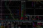
Anytime you see a sickle hodo in a well versed tornadic environment it's no bueno.... No wonder the mention of a regional tornado oubtreak
Z
Zander98al
Guest
Z
Zander98al
Guest
The speed shear is freaking crazy on that sounding above. That is a very omnious sounding.
Jessy89
Member
This set up a storm chaser playground
Sent from my iPhone using Tapatalk
Sent from my iPhone using Tapatalk

