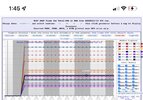
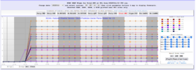
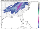
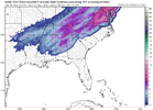
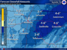
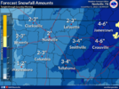
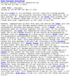
3.32 mean on the SREF plumes for BHM. 8 members over 4 with one at 8.80 inches. Why do those have to be so damn wrong all the time? There are some massive spreads with this system
-
Hello, please take a minute to check out our awesome content, contributed by the wonderful members of our community. We hope you'll add your own thoughts and opinions by making a free account!
You are using an out of date browser. It may not display this or other websites correctly.
You should upgrade or use an alternative browser.
You should upgrade or use an alternative browser.
Wintry 3/10-13 Winter Weather
- Thread starter SD
- Start date
- Status
- Not open for further replies.
ChattaVOL
Member
For what its worth the sref snow mean continues to rise.....just out 15z.... over 3 inches
4.96 here.. wish I didn’t look at that

Sent from my iPhone using Tapatalk
Storm5
Member
HixsonWX
Member
That's actually down from the 9AM SREF. It was up around 5.5.4.96 here.. wish I didn’t look at that
Sent from my iPhone using Tapatalk
WEATHERBOYROY
Member
This afternoon the NWS Bham lowered my pinpoint low temp from 30 to 27....raised my possible snow from less than 1/2 inch to around 1 inch . at least for now most of the signs are favorablemodernweenie
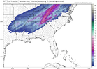
The NAM snow maps for 18z are beautiful but I do not know how it is going to accumulate what it is showing with 3 hours max of snow.
HixsonWX
Member
19z HRRR accumulations are generally lighter compared to the same hours on the 18z. For example, at 07z HSV was at 2" on the 18z but they are showing 1.3" on the 19z.
olhausen
Member
td tide
Member
Was hoping to see a few flakes mixing in but the NWS has removed it from the forecast for my area.
Looks like I actually have a decent shot at seeing snowfall, and maybe even accumulation, in Richmond tomorrow. I thought I was done with snow this year, but it seems not. 
HSVweather
Member
Fountainguy97
Member
Looks fun up this way tonight.
mydoortotheworld
Member
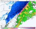
The southern extent of the snow on the 12k NAM is bonkers. No way that verifies. 3k is more likely and even then it may be overdoing it (for here in GA at least)
bigstick10
Member
This sentence may not age well???The southern extent of the snow on the 12k NAM is bonkers. No way that verifies. 3k is more likely and even then it may be overdoing it (for here in GA at least)
WEATHERBOYROY
Member
iT'S a beautiful sight to see the cold chasing the moisture in southern Ark and NE texas....and overtaking it! Also starting to see the moisture feed increasing from the GOM. Gonna be vermodernweeniey interesting!
From Rah NWS...... giddy up!! lol
The forecast still does not include any snow
accumulation considering it`s been several days since there were any
below freezing temperatures and the ground should be very warm, but
cannot rule out the possibility of accumulating snow if any
mesoscale banding develops behind the front and snowfall rates are
strong enough to overcome the warm ground.
Branch
Member
Looking better and better. Gotta say- not sifting through 50 pages of NC weather is pretty nice. I like the trends for our western side.
ATLwxfan
Member
This sentence may not age well???
I mean I am not seeing much to suggest any accumulation outside the far northwest suburbs of Atlanta. Doesn’t mean it won’t. Just means it’s very unlikely.
Sent from my iPhone using Tapatalk
here's a snippet from the afternoon disco from MRX - this might explain why some model runs are throwing out some big totals, some crazy strong lift involved with this setup
...There is a very high degree of confidence that accumulating snowfall
will be seen across the entire forecast area. There is also high
confidence that a short period (roughly 2-4 hours) of heavy snowfall
rates will be seen. Model plan views show the CWA between two
distinct jet structures which will favor strong upward motion.
Additionally, cross sections show this deep upward omega along with
saturated air extending through the dendritic growth zone and also
into regions of negative saturated EPV. All of this supports the
idea of high synoptically driven precip rates with the potential for
some enhancement via convective processes and resulting 2"/hr
snowfall rates. All of this has lead to a broad increase in expected
snow accumulations, especially over the central and parts of the
southern TN valley, which are locations that should be favorably
positioned beneath upper jet structures...
ForsythSnow
Moderator
ATLwxfan
Member
The southern extent of the snow on the 12k NAM is bonkers. No way that verifies. 3k is more likely and even then it may be overdoing it (for here in GA at least)
Oh yeah…you love to see it even as you toss it.
Sent from my iPhone using Tapatalk
Jessy89
Member
Just checked into our room in Maggie valley nc. Hoping for a couple inches we shall see
Sent from my iPhone using Tapatalk
Sent from my iPhone using Tapatalk
HSVweather
Member
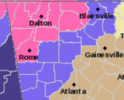
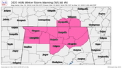
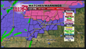
Etowah county added to winter storm warning
Shinrin
Member
Blount and Cherokee as well, for up to two inches of snow in these areas.Etowah county added to winter storm warning
yep BMX added some counties to WSW. Slowly moving southEtowah county added to winter storm warning
Ron Burgundy
Member
Lmao at this line from the FFC disco. Forecaster Lusk just became my fave in that office. ?
Expect that the WWA map is going to look a bit like a Bob Ross painting over the CWA at some point later tonight, with winter advisories and warnings, wind advisories, and potential for severe watches and warnings.
Expect that the WWA map is going to look a bit like a Bob Ross painting over the CWA at some point later tonight, with winter advisories and warnings, wind advisories, and potential for severe watches and warnings.
HSVweather
Member
Z
Zander98al
Guest
Under a winter storm warning here in extreme north Georgia. Also I passed by your town Forsyth made me think of your username lol @ForsythSnow
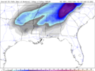
1. Lmao, I highly doubt there is going to be 4” of snow almost down to Columbus, GA, as this 12 km 18Z NAM map shows.
2. I think it is best for me to not post the ridiculously overdone (for ATL) 18Z GFS Maxar clown map. There are issues with low resolution as I noted earlier on these maps.
HixsonWX
Member
You mean the one that drops 12.5” in Chattanooga?… ?1. Lmao, I highly doubt there is going to be 4” of snow almost down to Columbus, GA, as this 12 km 18Z NAM map shows.
2. I think it is best for me to not post the ridiculously overdone (for ATL) 18Z GFS Maxar clown map. There are issues with low resolution as I noted earlier on these maps.
I wonder with the amount of lift possible if there might be some thundersnow somewhere.
- Status
- Not open for further replies.

