D
-
Hello, please take a minute to check out our awesome content, contributed by the wonderful members of our community. We hope you'll add your own thoughts and opinions by making a free account!
You are using an out of date browser. It may not display this or other websites correctly.
You should upgrade or use an alternative browser.
You should upgrade or use an alternative browser.
Pattern Novemburrr
- Thread starter SD
- Start date
D
Deleted member 609
Guest
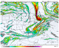
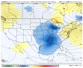
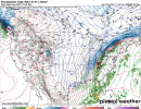
It's actually a crappy setup. Never trust ULL's from the SW unless they're large and disorganized.This one looks better. Too bad it's a million days away.View attachment 95729
I always think the opposite.. I suppose you can never trust them but more often than not they are going to surprise you with something .. obviously we don’t know what we’re dealing with this far away but seems funIt's actually a crappy setup. Never trust ULL's from the SW unless they're large and disorganized.
Well, verbatim of course. You really can't trust anything 5 days out.I always think the opposite.. I suppose you can never trust them but more often than not they are going to surprise you with something .. obviously we don’t know what we’re dealing with this far away but seems fun
olhausen
Member
NBAcentel
Member
NBAcentel
Member
Webberweather53
Meteorologist
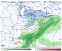
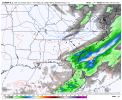
let’s please trend to some rain View attachment 95738
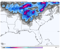
That's a really close call to something substantial in the coastal plain of NC
Webberweather53
Meteorologist
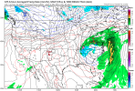
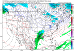
GFS & Canadian look pretty strung out w/ this upper trough that exits from my part of the world in a few days and is more progressive in the northern stream (as usual), whereas the Euro is slower + more amped and gives folks in eastern NC some hope of seeing a little snow for late this weekend. The ICON looks completely lost w/ the upper low getting stuck over the Baja (almost certainly not happening).
More times than not, the ECMWF tends to come out on top in these kinds of situations in the medium range, but need to see more run-run consistency and if the 12z EPS backs it up before I dive head first into the ECMWF camp.
GFS
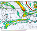
ECMWF
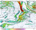
More times than not, the ECMWF tends to come out on top in these kinds of situations in the medium range, but need to see more run-run consistency and if the 12z EPS backs it up before I dive head first into the ECMWF camp.
GFS

ECMWF

Making its own cold airLooks legitView attachment 95728
NW trend should have us sitting pretty soon enoughlet’s please trend to some rain View attachment 95738
NBAcentel
Member
I’m not joking if we miss out on this then severe drought is knocking on the doorlet’s please trend to some rain View attachment 95738
LickWx
Member
Currently 52 and climbing , much warmer than what short range models had today’s high as! Let’s go baby. I like the 10 day, sunny and mild overall, still mostly cold next few days though.
NW trend should have us sitting pretty soon enough
Hey, its my turn to say that.
Nice apps rubber to start off Met winter!View attachment 95755
Not too shabby of a look day 10 on the Euro as we start cranking up December
Yes pretty much always! Now on a cloudy day or if it's raining I have seen my Davis about 1 degree colder.Does your flow always drop below your davis? I've noticed that for most cold mornings my flow is 1-2 cooler than davis
HugeSnowStick
Member
LOL, whatever, I/we hope...

 www.yahoo.com

Farmer's Almanac Predicts an Extra-Long, Extra-Cold Winter with 'Bone-Chilling' Temperatures
The Farmer's Almanac is warning the U.S. to gear up for a wintery season that could be one of "the longest and coldest that we've seen in years"
tennessee storm
Member
Almost comical …LOL, whatever, I/we hope...

Farmer's Almanac Predicts an Extra-Long, Extra-Cold Winter with 'Bone-Chilling' Temperatures
The Farmer's Almanac is warning the U.S. to gear up for a wintery season that could be one of "the longest and coldest that we've seen in years"www.yahoo.com
32 with some frost already
- Joined
- Jan 5, 2017
- Messages
- 3,779
- Reaction score
- 5,990
Down to 39 already...could we score another 32 or below tonight under clear skies and calm winds?
accu35
Member
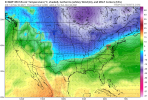
Euro really drops the cold end of run
Shaggy
Member
Super mega frost this morning
Does anyone have November’s temperature anomaly for the month at any given location right now?
Euro really drops the cold end of run
That look is exactly how we score in this pattern.
View attachment 95781
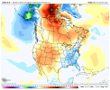
cold Alaska hasn’t hurt us so far..stay tuned
cold Alaska hasn’t hurt us so far..stay tuned
cold Alaska hasn’t hurt us so far..stay tuned
Rosie
Member
Happy Thanksgiving!???
Jessy89
Member

Little fantasy snow but this time period worth watching
Sent from my iPhone using Tapatalk
Webberweather53
Meteorologist
Webberweather53
Meteorologist
Webberweather53
Meteorologist
Continues to rain here, the ground is soaked now
LukeBarrette
im north of 90% of people on here so yeah
Meteorology Student
Member
2024 Supporter
2017-2023 Supporter
Congrats on the precipContinues to rain here, the ground is soaked now
accu35
Member
tennessee storm
Member
To bad it doesn’t have any support yet from the ensembles …Euro impressive
View attachment 95826
Nomanslandva
Member
Still bone dry up here. These fronts have not produced anything just east of the mountains. Desert December inbound?
.14 last night looks like we will stay below 1 inch for the month. Boo
Quite frosty this morning. Headed to the flea market with my little guy

