A new invest has been designated this afternoon.Satellite-derived wind data and satellite imagery indicate that an
area of low pressure has formed over the far eastern Tropical
Atlantic in association with a tropical wave that recently moved off
the west coast of Africa. Environmental conditions are conducive
for development, and a tropical depression is likely to form within
the next couple of days while the system moves west-northwestward at
10 to 15 mph over the eastern tropical Atlantic.
* Formation chance through 48 hours...high...70 percent.
* Formation chance through 5 days...high...90 percent.
-
Hello, please take a minute to check out our awesome content, contributed by the wonderful members of our community. We hope you'll add your own thoughts and opinions by making a free account!
You are using an out of date browser. It may not display this or other websites correctly.
You should upgrade or use an alternative browser.
You should upgrade or use an alternative browser.
Tropical Hurricane Larry
- Thread starter Snowfan
- Start date
Henry2326
Member
Downeastnc
Member
Henry2326
Member
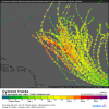
I thought exactly the same. Even more interesting, look at the dates.....this "history repeating itself thing" is getting weird.Euro loves it some 90L.....some of those tracks could be trouble if they miss a trough and head back west, very Florencee feel to some of those tracks....
View attachment 89873

Henry2326
Member
Shaggy
Member
This to me is the most pivotal time in 90L early development. It really starts to form on that southern end but then this is the moment the northern end also starts to develop. That opens the avenue for quick escape. If this forms further south without that northern end of the monsoon trough trying to develop the western shifts in the models are possible IMO.
Attachments
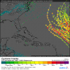
18Z EPS 144 (end of run): All 51 members are still recurving with already a NW to NNW movement by ~hour 120. And this includes those members moving W to WNW pretty far south initially in the eastern Atlantic. Granted, the mean is a bit further west than the prior runs. But still there's more than enough upper troughing coming into the NE US that follows Ida which all serve to keep the WAR quite weak for the next 7-10 days and thus enough steering to allow for a recurve well OTS with regard to the SE US.
Nothing is ever close to being set in stone this far in advance in the tropics. So, it obviously is still worth monitoring. But I continue to like the odds a lot right now.
Also, Bermuda, Canada, and even the NE US are in somewhat more danger, especially Bermuda. But that can be addressed later.

*Edited to clarify that I'm mainly talking about the SE US, not necessarily other areas like the NE US, Canada, and certainly Bermuda.
Nothing is ever close to being set in stone this far in advance in the tropics. So, it obviously is still worth monitoring. But I continue to like the odds a lot right now.
Also, Bermuda, Canada, and even the NE US are in somewhat more danger, especially Bermuda. But that can be addressed later.

*Edited to clarify that I'm mainly talking about the SE US, not necessarily other areas like the NE US, Canada, and certainly Bermuda.
Last edited:
Downeastnc
Member
Yep, those would be 95%+ fish vs the SE US if the run went out further....hope it has the right idea. No reason to doubt it right now. Interesting that it says valid for 1 PM CDT on 9/9/21, but in reality it is for 1 PM CDT on 9/5/21 since the 18Z ends at 144.
Shaggy
Member
Already at 102 the icon shows a weaker Katie and a stronger ridge and even though it's not significant 90L is further SW this run.
0Z UKMET: gets it down to 960 mb moving NW well NE of the Lesser Antilles
NEW TROPICAL CYCLONE FORECAST TO DEVELOP AFTER 36 HOURS
FORECAST POSITION AT T+ 36 : 12.1N 27.4W
LEAD CENTRAL MAXIMUM WIND
VERIFYING TIME TIME POSITION PRESSURE (MB) SPEED (KNOTS)
-------------- ---- -------- ------------- -------------
1200UTC 01.09.2021 36 12.1N 27.4W 1006 31
0000UTC 02.09.2021 48 12.4N 31.6W 1003 36
1200UTC 02.09.2021 60 12.7N 35.8W 1000 42
0000UTC 03.09.2021 72 12.9N 39.7W 997 43
1200UTC 03.09.2021 84 13.6N 43.2W 991 47
0000UTC 04.09.2021 96 15.0N 46.1W 983 55
1200UTC 04.09.2021 108 16.6N 48.8W 974 58
0000UTC 05.09.2021 120 18.7N 51.0W 969 62
1200UTC 05.09.2021 132 20.8N 53.4W 968 58
0000UTC 06.09.2021 144 22.8N 55.5W 960 69
Edit: 0Z Euro also goes fishing.
Last edited:
Henry2326
Member
Shaggy
Member
Yeah this one is a recurve all day as modeled
DadOfJax
Member
EAST!!
Downeastnc
Member
The trend has certainly been west, still think no way it gets to the SE but Bermuda for sure in play and seeing some of those west bending members makes you think the NE or Canada not out of it yet.
Downeastnc
Member
The trend has certainly been west, still think no way it gets to the SE but Bermuda for sure in play and seeing some of those west bending members makes you think the NE or Canada not out of it yet.
I think the SE is still possible, a few more west shifts and all of a sudden we are talking just north of the islands, or just east of the Bahamas, the spread is just getting bigger, this is classic evolution of models recurving to soon being sniffed out.....that does not mean I am saying this is coming far enough west to hit but the way this is unfolding is how we see things evolve when a early modeled recurve ends up being a legit threat....
Henry2326
Member
If it were to stay weak and South through D5/6/7 it would be big trouble for the EC. As is with the early strengthening in most models its likely to get well north becoming a problem for Bermuda and SE CanadaThe trend has certainly been west, still think no way it gets to the SE but Bermuda for sure in play and seeing some of those west bending members makes you think the NE or Canada not out of it yet.
Downeastnc
Member
If it were to stay weak and South through D5/6/7 it would be big trouble for the EC. As is with the early strengthening in most models its likely to get well north becoming a problem for Bermuda and SE Canada
This guy actually suggest the opposite of what we would normally expect with regard to the weaker/wester idea we normally see.....
This guy actually suggest the opposite of what we would normally expect with regard to the weaker/wester idea we normally see.....
I actually think the wave behind it is the one to really watch. We may get into an Edouard/Fran scenario where the outflow from the first storm hampers the second and allows it to stay weak and west.
As for this storm it'll take something pretty significant changing with the main subtropical ridge just west of the Azores to get it well west imo. Not saying it's impossible but I don't see it even if it went WSW for a while
Downeastnc
Member
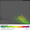
I'm glad I said "almost" as 1 of the 31 12Z GEFS members takes a rogue path W into NC 9/13:
View attachment 89930
I am suppose to go to the mts for a week and I leave Sept 12th.....I guarantee you this comes here and ruins my vacation....
Brent
Member
Oh and the next name is Larry!!!
Downeastnc
Member
Oh and the next name is Larry!!!
Yep we screwed then we get all the redneck storms in NC, Bertha, Fran, Floyd, Florence, Dennis, Irene etc etc
Henry2326
Member
Oh and the next name is Larry!!!
I wish him good walking weather wherever he strolls.
On the 12Z EPS, all members stroll with the fish.
Henry2326
Member
Brent
Member
TD 12
...NEW TROPICAL DEPRESSION FORMS IN THE EASTERN TROPICAL ATLANTIC...
...FORECAST TO INTENSIFY OVER THE NEXT COUPLE OF DAYS...
SUMMARY OF 800 PM CVT...2100 UTC...INFORMATION
----------------------------------------------
LOCATION...11.2N 21.1W
ABOUT 335 MI...535 KM SE OF THE SOUTHERNMOST CABO VERDE ISLANDS
MAXIMUM SUSTAINED WINDS...35 MPH...55 KM/H
PRESENT MOVEMENT...WNW OR 285 DEGREES AT 16 MPH...26 KM/H
MINIMUM CENTRAL PRESSURE...1006 MB...29.71 INCHES
TD 12. Should be a good ACE producer for the next 1-2 weeks.
BULLETIN
Tropical Depression Twelve Advisory Number 1
NWS National Hurricane Center Miami FL AL122021
800 PM CVT Tue Aug 31 2021
...NEW TROPICAL DEPRESSION FORMS IN THE EASTERN TROPICAL ATLANTIC...
...FORECAST TO INTENSIFY OVER THE NEXT COUPLE OF DAYS...
SUMMARY OF 800 PM CVT...2100 UTC...INFORMATION
----------------------------------------------
LOCATION...11.2N 21.1W
ABOUT 335 MI...535 KM SE OF THE SOUTHERNMOST CABO VERDE ISLANDS
MAXIMUM SUSTAINED WINDS...35 MPH...55 KM/H
PRESENT MOVEMENT...WNW OR 285 DEGREES AT 16 MPH...26 KM/H
MINIMUM CENTRAL PRESSURE...1006 MB...29.71 INCHES
Henry2326
Member
Henry2326
Member
Henry2326
Member
West! It's the new east ?
Shaggy
Member
The gfs has amd euro have been consistent with TD 12 so far.
I also ha ent forgotten that atleaat for a couple runs the gfs took grace up.the east coast and it went into Mexico and Ida was suppose to go into Mexico but hit Lousiana. Granted those runs weren't as persistent as the runs now with TD 12 and once it caught on with the other storms it was locked in and really good.
I guess we see how the next couple of days go.


