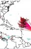
Keep in mind that there has yet to be any south of due west motion since TC genesis. So, that actually occurring during the next 12-18 hours remains to be seen. The modeling I've seen is due west or just N of due west. So, it is possible. In case it does, I have my own list as of 2011 because I did my own research on WSW motion in the E ATL 10+ years ago:
From my 8/31/11 analysis:
"Looking back all the way to 1851, I found only 30 TS+'s that showed some WSW motion during their early lives in the eastern Atlantic (including just during TD stage), indicative of pretty strong E ATL sfc high pressure to the north. Here are some stats:
1) Out of these 30, 12 (40%) hit the US (all but Carol of 1953 hit as a hurricane..Carol was a grazer), which is 2.4 times the 1 in 6 chance for ALL Cape Verde type storms since 1960 (w/# days African coast to US)(all but Able and Fran were cat 4+ at strongest):
- #6 of 1893 (GA/SC) (14)
- #4 of 1928 (FL)(11)
- #4 of 1947 (FL, LA) (14)
- Able of 1952 (SC) (13)
- Carol of 1953 (ME grazed) (11)
- Donna of 1960 (FL, NC, New England) (12)
- Dora of 1964 (FL) (13)
- Allen of 1980 (TX) (12)
- Hugo of 1989 (SC) (12)
- Fran of 1996 (NC) (14)
- Isabel of 2003 (NC) (15)
- Ivan of 2004 (AL/FL) (16)
The 18 that didn't hit the US (cat 4+ at strongest only Gabrielle, Luis, Dean, Bill, and Igor):
- #2 of 1927
- Charlie of 1950
- Dog of 1951
- Fox of 1951
- Carol of 1965
- Anna of 1969
- Christine 1973
- Earl 1980
- Gabrielle 1989
- Fran of 1990
- Danny of 1991
- Luis of 1995
- Gustav of 1996
- Ivan of 1998
- Dean of 2007
- Bill of 2009
- Fred of 2009
- Igor of 2010"
To update my 2011 analysis, I just checked for WSW movers during 2011-20 and found one: Helene of 2018. It didn't hit the US:
https://www.nhc.noaa.gov/data/tracks/tracks-at-2018.png
So, if I add that to my previous analysis, I now have 12 hitting the US and 19 not. That is still a pretty high 39% US hit rate, much higher than that for all eastern Atlantic storms. Also, if I were to ignore those that occurred during El Nino since we're not in one, the % is even higher.