Brent
Member
If this does go bad in DFW Waco is looking like a good starting point for a chase
But we'll see I really don't want to go west again lol
If this does go bad in DFW Waco is looking like a good starting point for a chase
But we'll see I really don't want to go west again lol
Time for another trip to AbileneThat's going well lol ?View attachment 64322
Still time for improvement, but further east ( GA and Carolinas) we are loosing upper support and colder air with it. Damn....I thought this one would be better for more of us. Good news is, it helps TX into AL. Happy for yall if it works out for sure. Good news is....The pattern (arguably) looks the best we have seen in a long time for most of this month!!


That drive down I-35E is a ----- because of construction from Red Oak to Hillsboro.
.png")
Please verify lmao ?View attachment 64352View attachment 64353
modernweenie
View attachment 64363

If I’m in Dallas area I hug the SREF. Take it to dinner and a movie. View attachment 64382
Glad to see you posting lately Bing!If I’m in Dallas area I hug the SREF. Take it to dinner and a movie. View attachment 64382
If I’m in Dallas area I hug the SREF. Take it to dinner and a movie. View attachment 64382
Yeah I'm feeling this one slowly slipping away up here I'm losing confidence we even really break the snowless streak at this point lol
But maybe I'll be surprised


Maybe the HRRR will pull a coup, lol.
Natchez might be ok. Shreveport would be better but that's a good ways away from you I thinkWhere do I go to chase this thing close by? Do I need to go up to Natchez or all the way up to Vicksburg to see the white stuff?


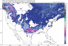
This is stupid close, ah ---- Here we go again View attachment 64436View attachment 64435View attachment 64437
Maybe the HRRR will pull a coup, lol.
Not too worried about the hrrr at this range
That's true.When the HRRR the only model that still looked good and it turns to crap like the other models, that's definitely a reason to be worried.
Close the thread. I won’t start another one!